APPENDIX J — Designated Areas Within Manufacturing Districts
(6/6/24)
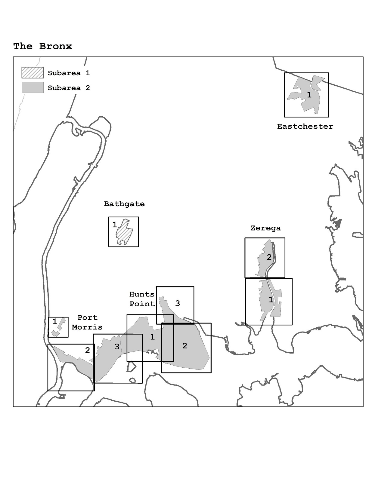
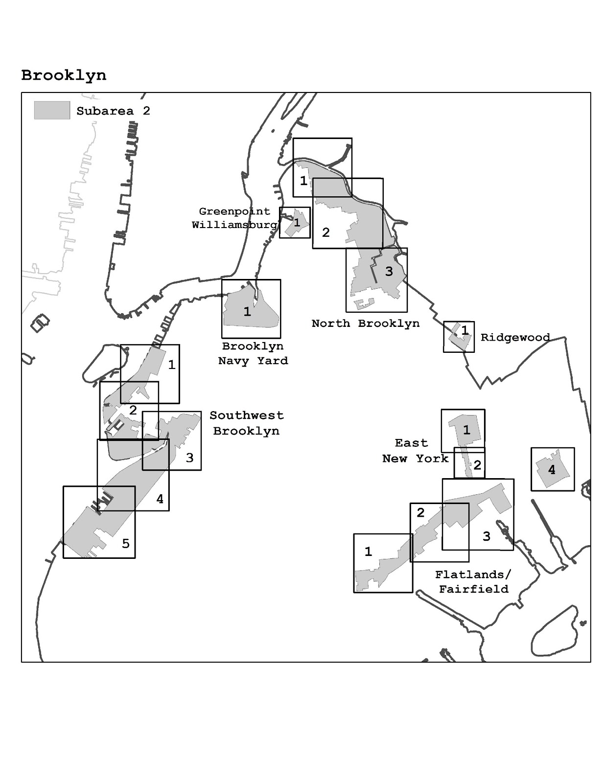
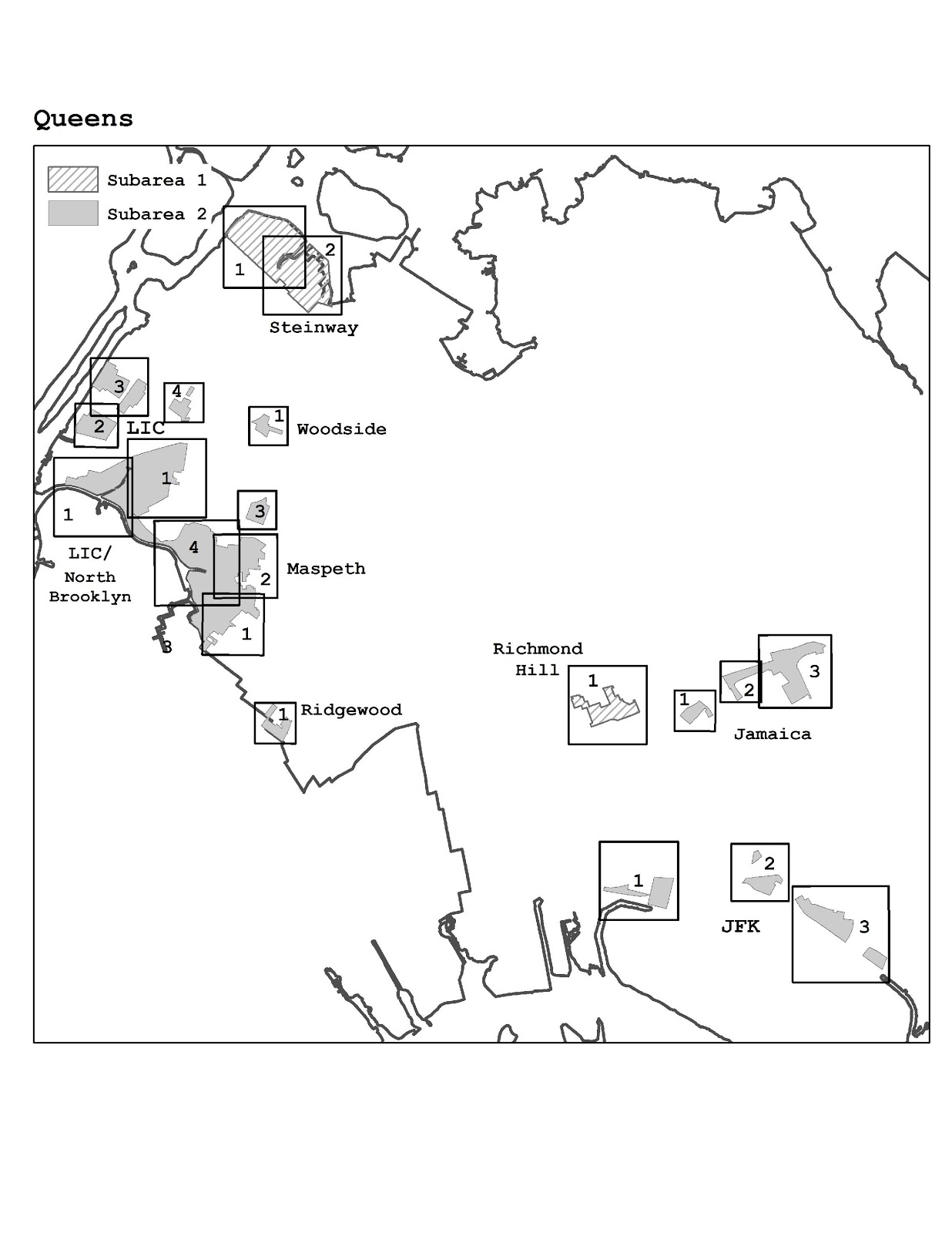
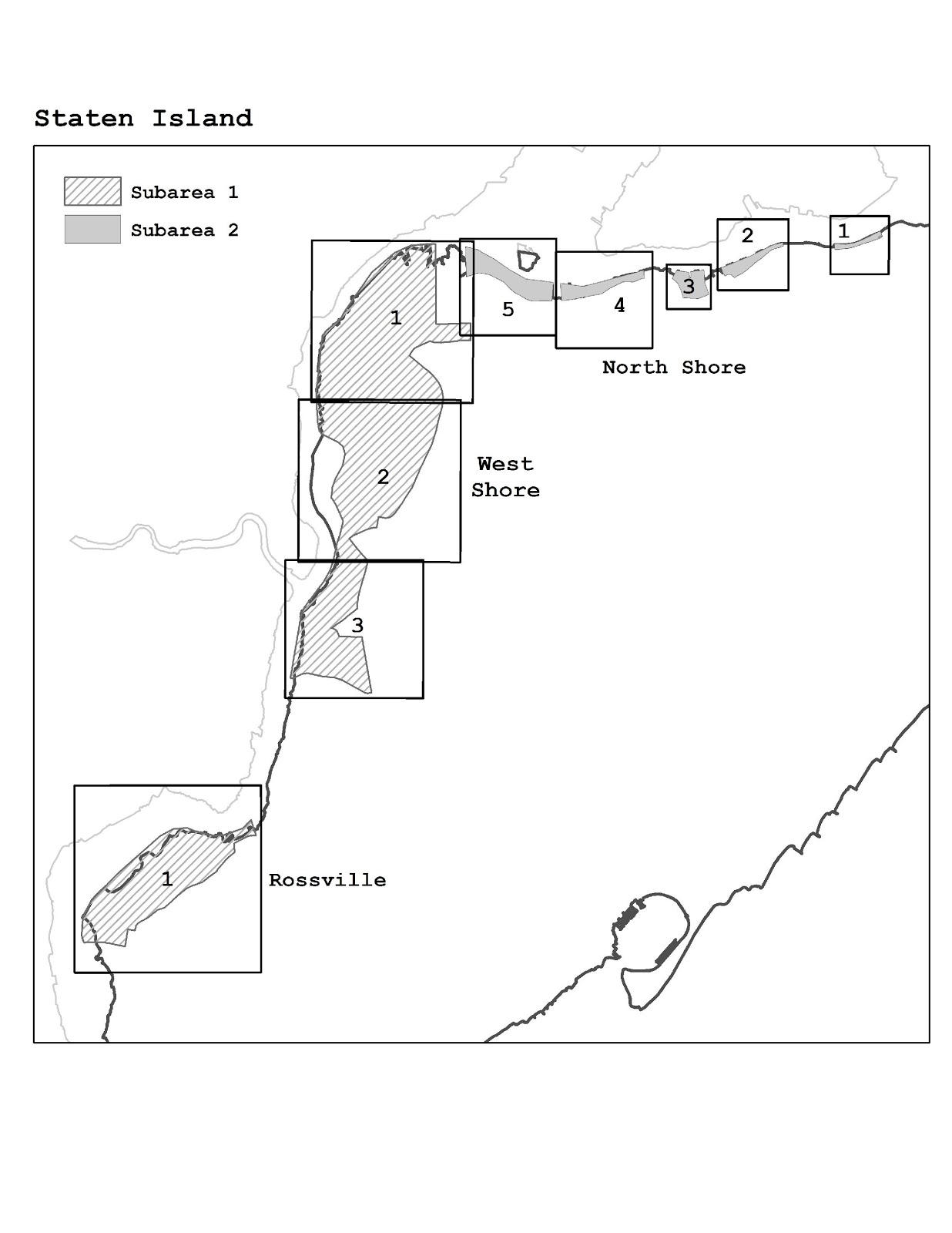
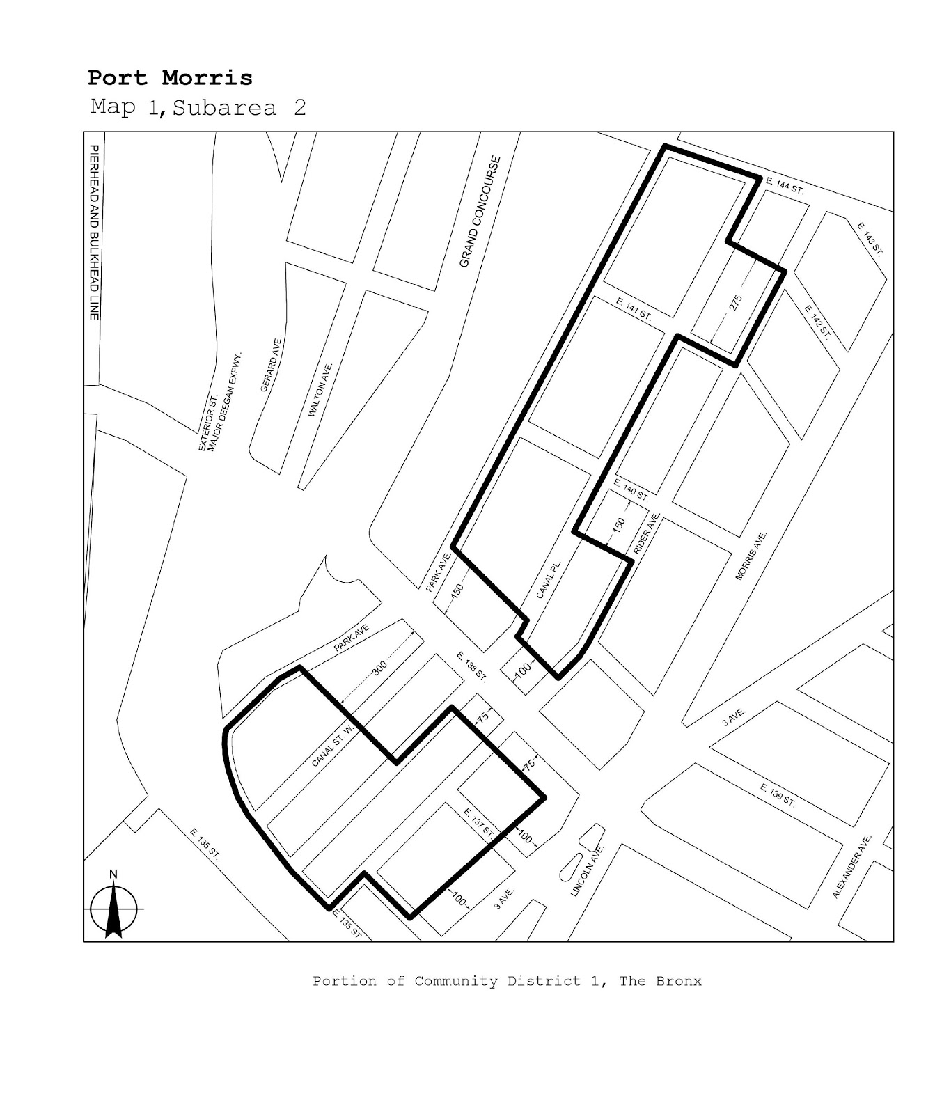
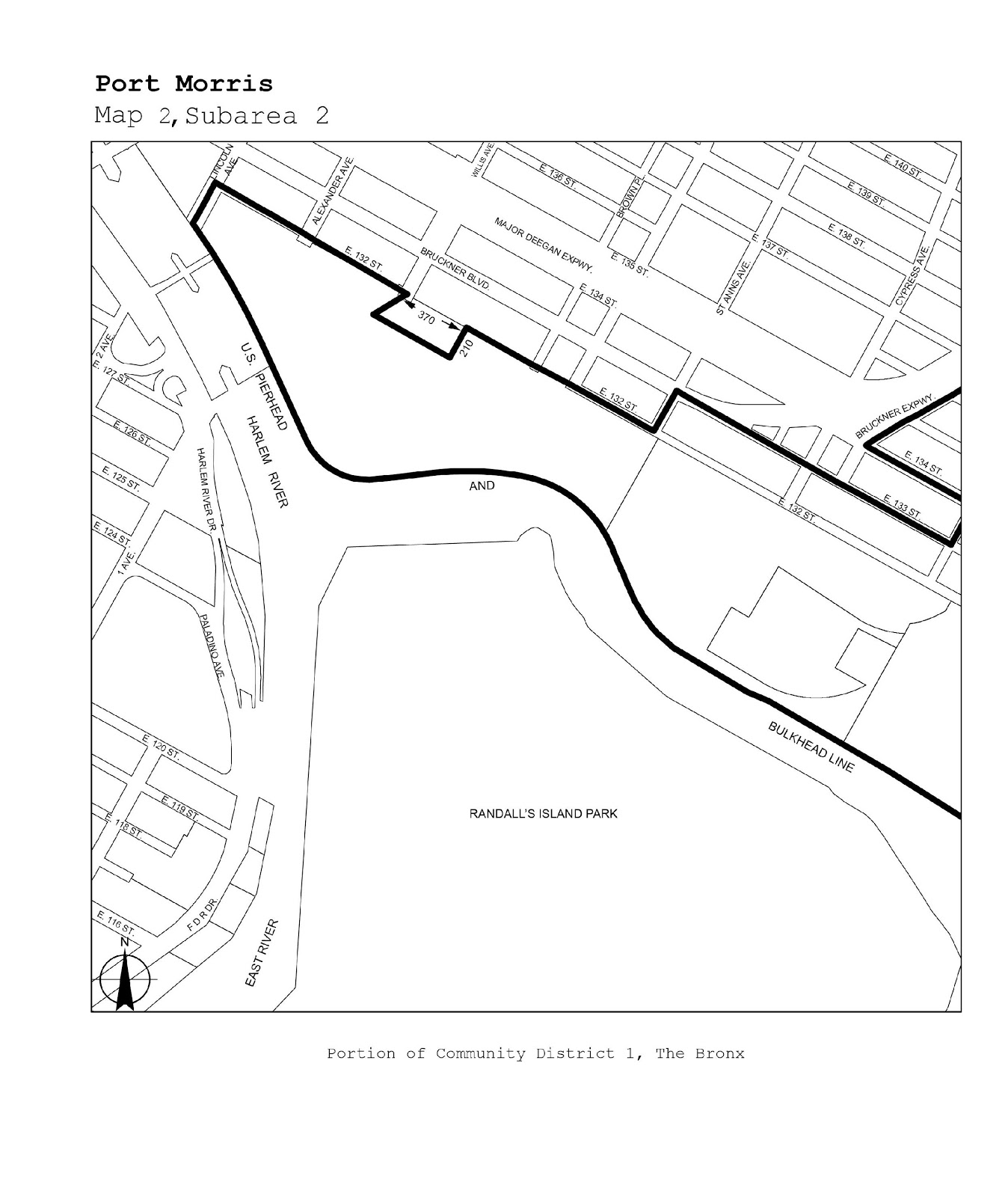
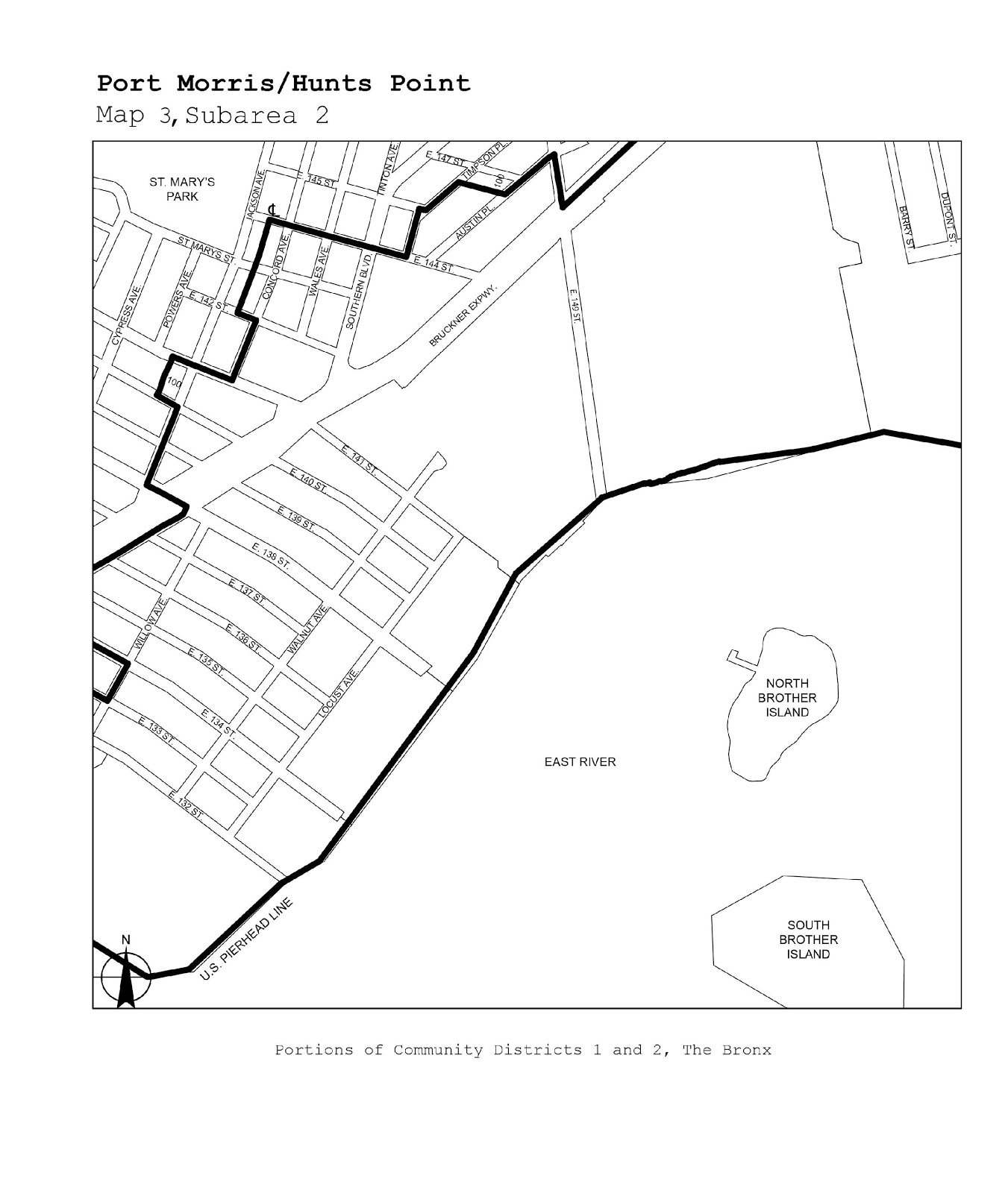
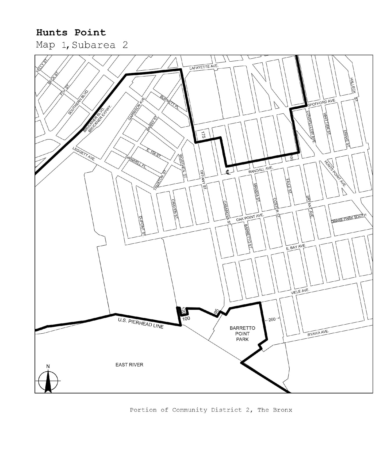
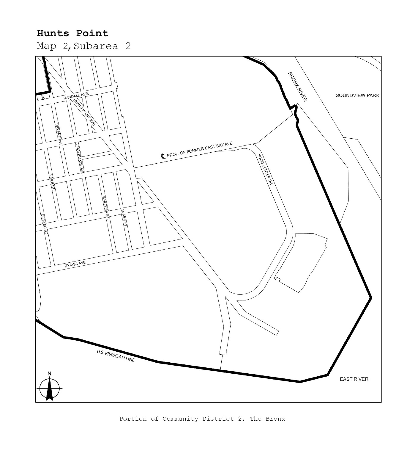
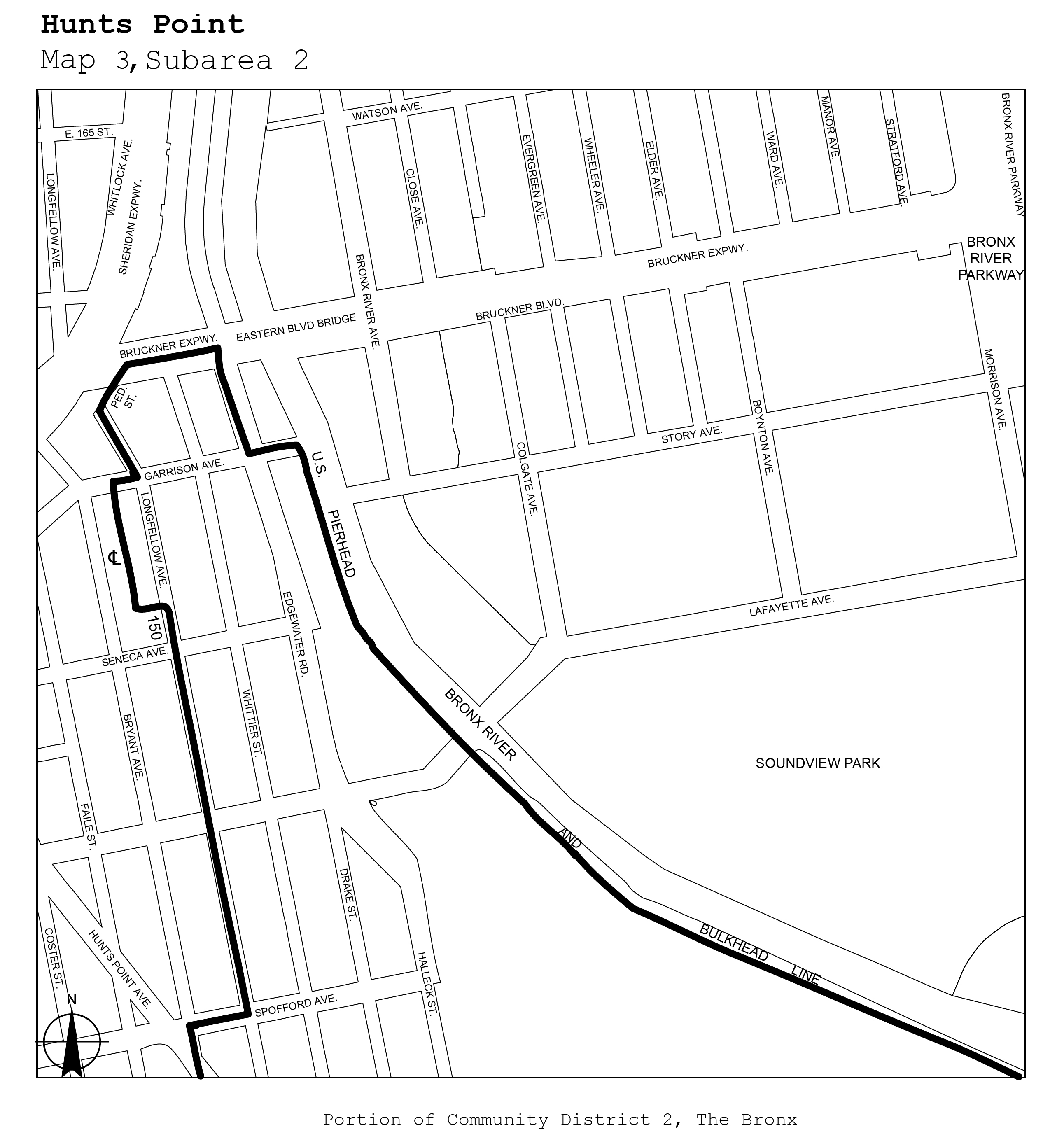
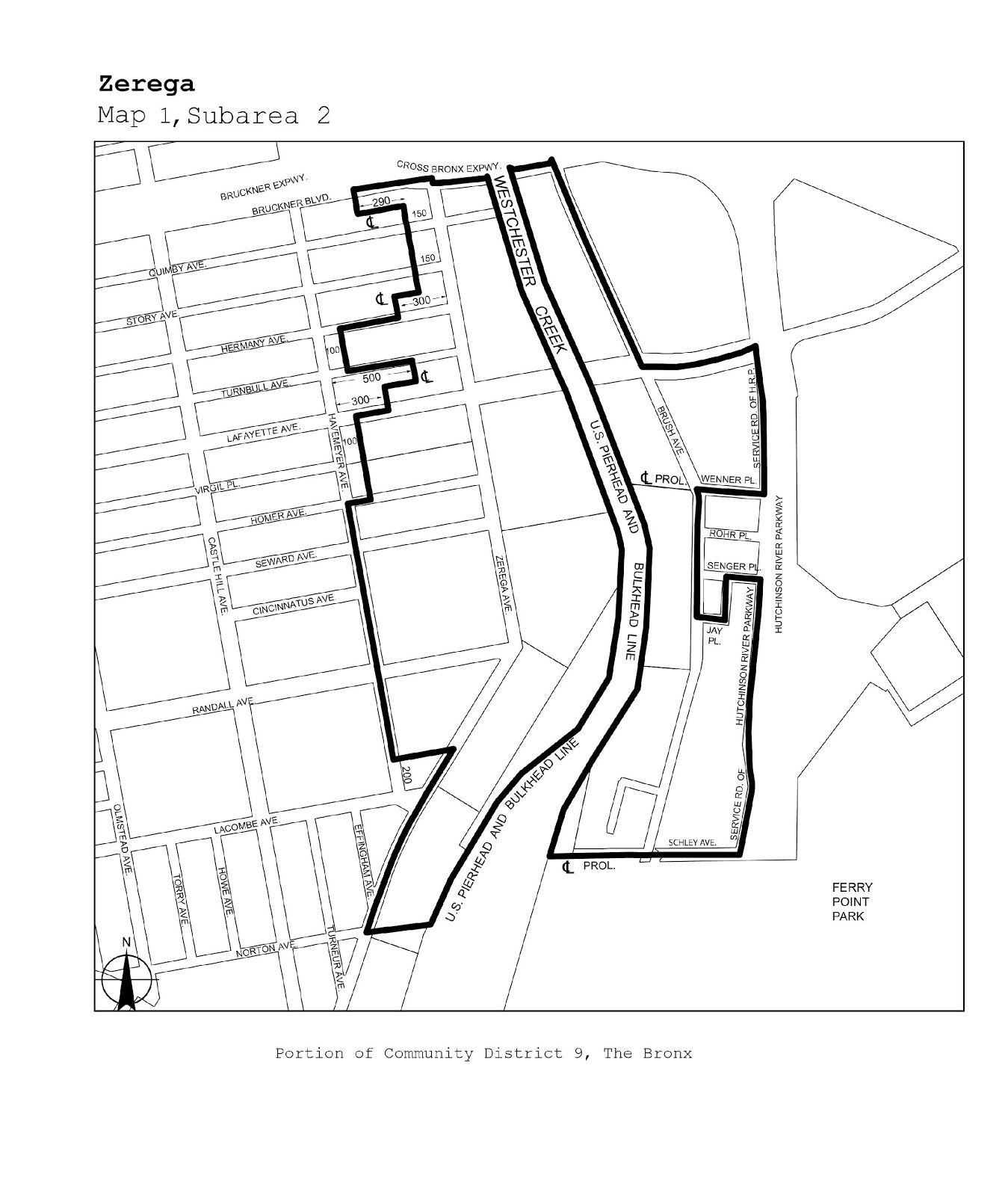
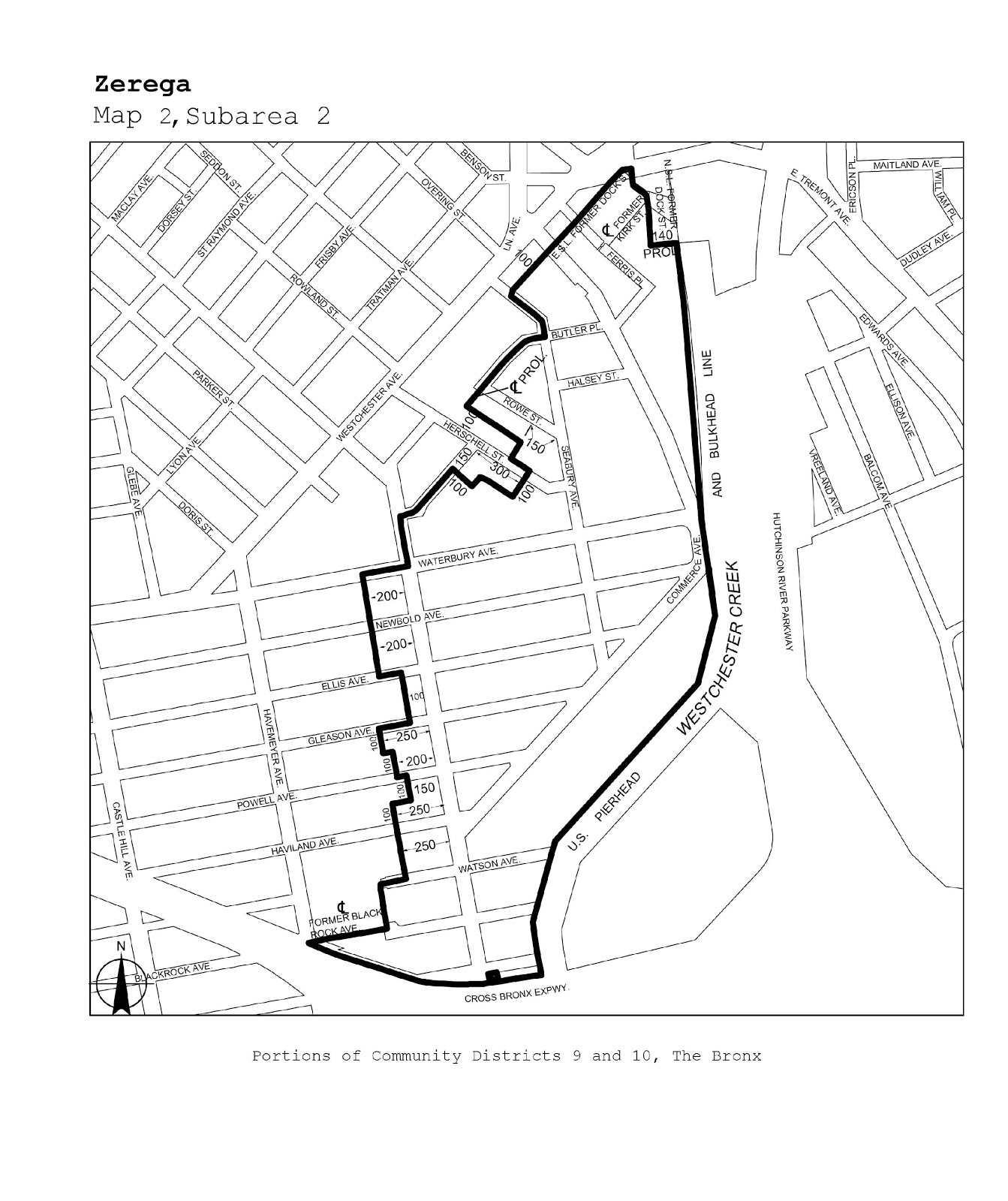
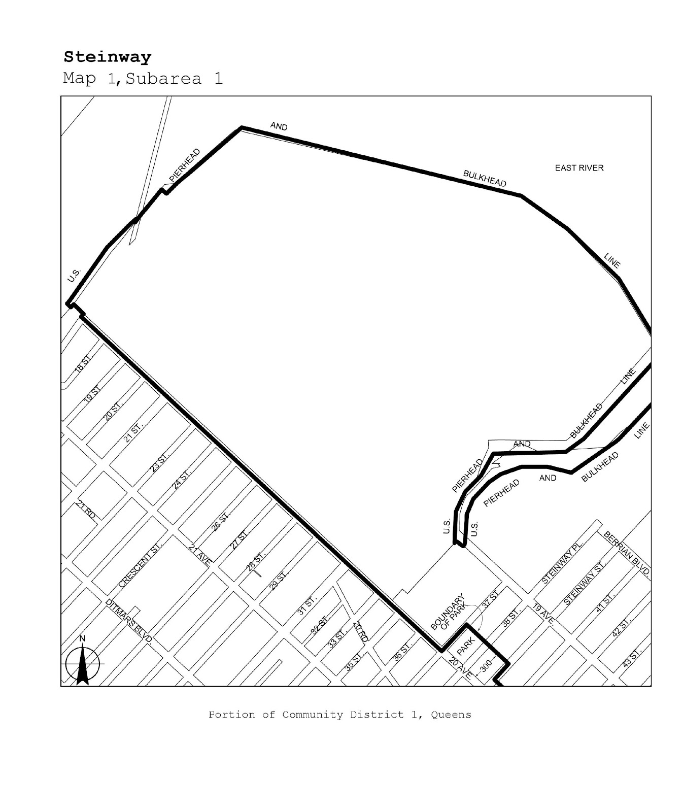
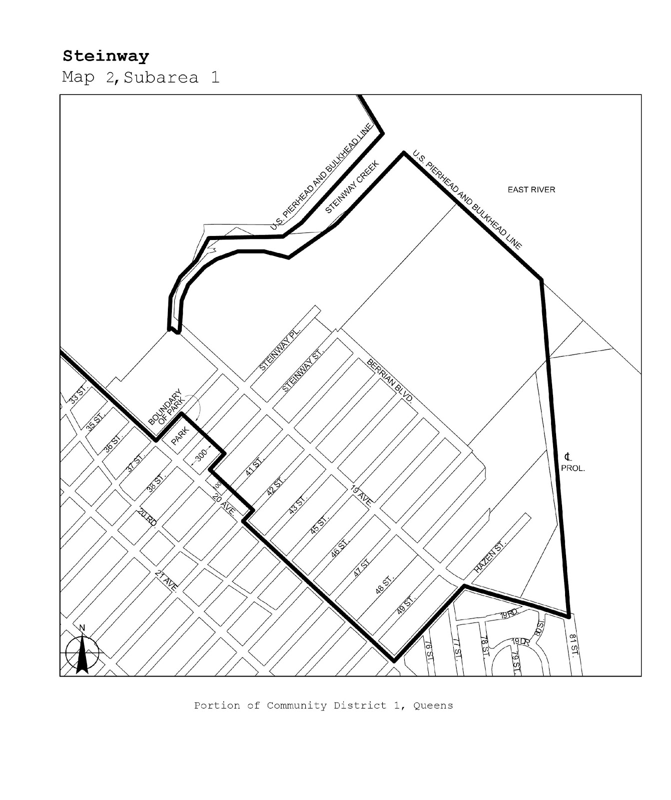
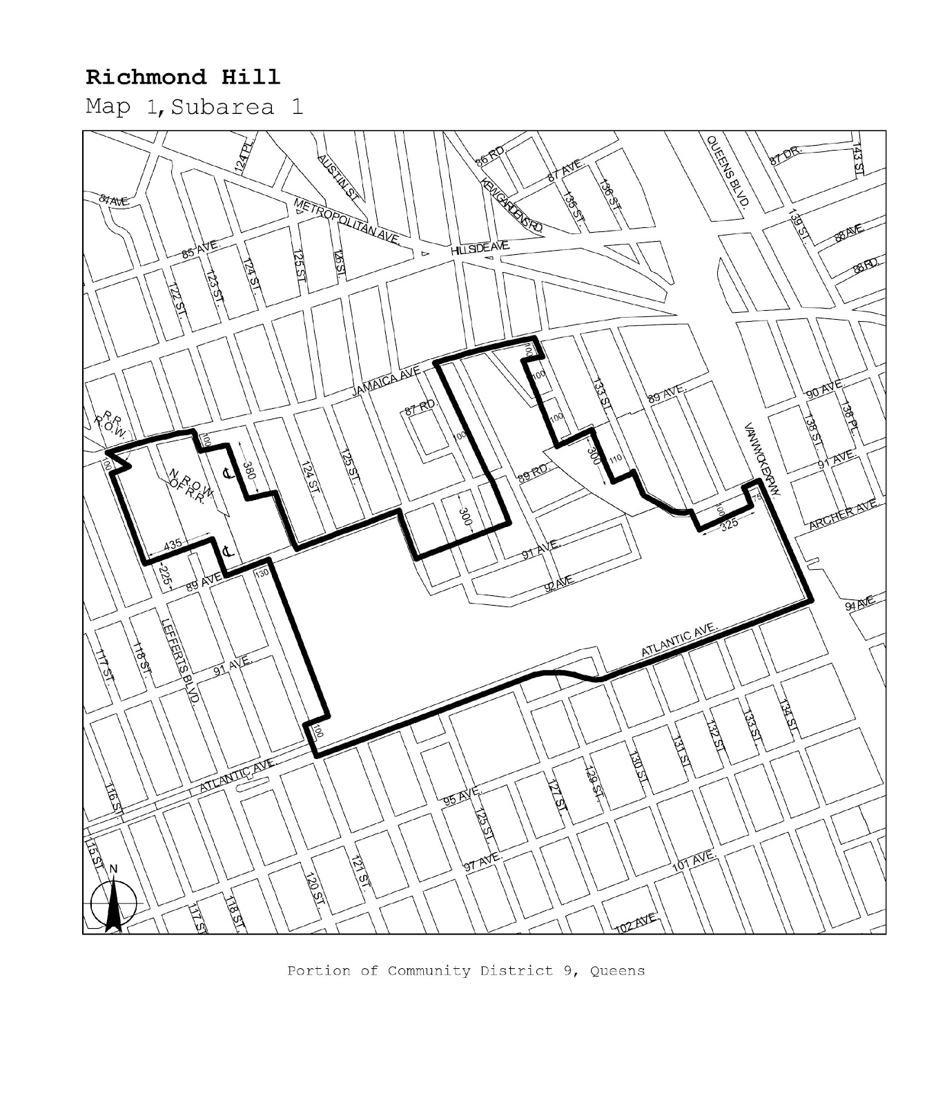
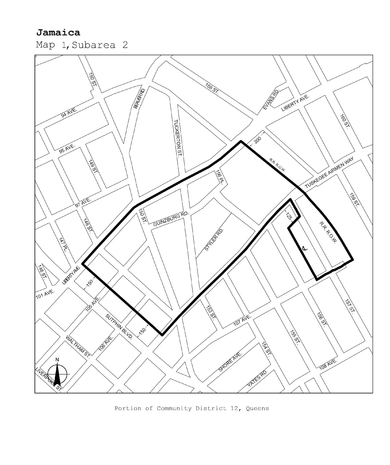
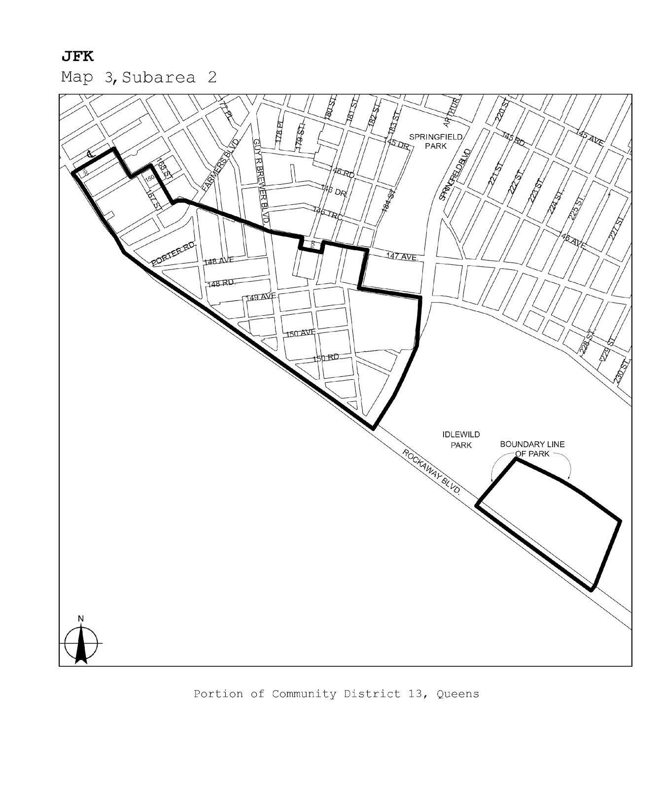
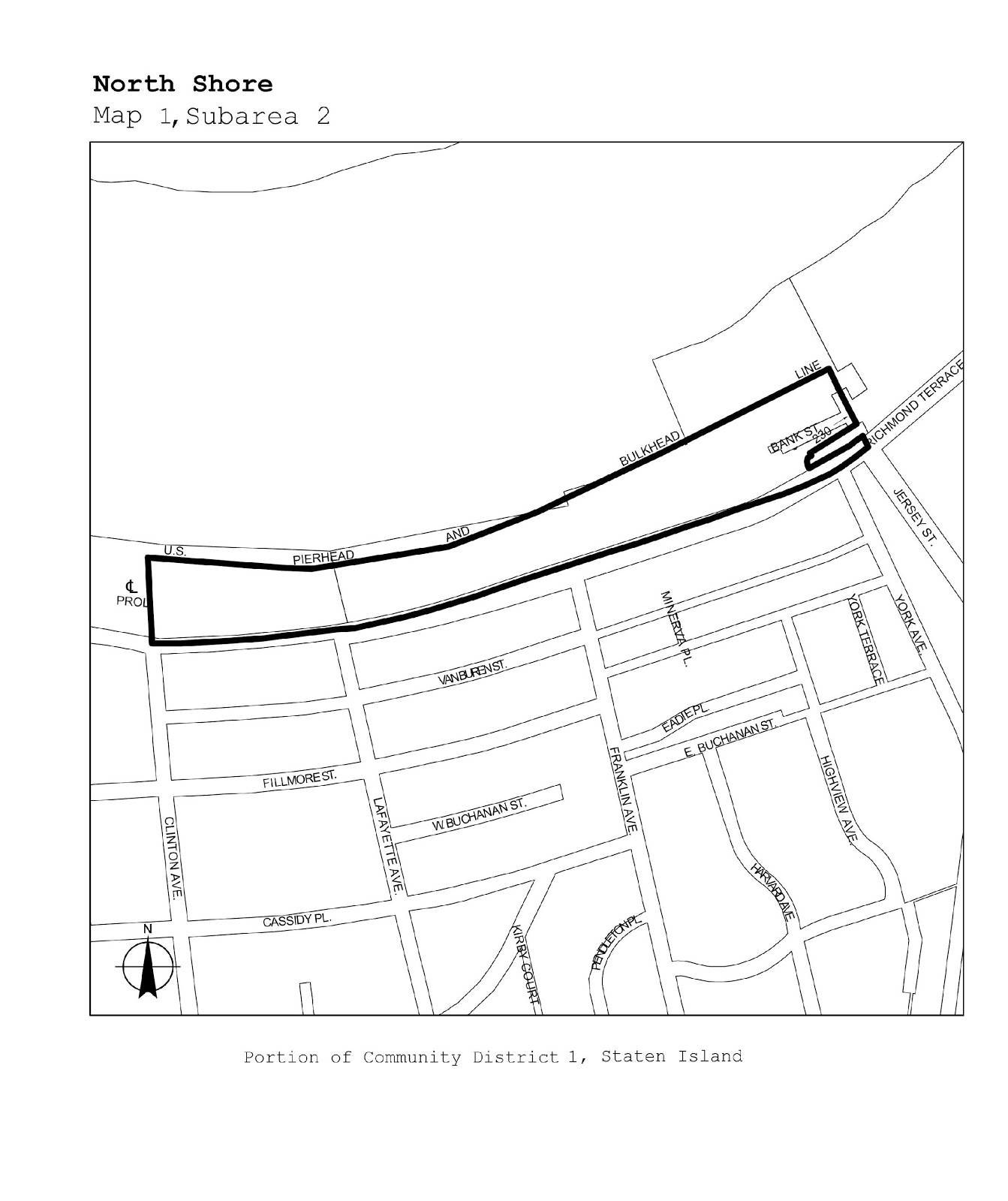
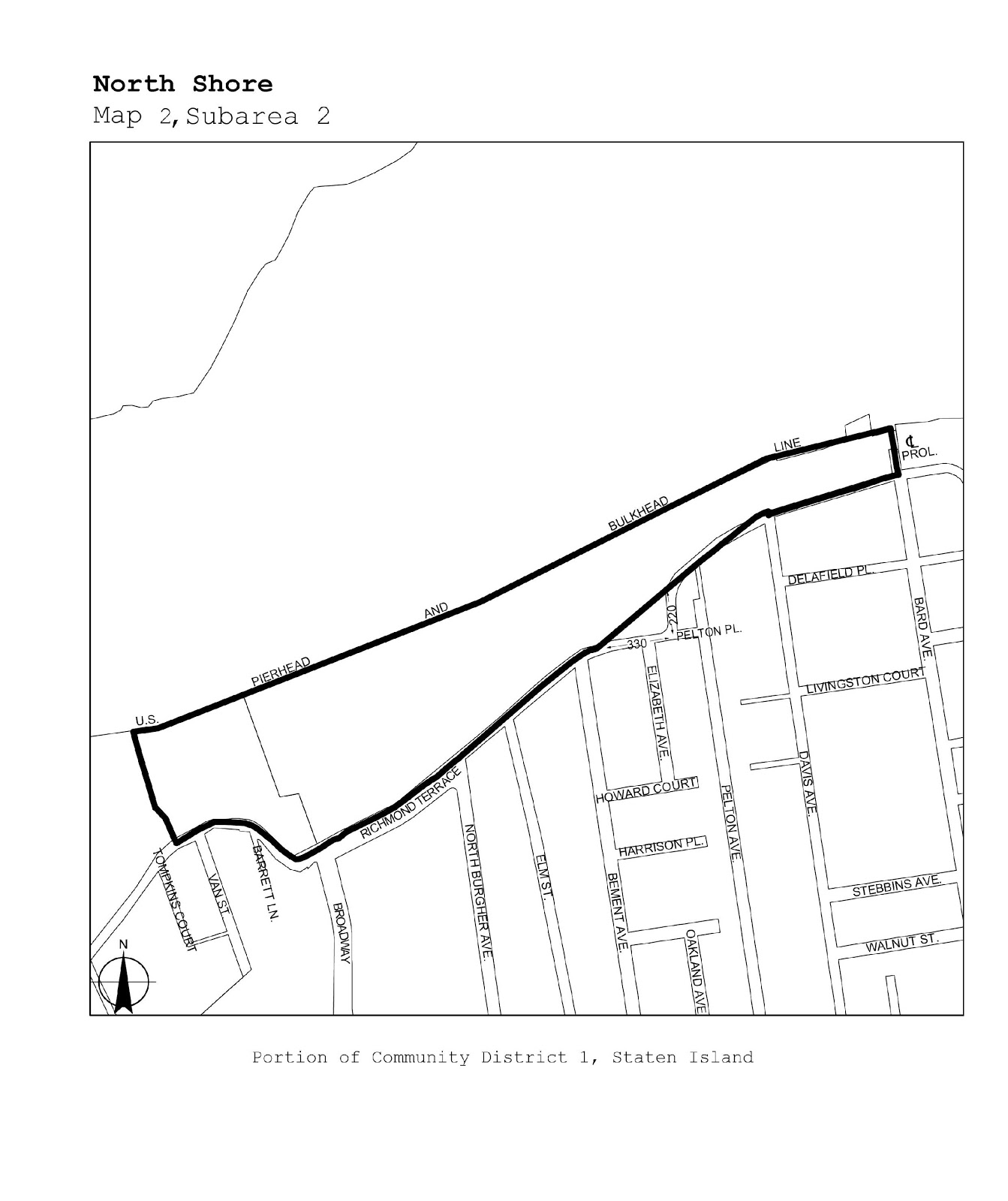
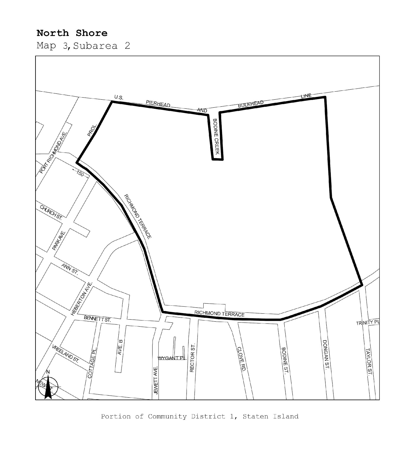
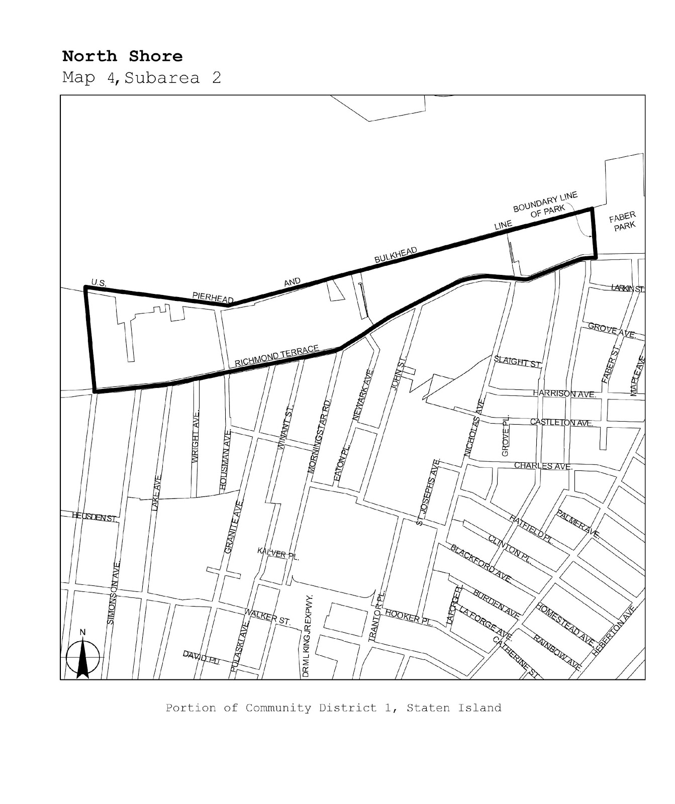
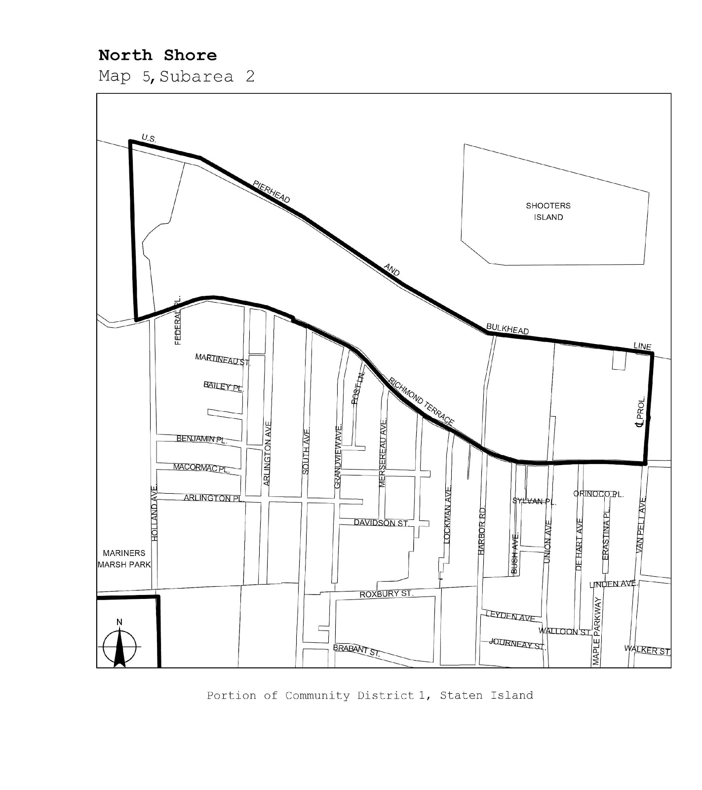
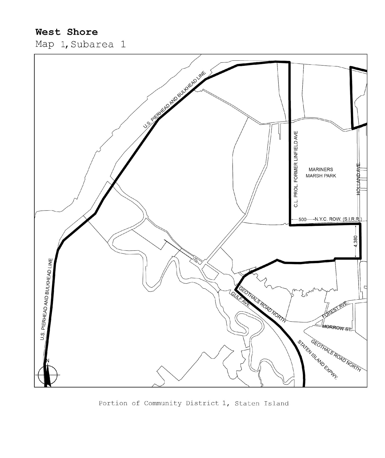
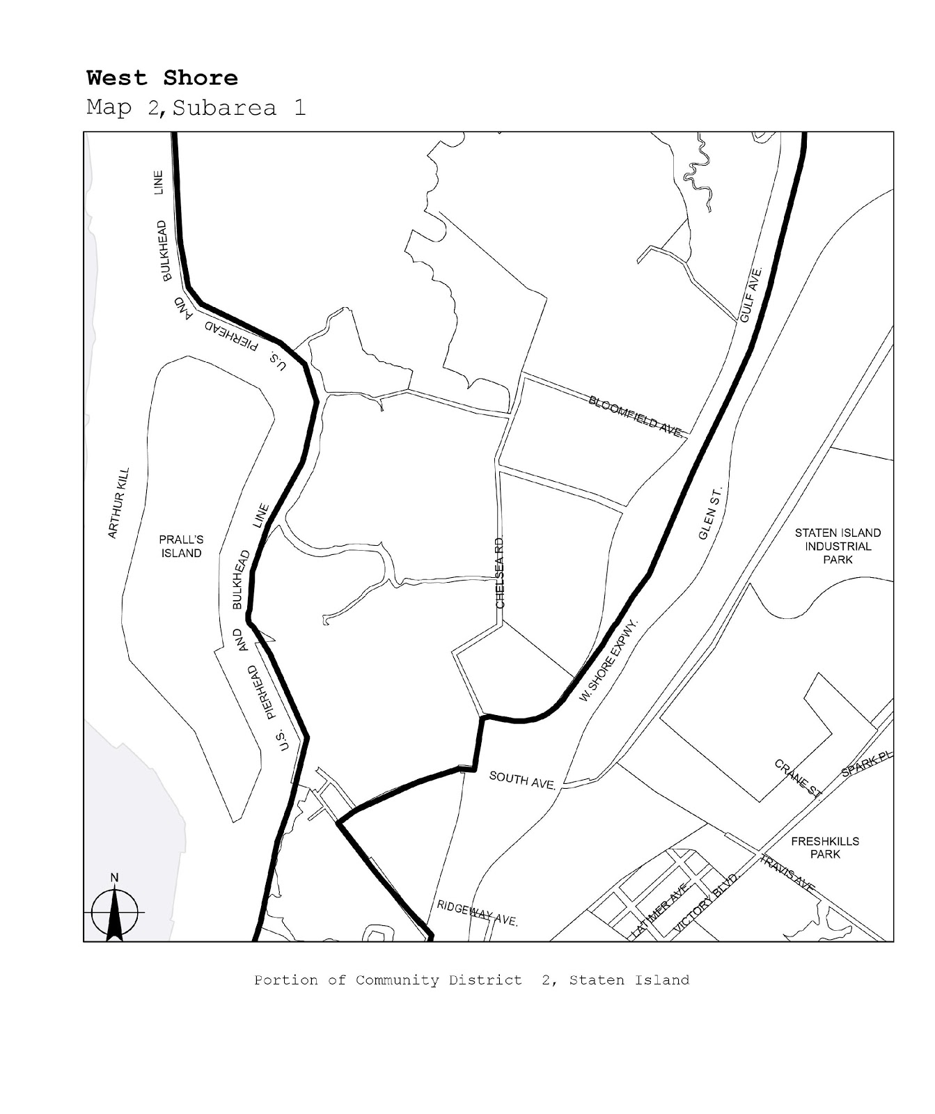
The boundaries of certain designated areas within Manufacturing Districts are shown on the maps in this APPENDIX. Designated areas in which self-service storage facilities are subject to the as-of-right provisions of Section 42-19 (Use Group IX – Storage) are shown on the maps in Subarea 1, and those in which such uses are subject to special permit of the City Planning Commission pursuant to Section 74-192 (Self-service storage facility in designated areas within Manufacturing Districts) are shown on the maps in Subarea 2.
SUBAREA 1
|
Borough |
Community Districts |
Name of Designated Area |
Map No |
|
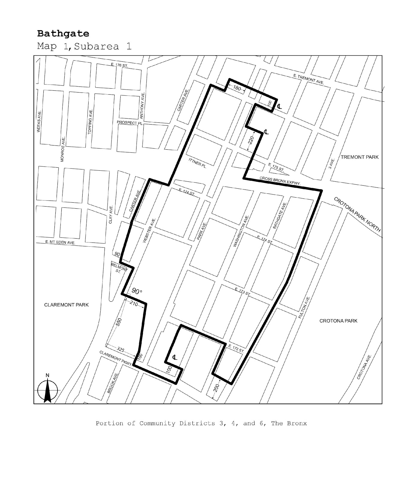
The Bronx |
3, 4, 6 |
Bathgate |
Map 1 |
|
Queens |
1 |
Steinway |
Maps 1, 2 |
|
Queens |
9 |
Richmond Hill |
Map 1 |
|
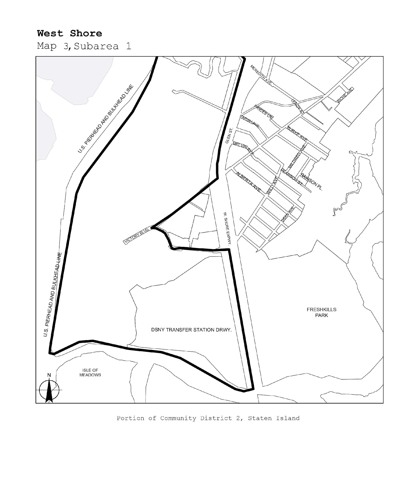
Staten Island |
1, 2 |
West Shore |
Maps 1-3 |
|
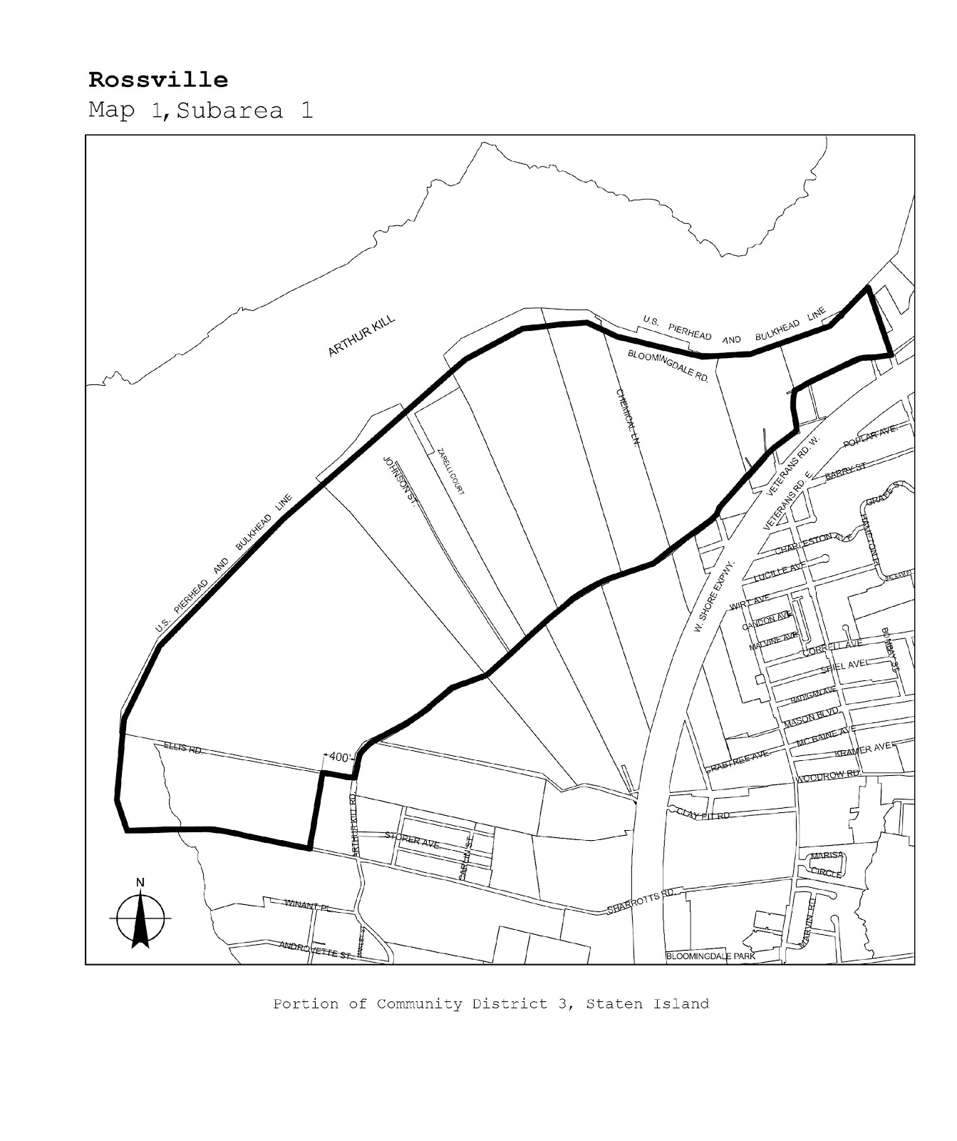
Staten Island |
3 |
Rossville |
Map 1 |
SUBAREA 2
|
Borough |
Community Districts |
Name of Designated Area |
Map No |
|
The Bronx |
1, 2 |
Port Morris |
Maps 1-3 |
|
The Bronx |
2 |
Hunts Point |
Maps 1-3 |
|
The Bronx |
9, 10 |
Zerega |
Maps 1, 2 |
|
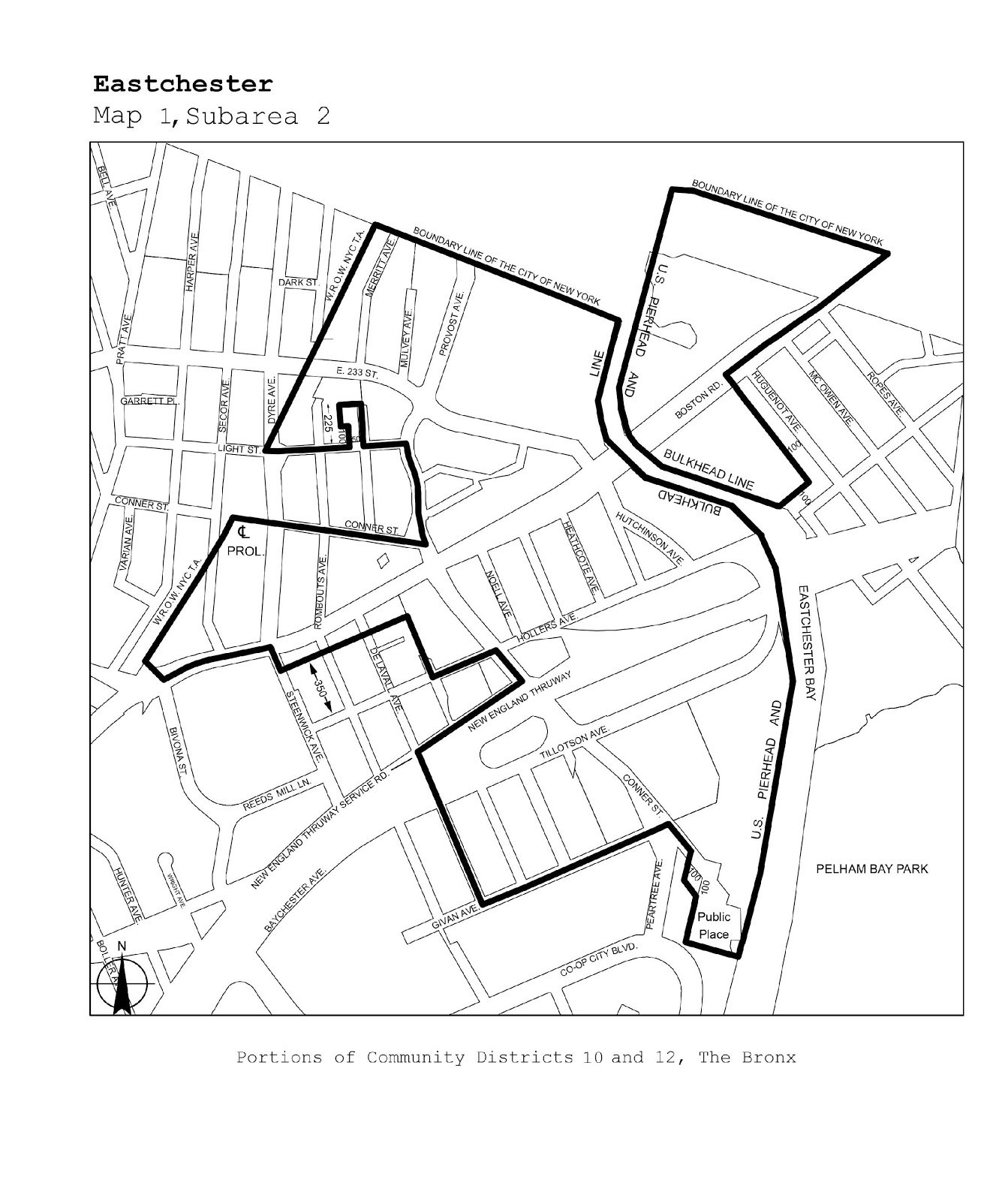
The Bronx |
10, 12 |
Eastchester |
Map 1 |
|
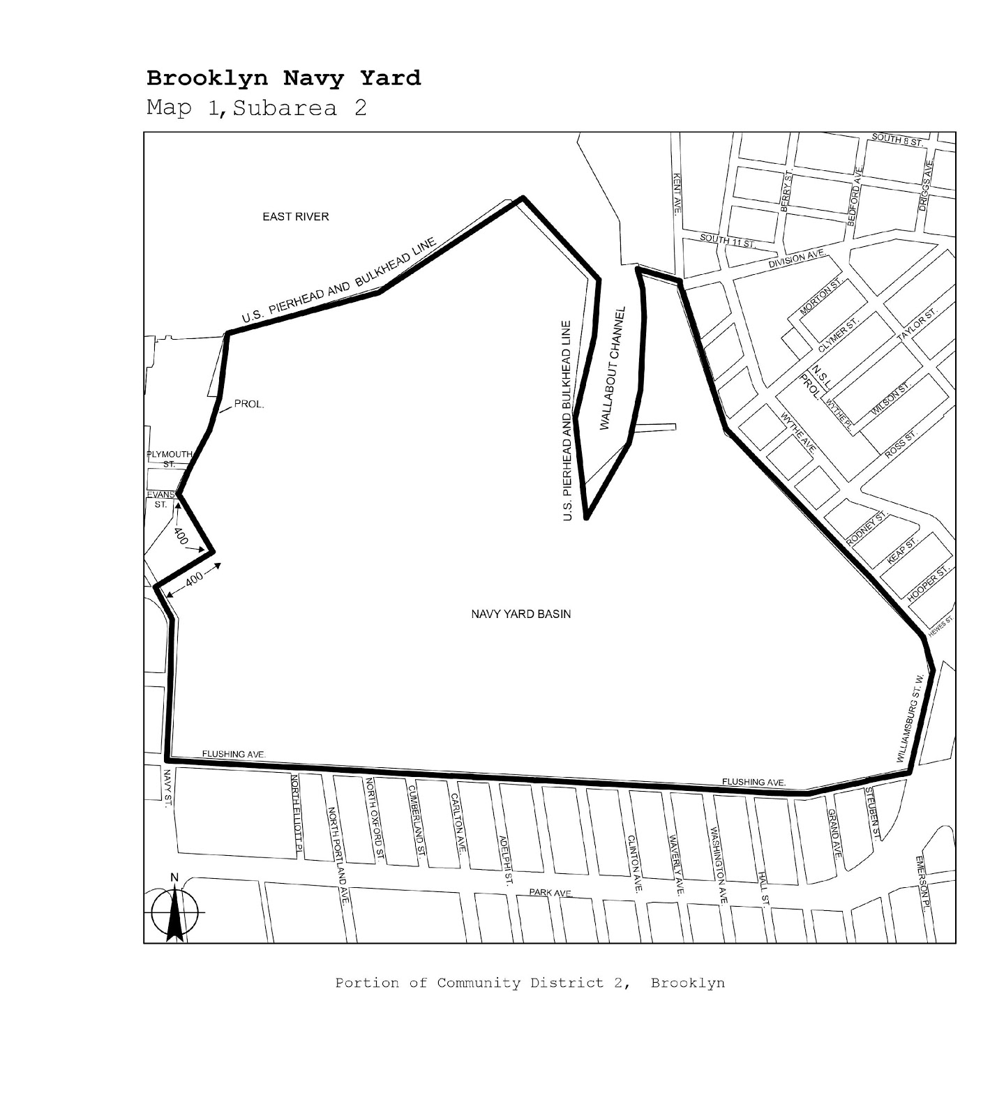
Brooklyn |
2 |
Brooklyn Navy Yard |
Map 1 |
|
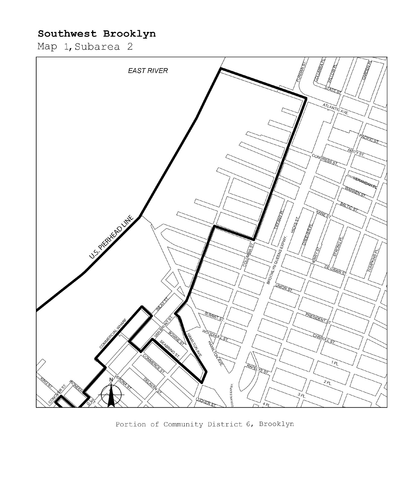
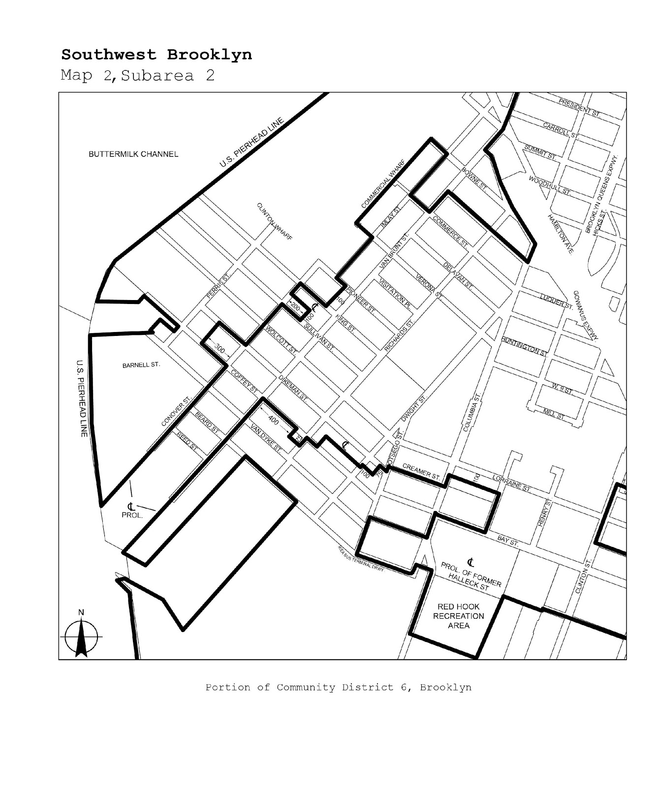
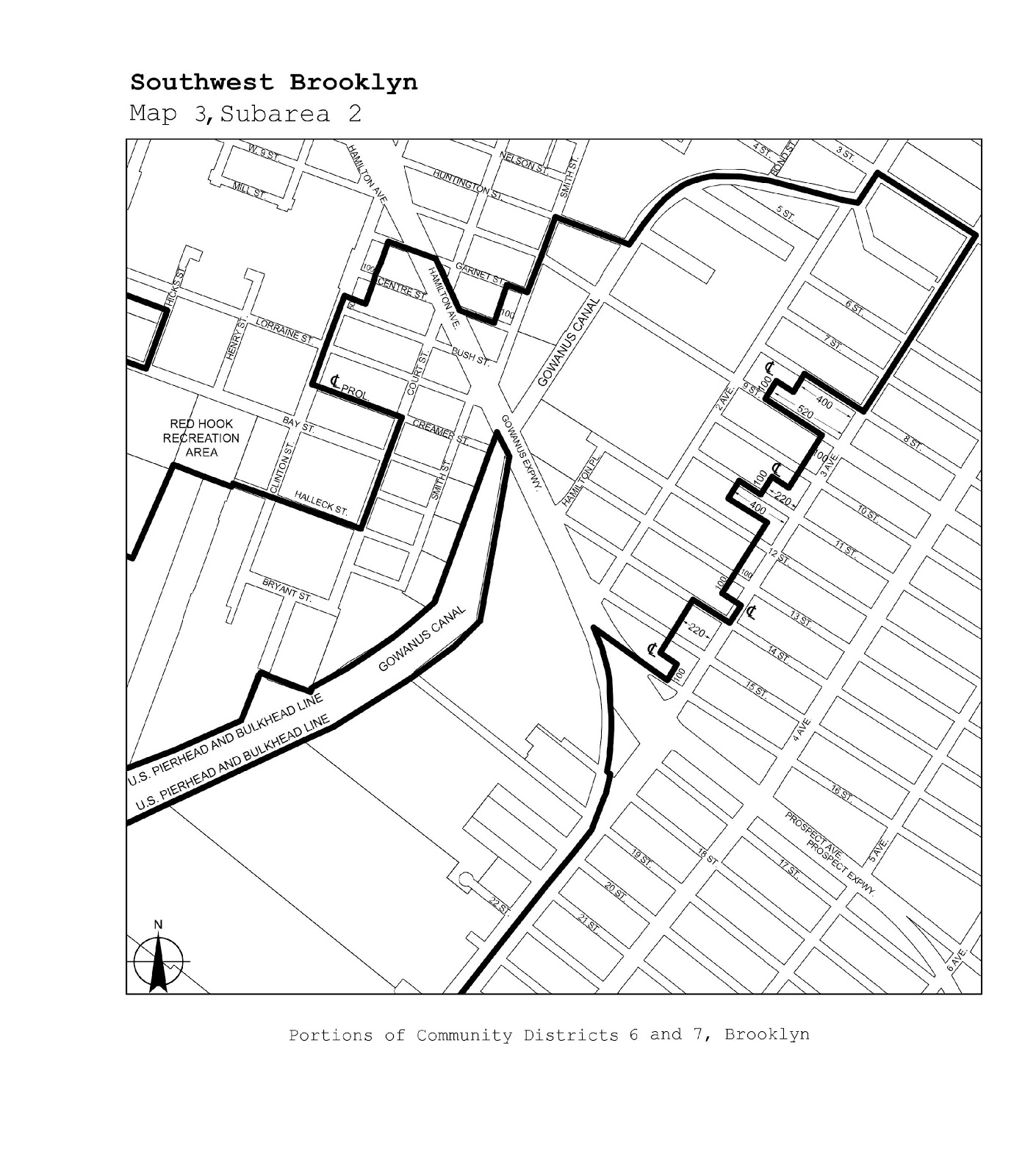
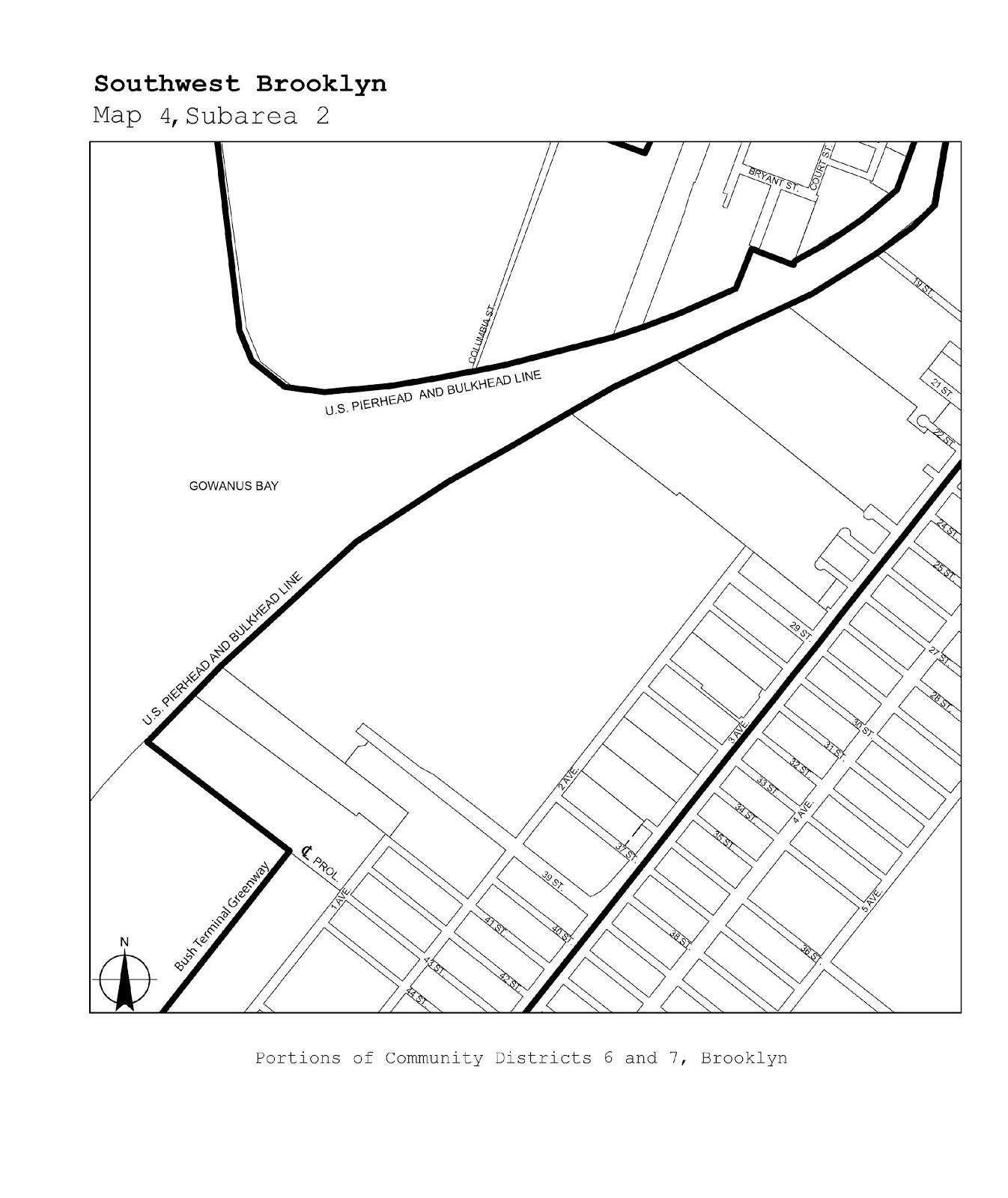
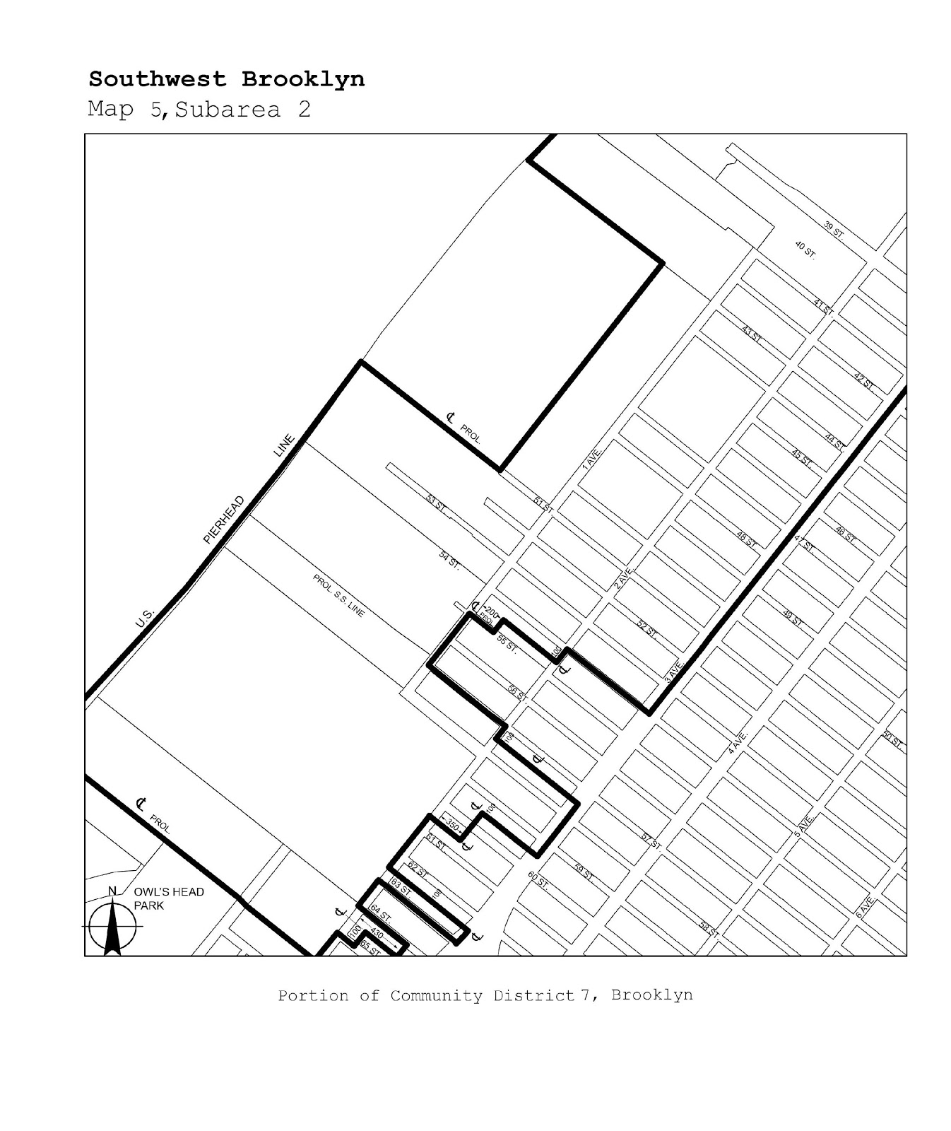
Brooklyn |
6, 7 |
Southwest Brooklyn |
Maps 1-5 |
|
Brooklyn |
5, 16, 17, 18 |
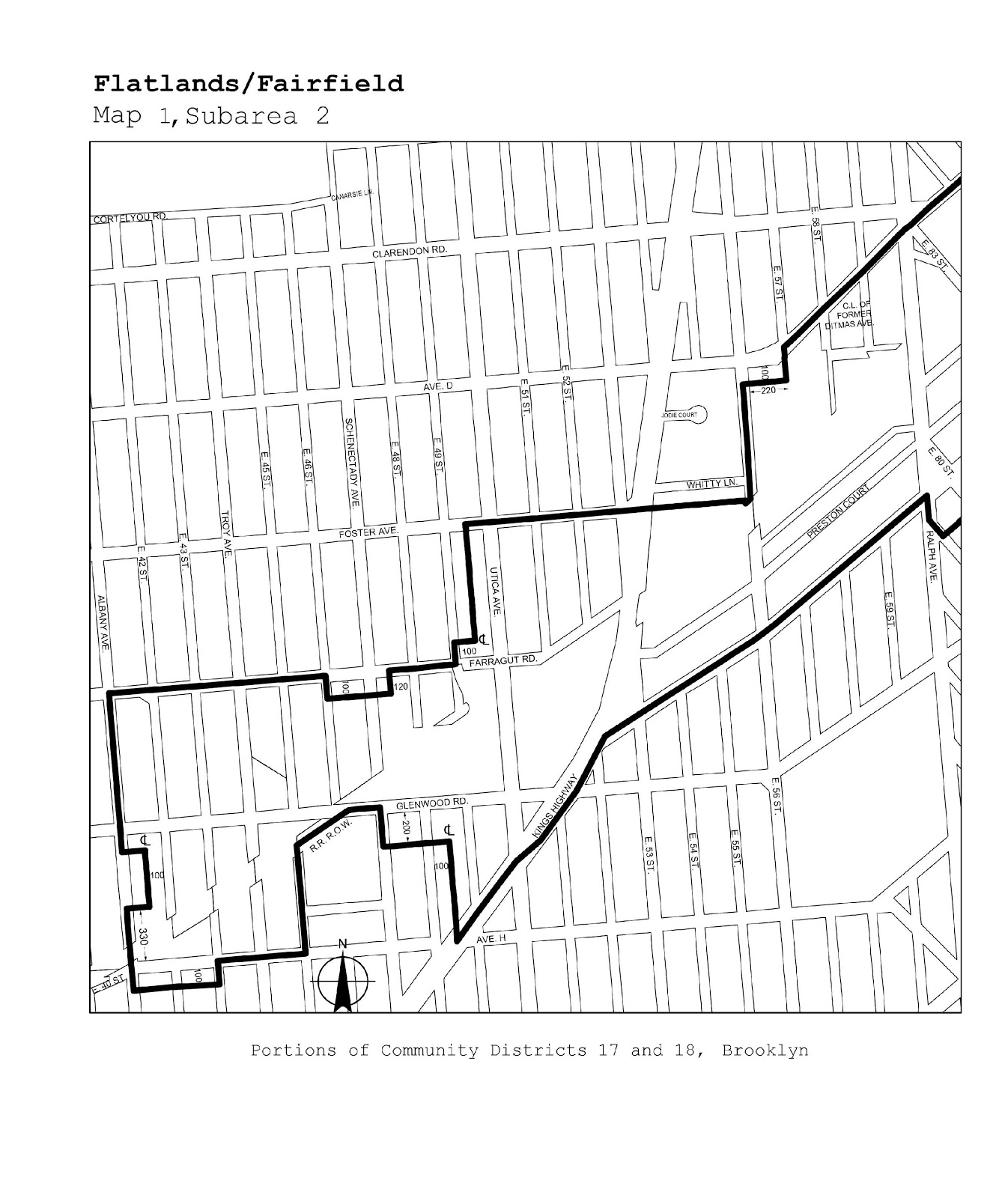
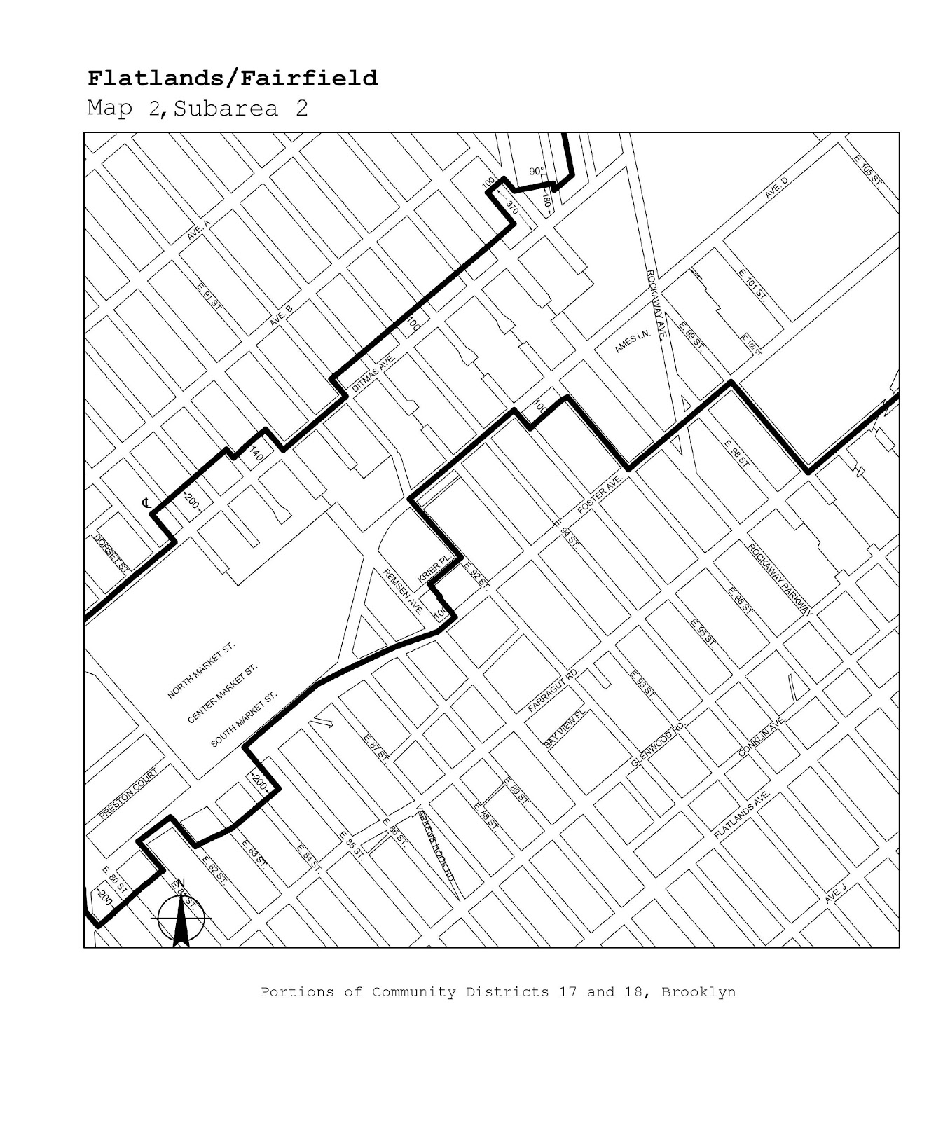
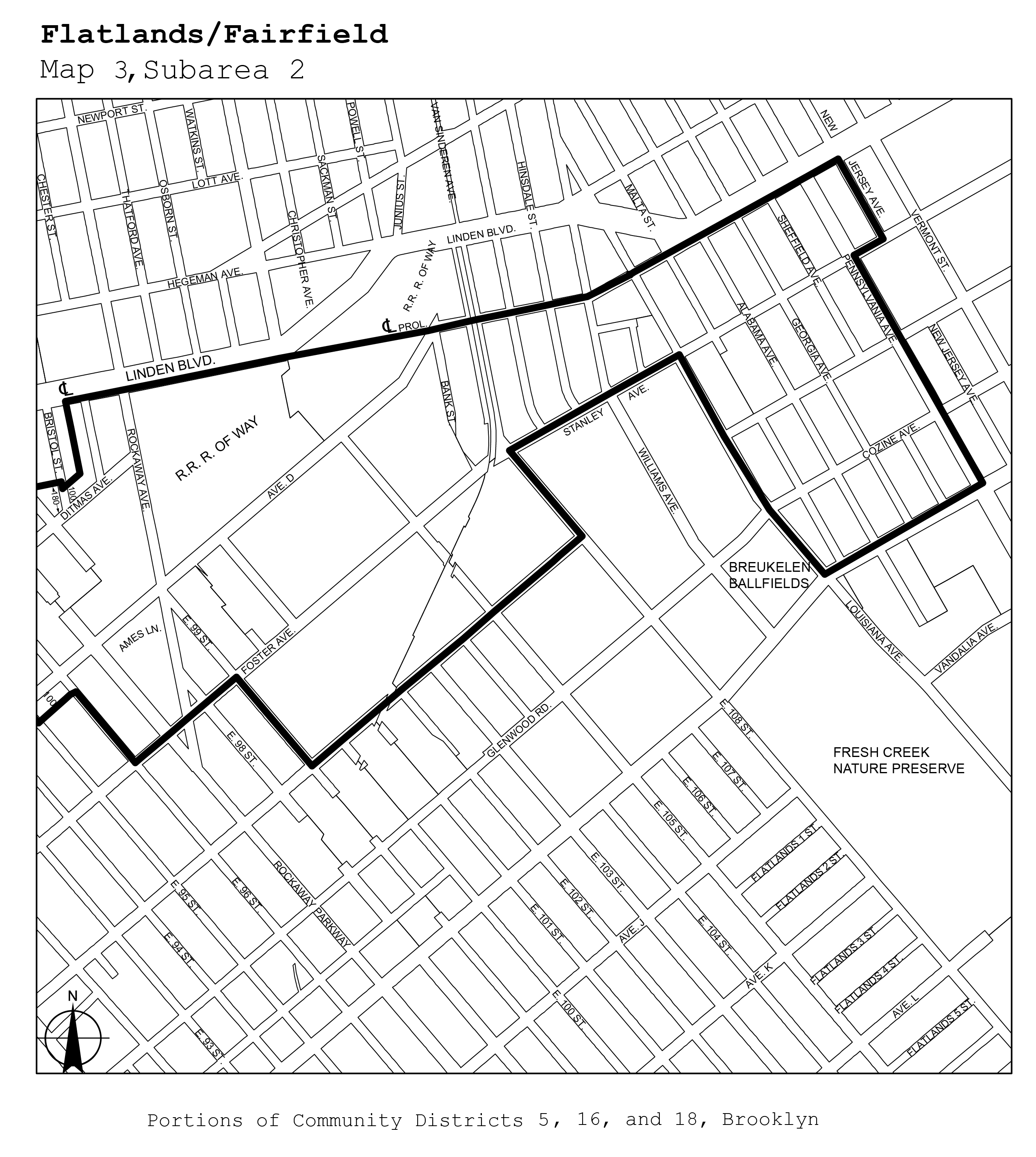
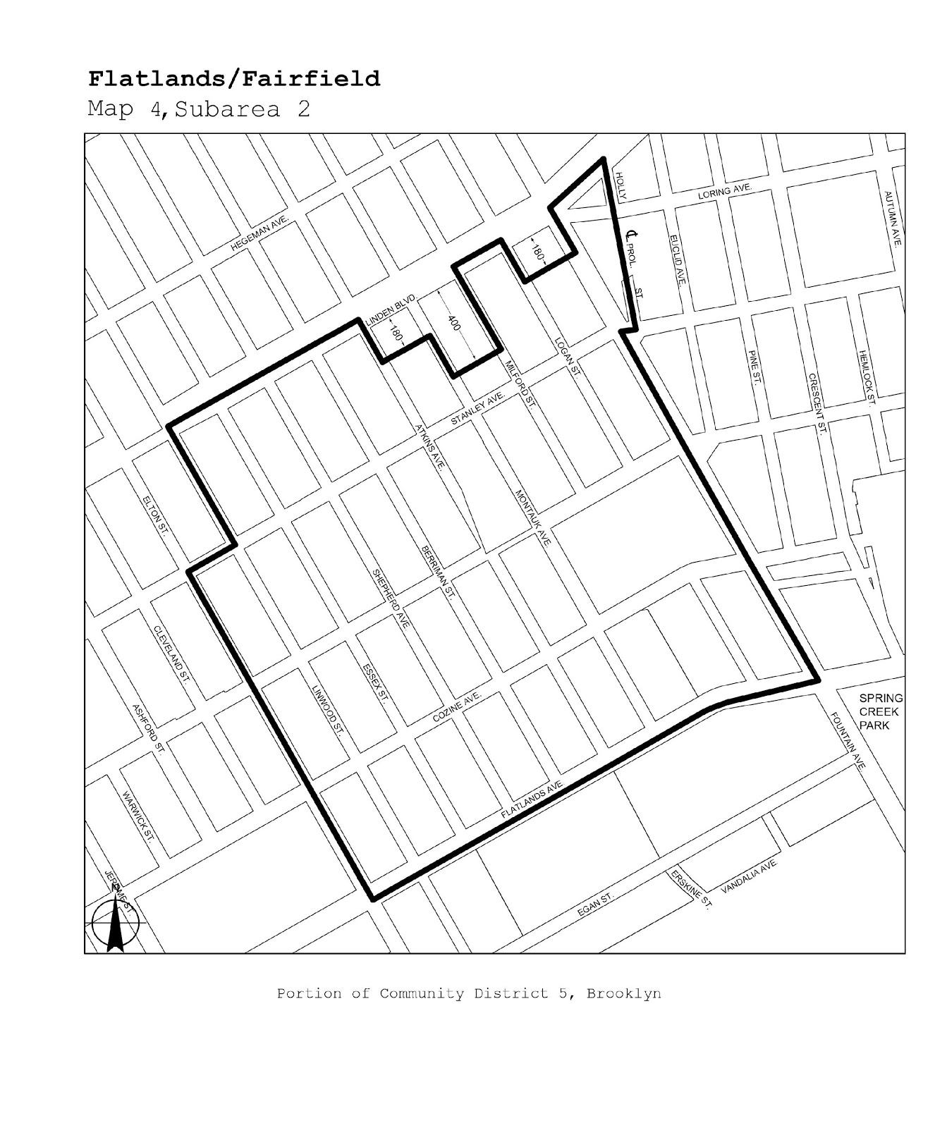
Flatlands/Fairfield |
Maps 1-4 |
|
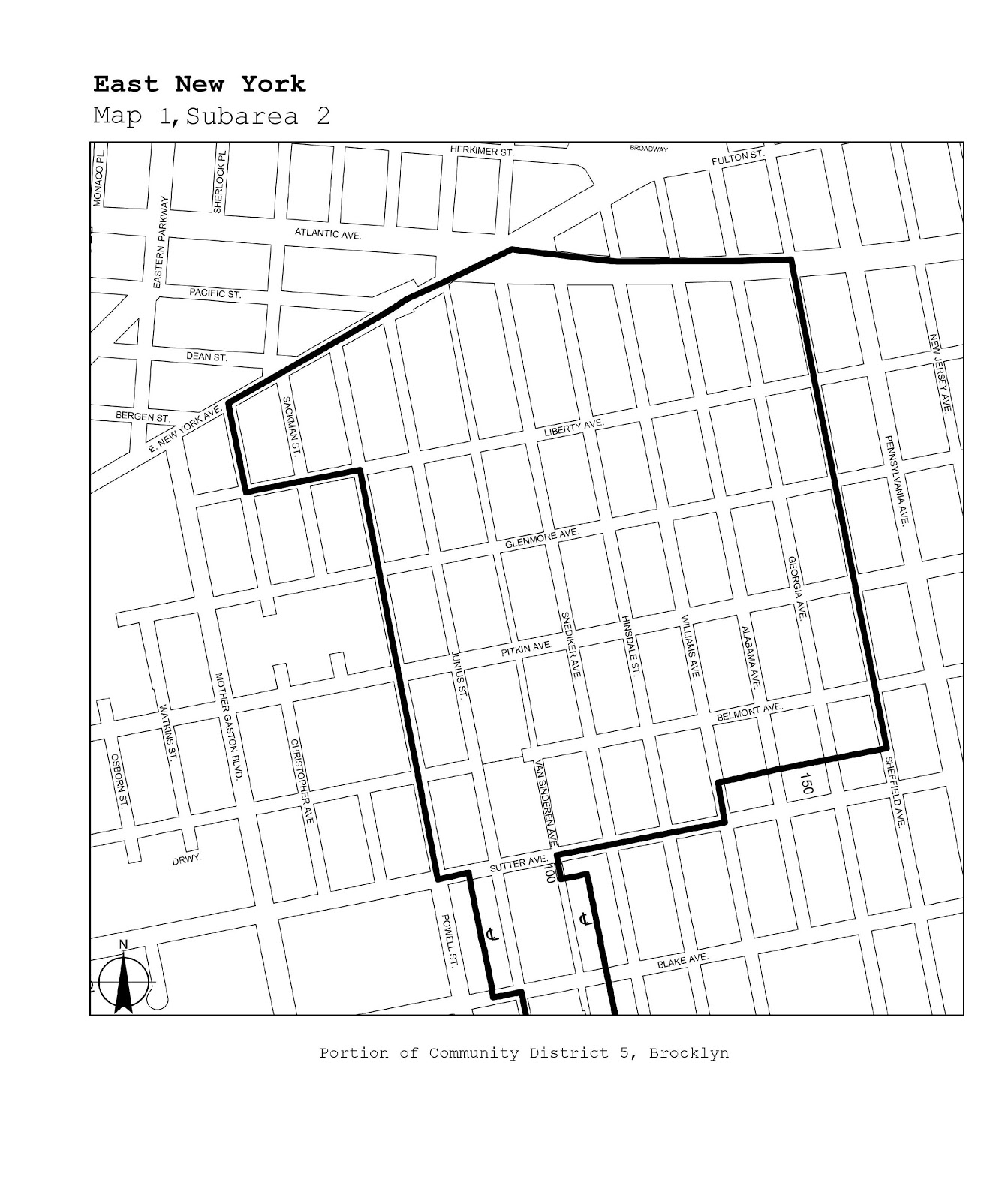
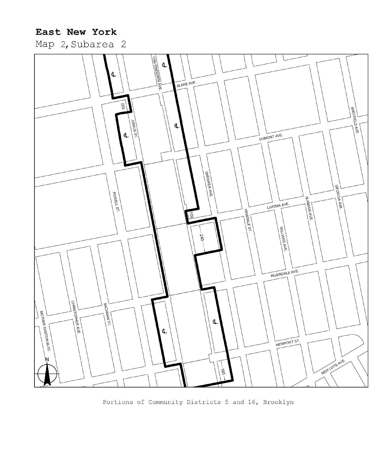
Brooklyn |
5, 16 |
East New York |
Maps 1, 2 |
|
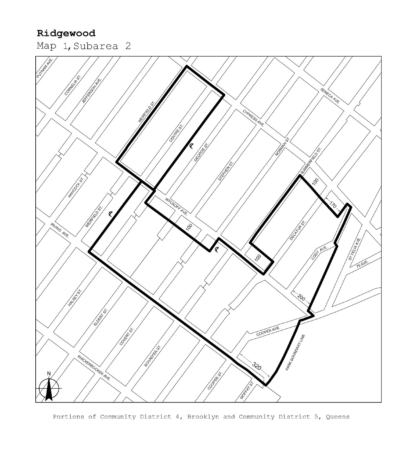
Brooklyn/Queens |
BK 4/QN 5 |
Ridgewood |
Map 1 |
|
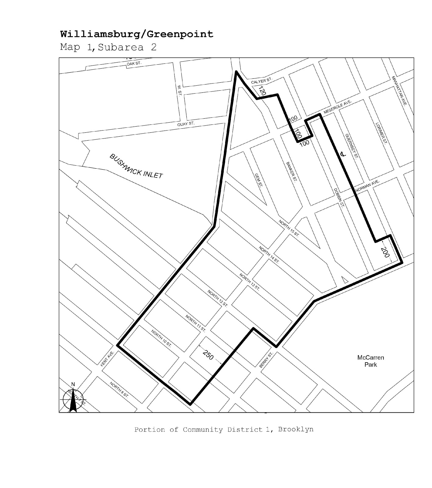
Brooklyn |
1 |
Williamsburg/Greenpoint |
Map 1 |
|
Brooklyn/Queens |
BK 1, 4/QN 2 |
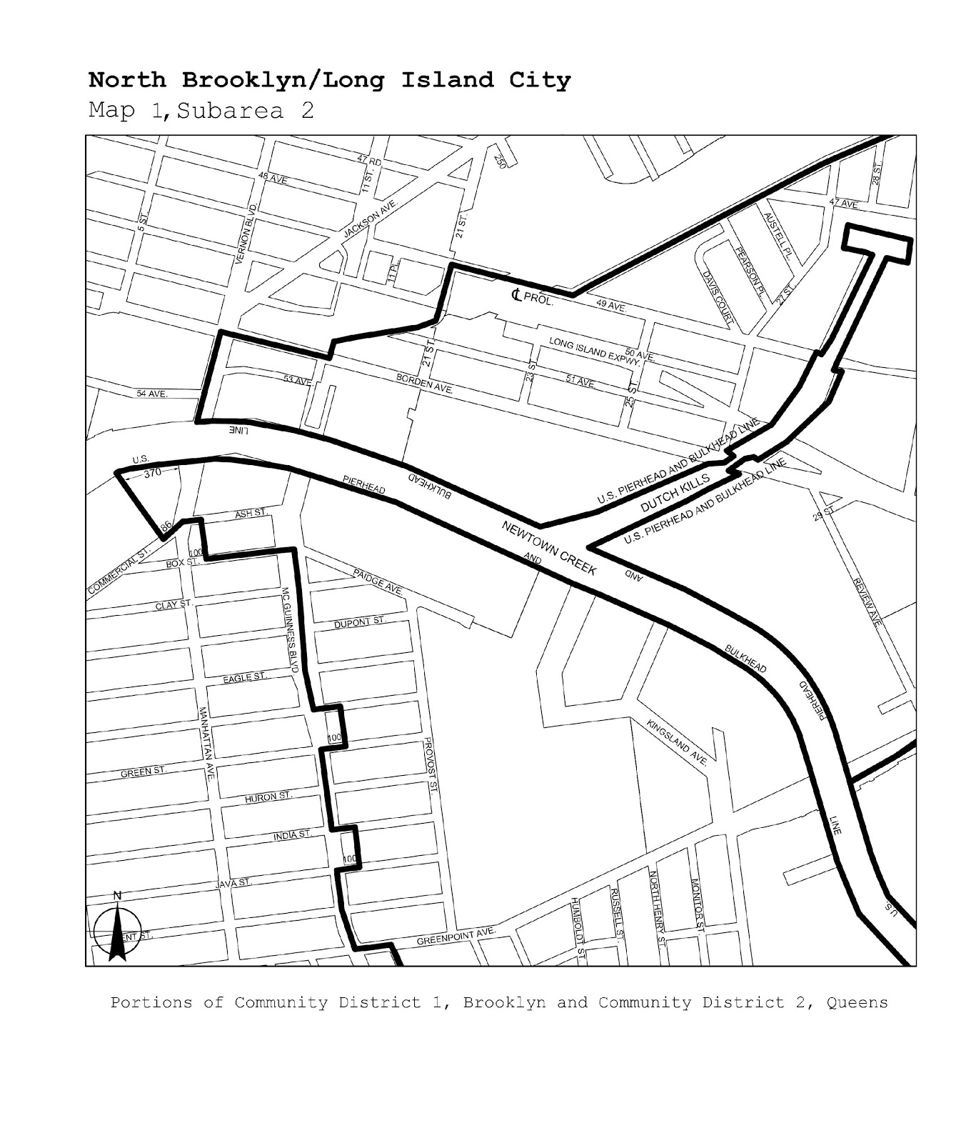
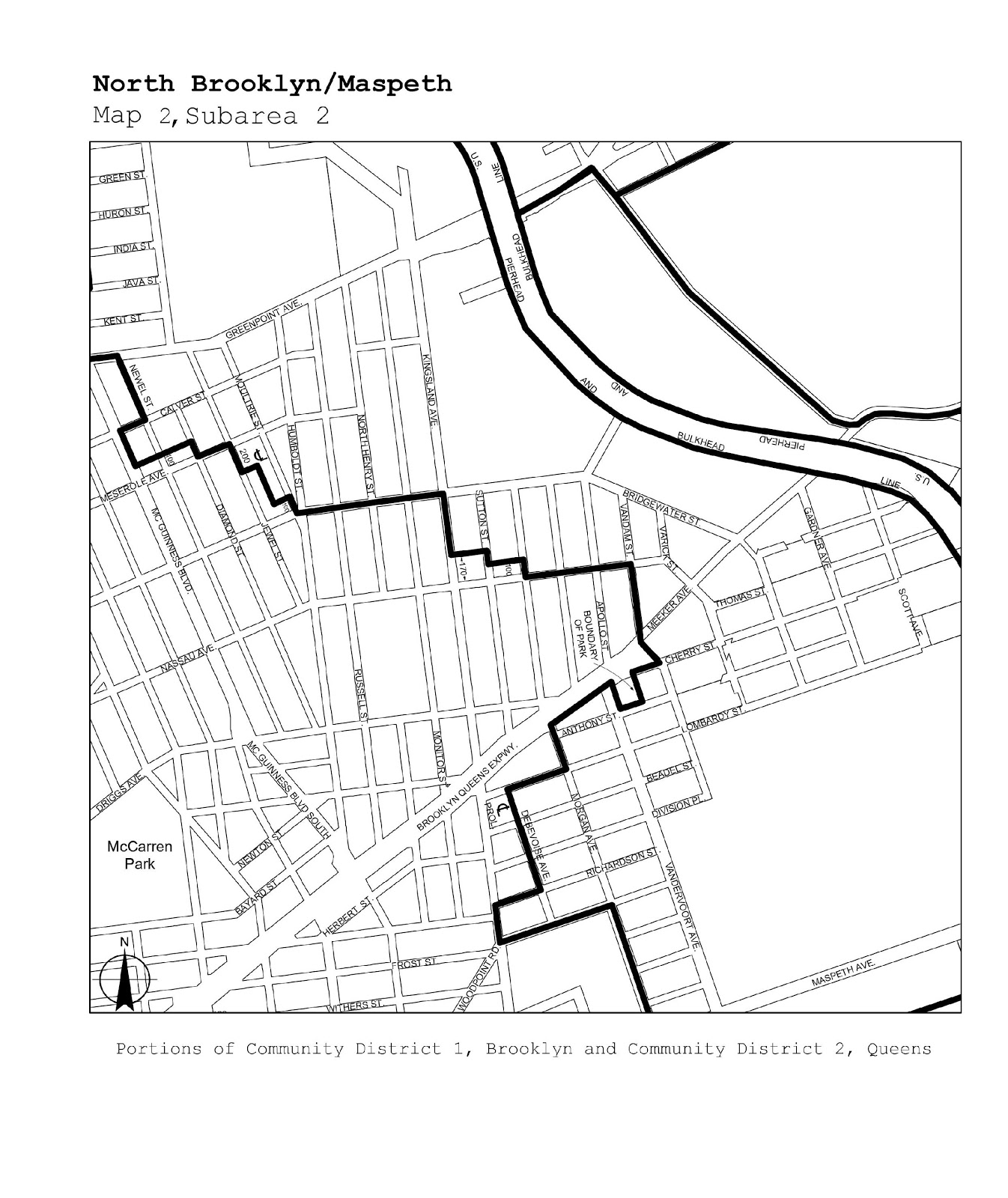
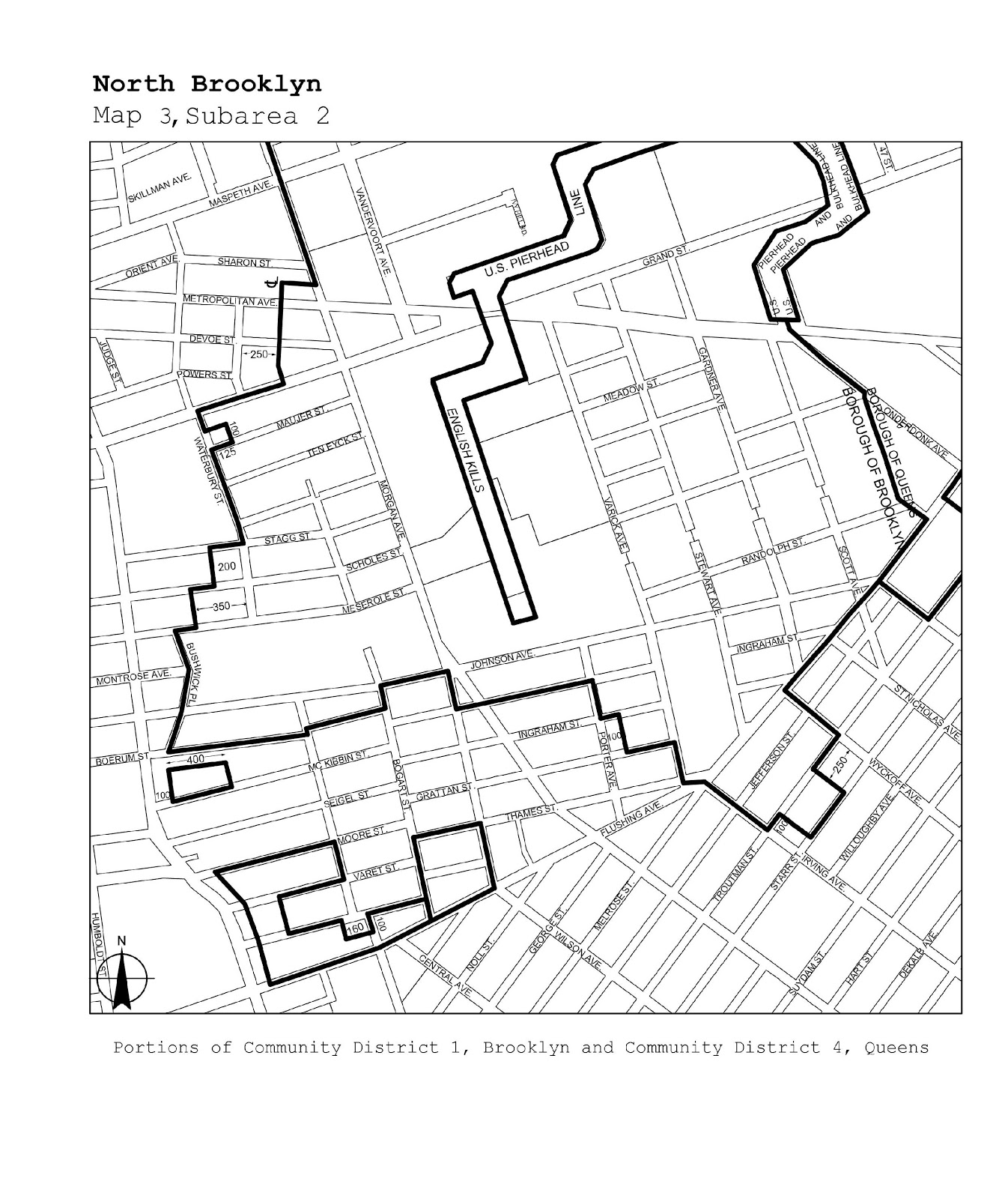
North Brooklyn/Long Island City/ Maspeth |
Maps 1-3 |
|
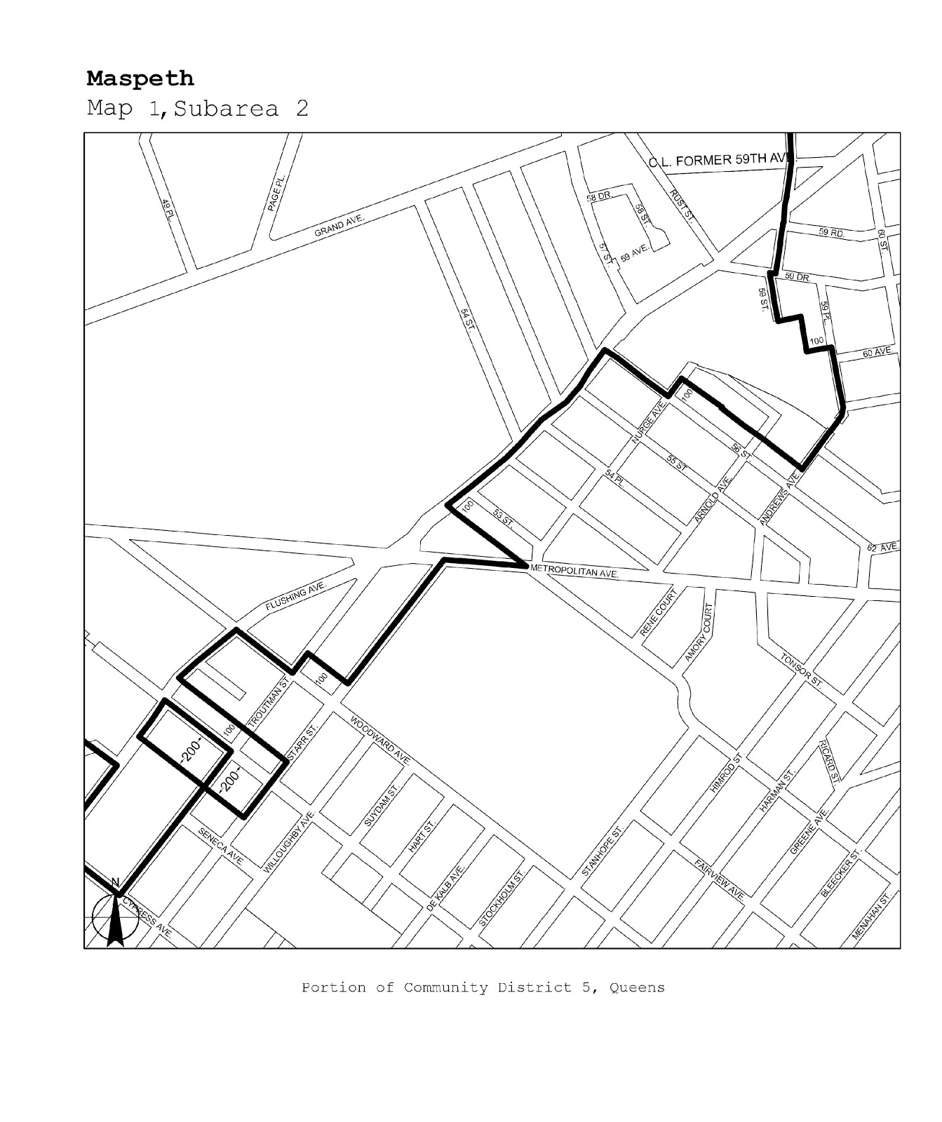
Queens/Brooklyn |
QN 2, 5/BK 1 |
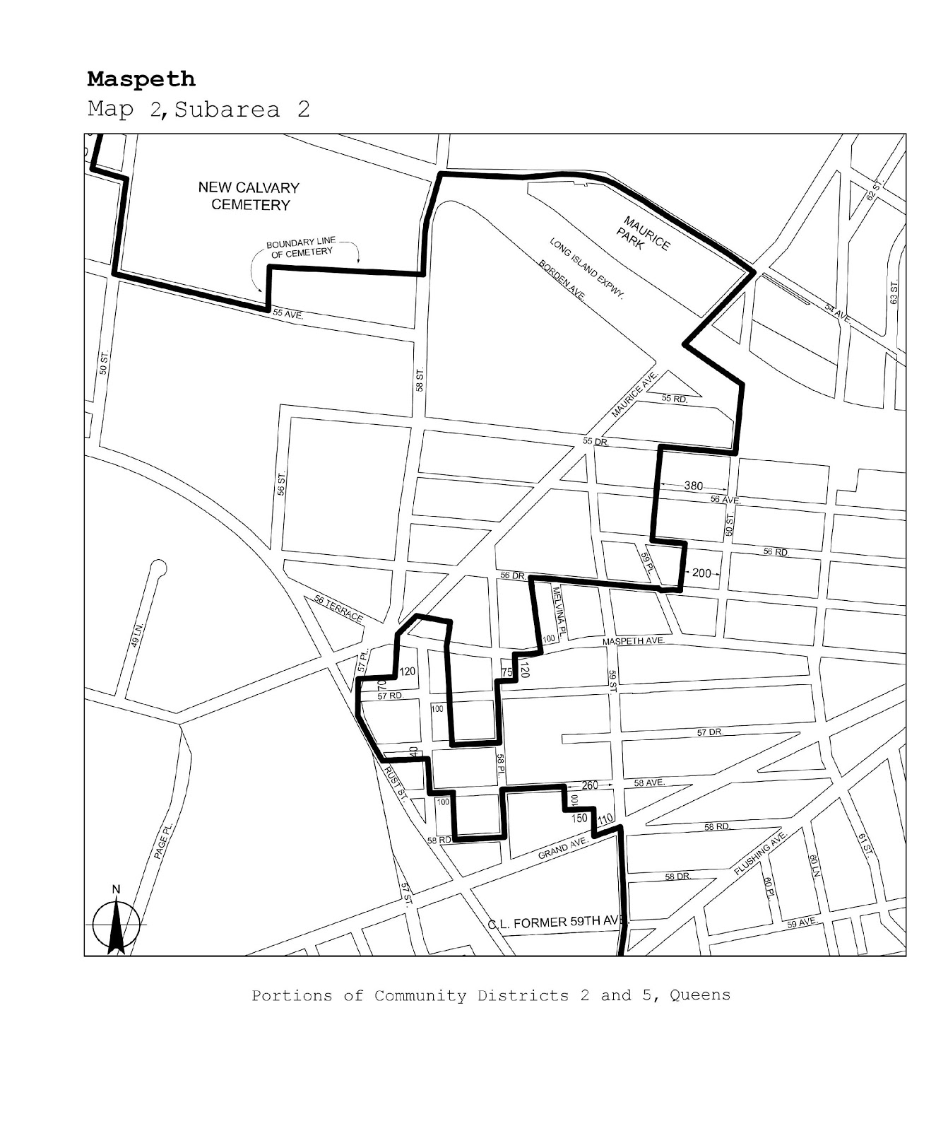
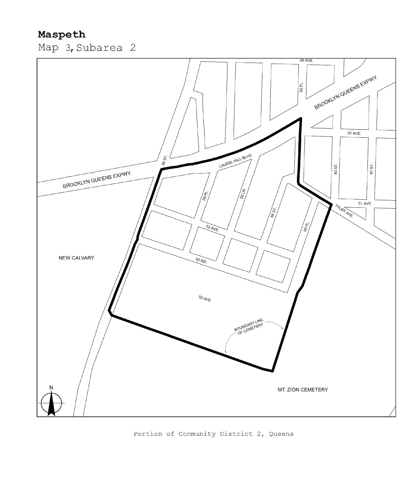
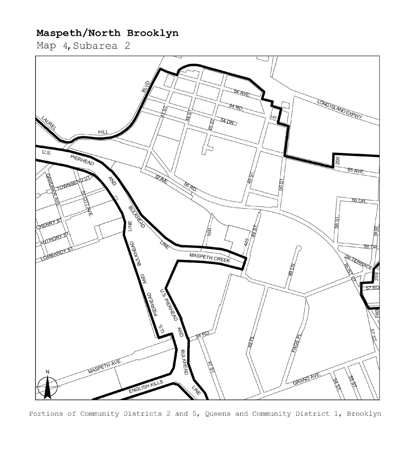
Maspeth/North Brooklyn |
Maps 1-4 |
|
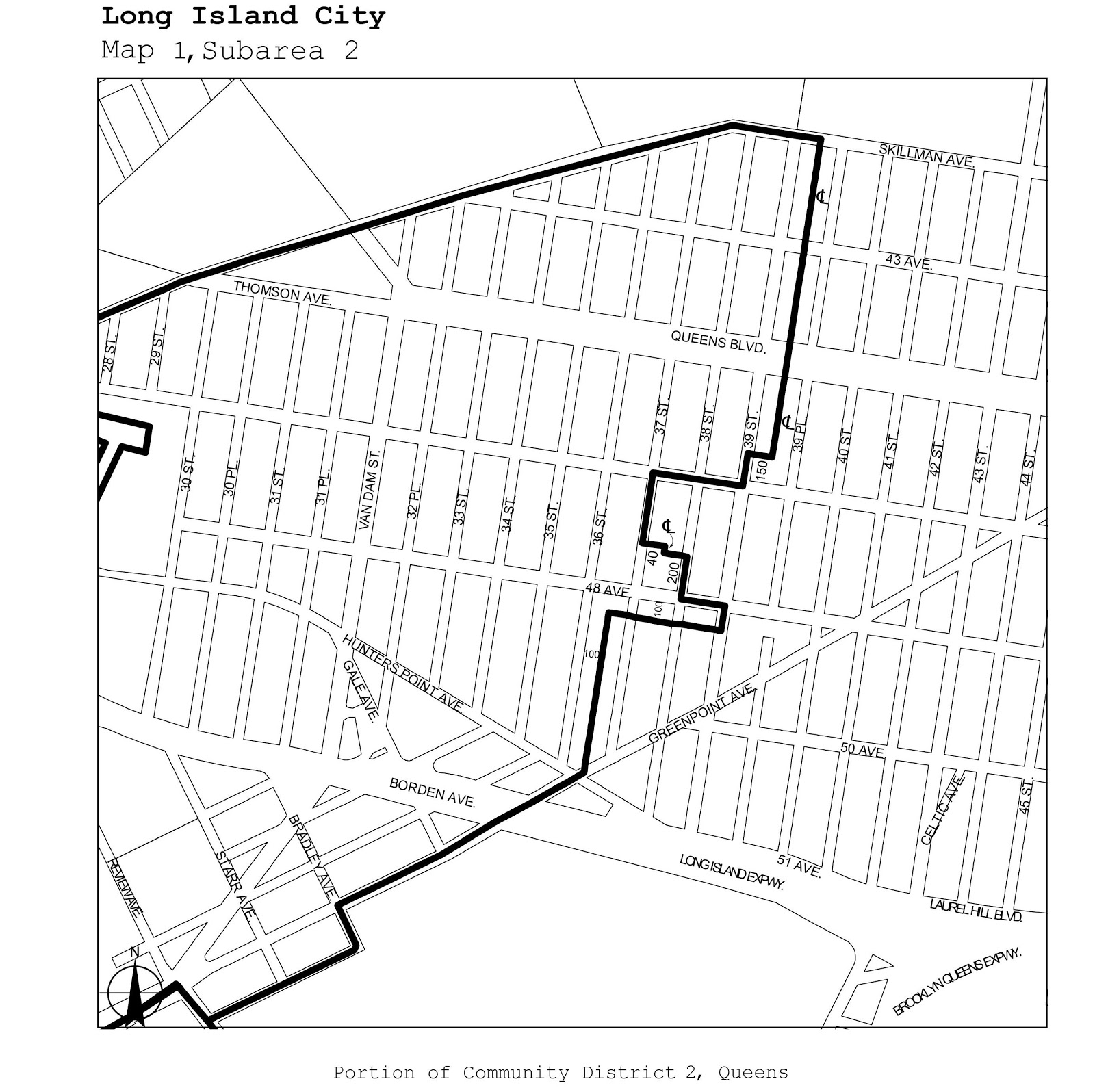
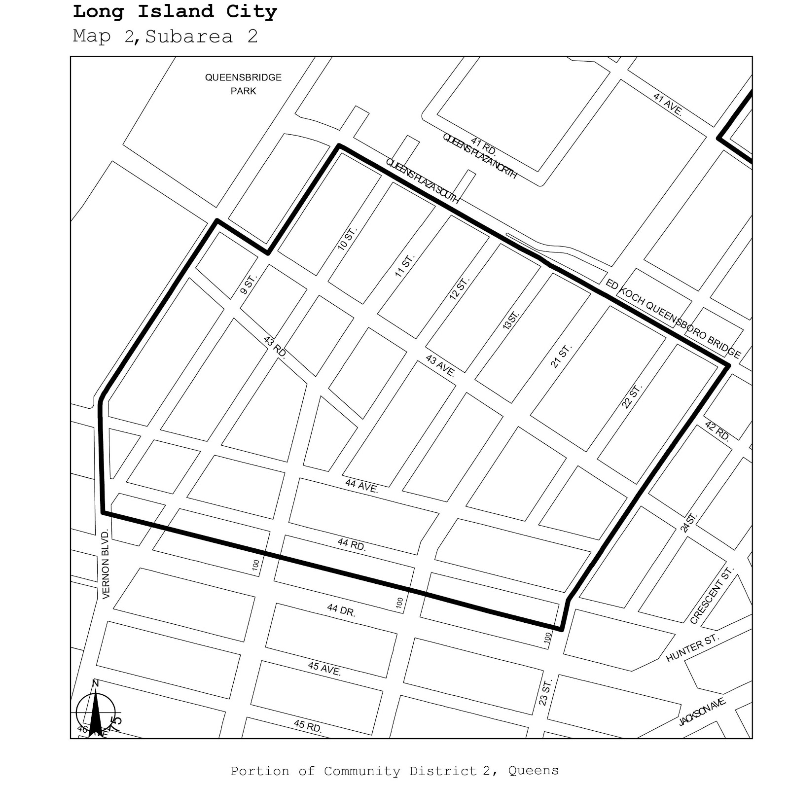
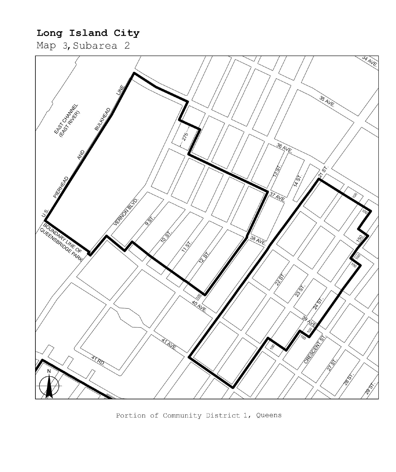
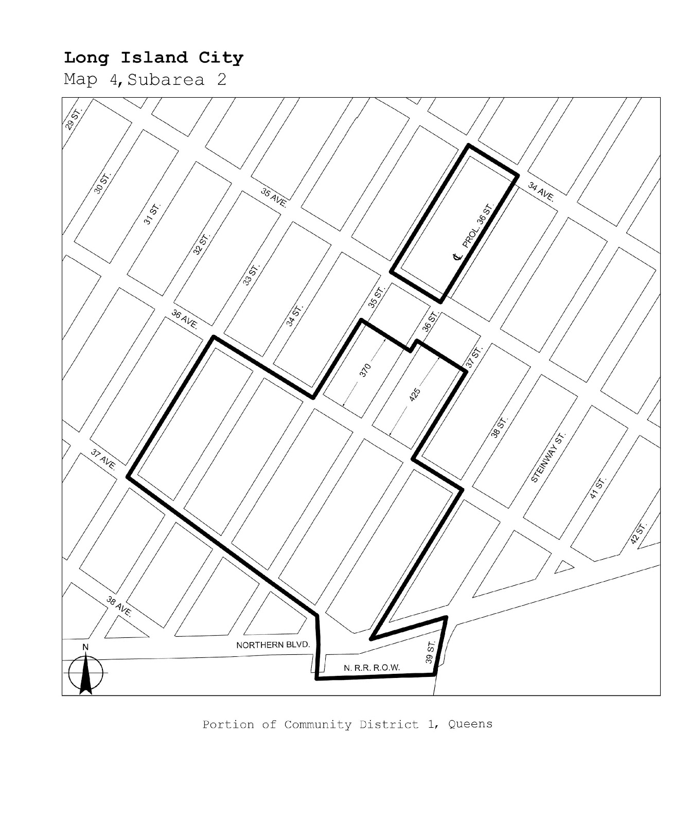
Queens |
1, 2 |
Long Island City |
Maps 1-4 |
|
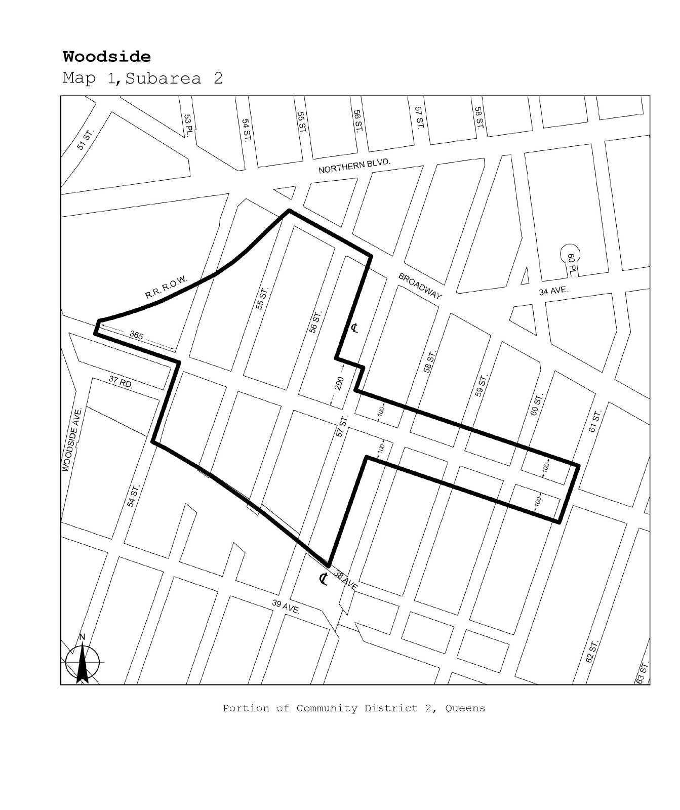
Queens |
2 |
Woodside |
Map 1 |
|
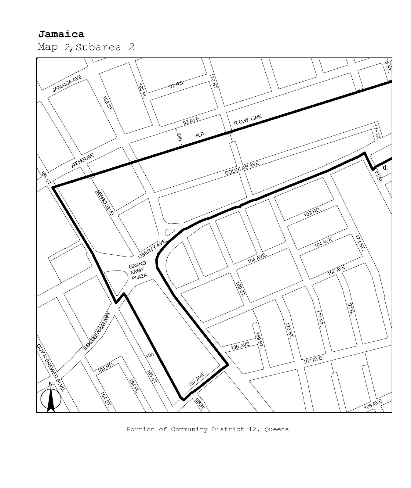
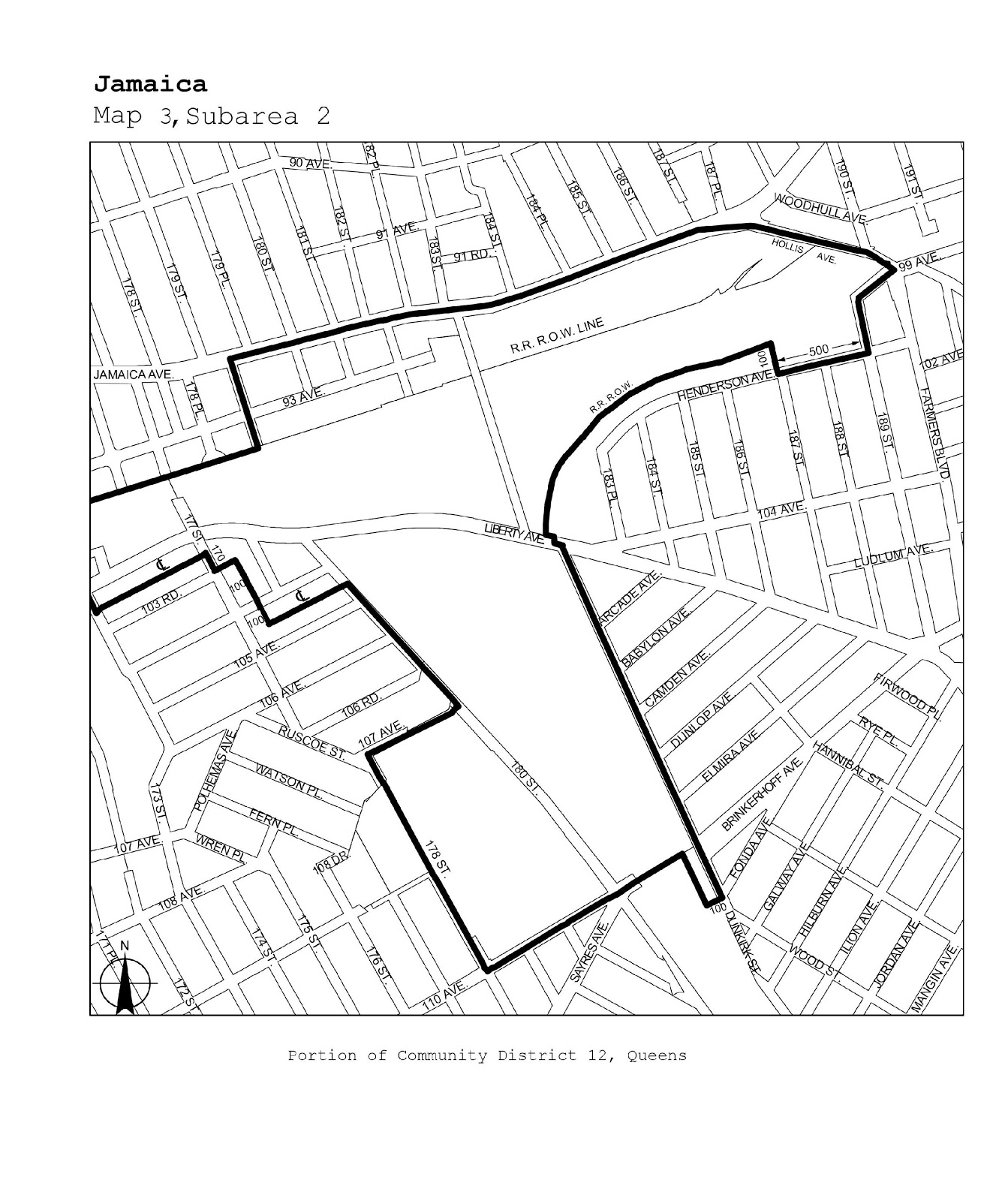
Queens |
12 |
Jamaica |
Maps 1-3 |
|
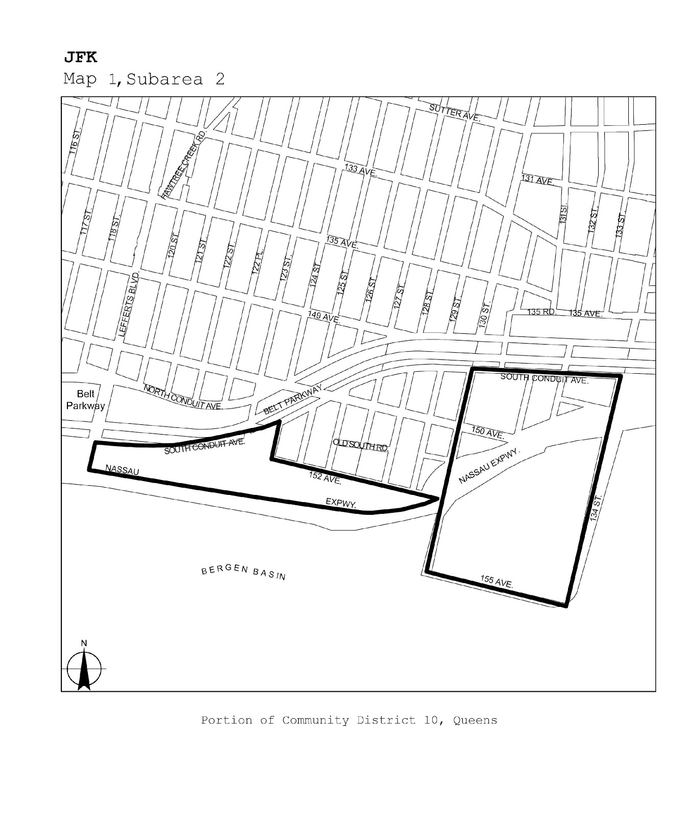
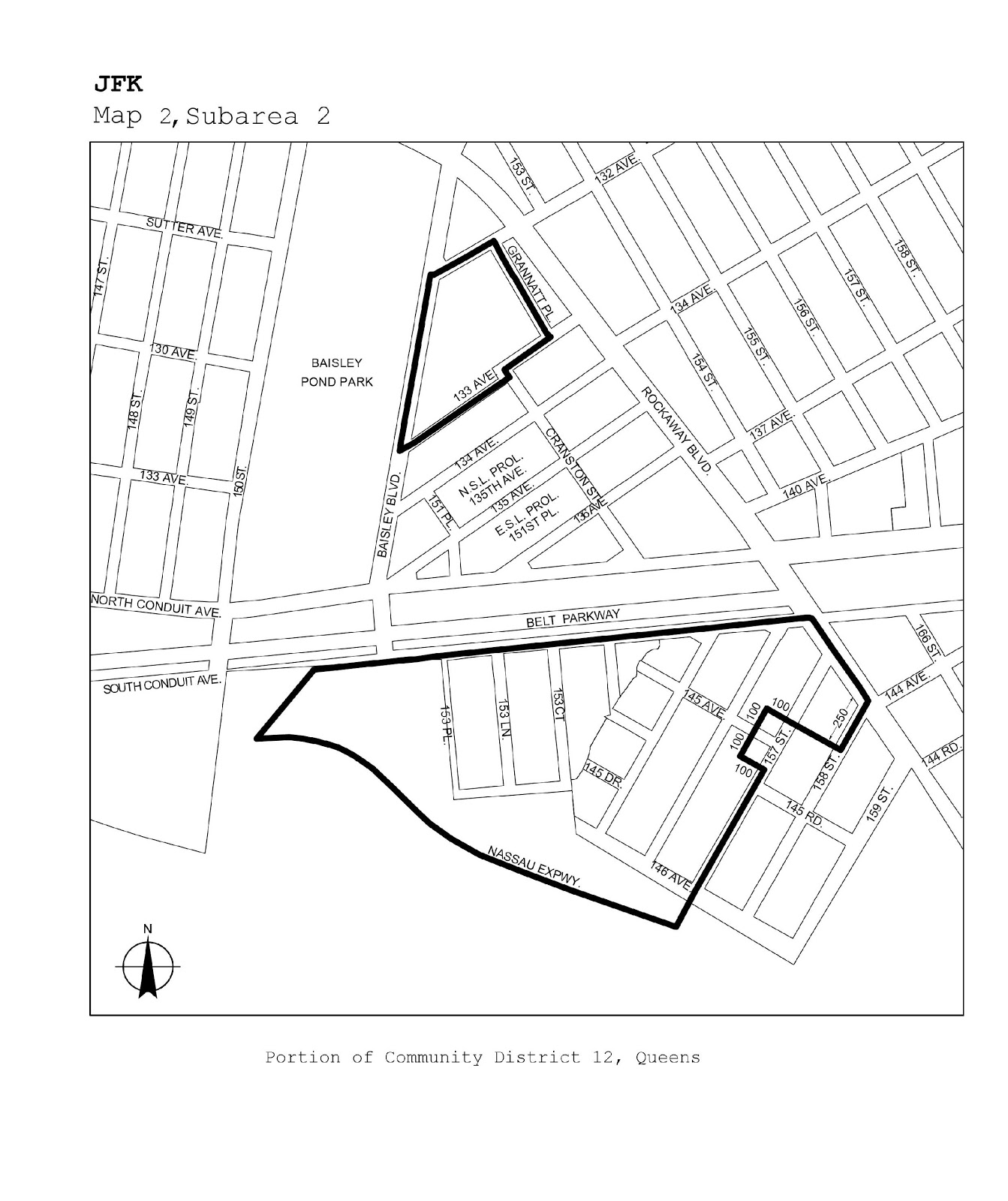
Queens |
10, 12, 13 |
JFK |
Maps 1-3 |
|
Staten Island |
1 |
North Shore |
Maps 1-5 |