Definitions
Center line of the street (bounding a zoning lot)
A line equidistant from and parallel or nearly parallel to the street lines on both sides of the street. However, for the purposes of daylight evaluation:
(a) on a street 75 feet in width, the center line of the street shall be considered to be a line 40 feet from, and parallel to, the front lot line of the zoning lot; and
(b) on a street more than 100 feet in width, the center line of the street shall be considered to be a line 50 feet from, and parallel to, the front lot line of the zoning lot.
Daylight Evaluation Chart (DEC)
A graphic tool which permits objective measurements of portions of sky blocked by a building when it is viewed from a vantage point. There are three daylight evaluation charts for use with street widths of 60 feet, 75 to 80 feet and 100 feet and over, respectively. All buildings are drawn on the appropriate daylight evaluation chart to evaluate their compliance with the regulations of Section 81-27 (Alternate Height and Setback Regulations—Daylight Evaluation). These three daylight evaluation charts are in Appendix B of this Chapter. A fourth chart in Appendix B is available for use with qualifying sites in the East Midtown Subdistrict, as defined in Section 81-613, with frontage along Park Avenue.
Far lot line
A lot line intersecting the street line of the vantage street such that, when viewed from the vantage point, the zoning lot does not contain any lot area that is on the far side of and immediately adjoining the lot line at its intersection with the street line. (See illustration of Far Lot Line and Vantage Point)
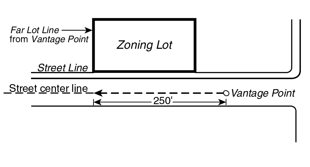
FAR LOT LINE AND VANTAGE POINT
(81-271.1)
Near lot line
A lot line, other than the far lot line, which intersects the street line of the vantage street and which defines the extent of the zoning lot's continuous frontage along the vantage street from the far lot line.
Profile curve
A curved line on the daylight evaluation chart rising from the intersection of the curved line representing an elevation angle of 72 degrees with the vertical line at the far lot line. The profile curve is used to evaluate a building's obstruction of the sky as seen in profile from the vantage point.
Profile encroachment
The space on the daylight evaluation chart which, when viewed from the vantage point, is on the far side of the profile curve and which is blocked by the projection of the building on the daylight evaluation chart. (See illustration of Profile Encroachment)
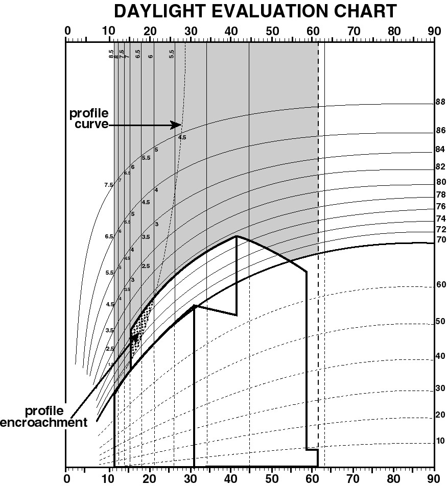
PROFILE ENCROACHMENT
(81-271.2)
Vantage point
A point on the center line of the street bounding the zoning lot and located 250 feet from the intersection of the extension of the zoning lot's far lot line with the center line of the street. (See illustration of Far Lot Line and Vantage Point)
Vantage street
A street bounding the zoning lot and on the center line of which a vantage point is located.