APPENDIX
Special Governors Island District Plan
Map 1 - Special Governors Island District, Subdistricts, and Subareas
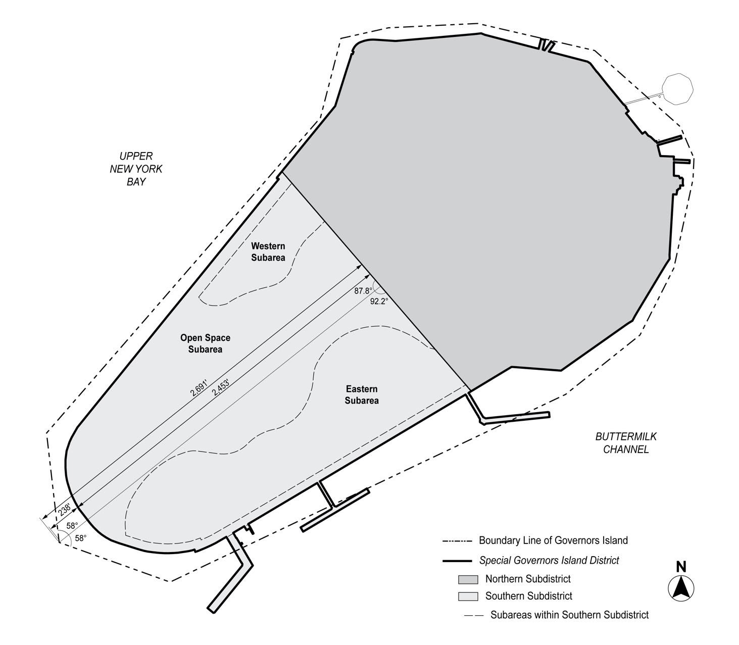
For the purpose of dimensioning the subareas illustrated above, the dimensions shall be as shown on the surveys dated April 17, 2020, available on the Department of City Planning website.
Map 2 - Building Parcels, Primary Connection Locations and Esplanade
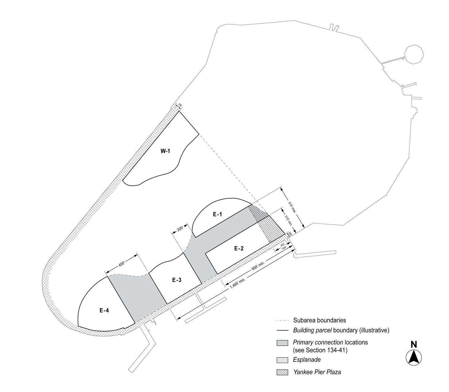
For the purpose of dimensioning the esplanade, the dimensions shall be as shown on the surveys dated April 17, 2020, available on the Department of City Planning website.
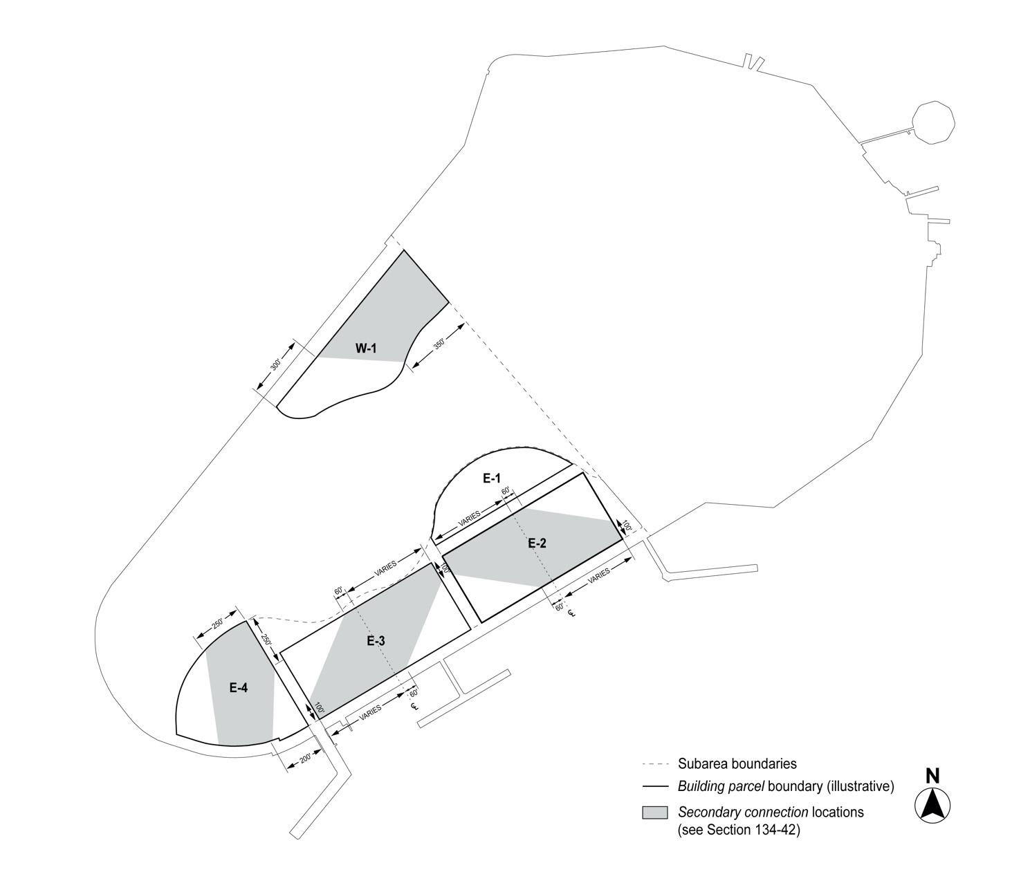
Map 3 - Secondary Connection Locations
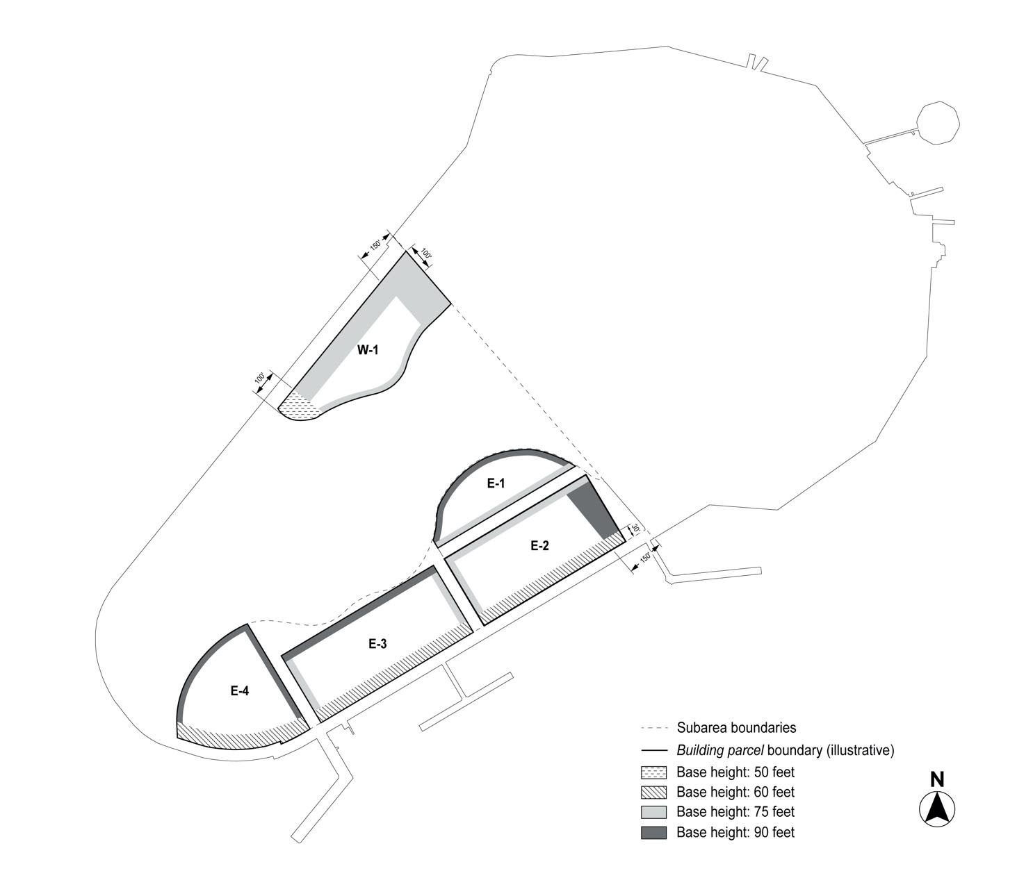
Map 4 – Maximum Base Heights and Setbacks