APPENDIX J — Designated Areas Within Manufacturing Districts
(12/19/17)
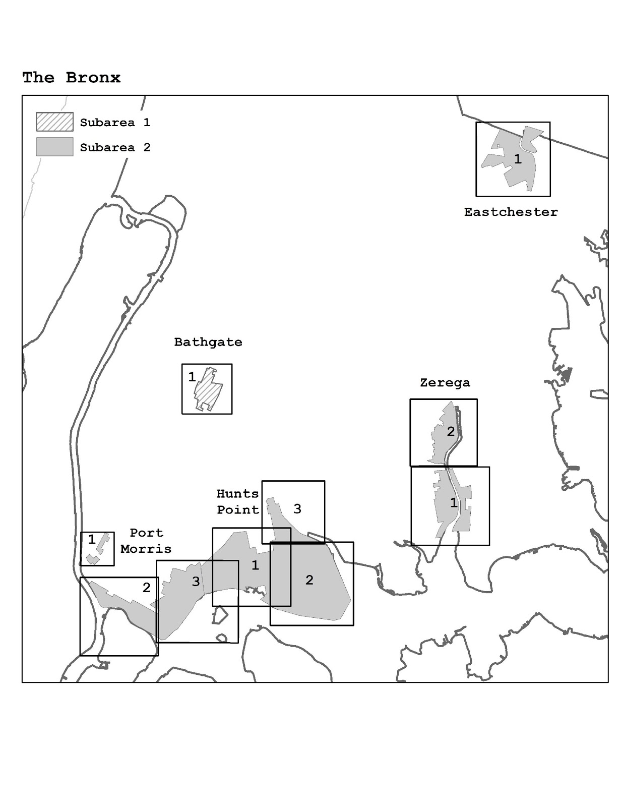
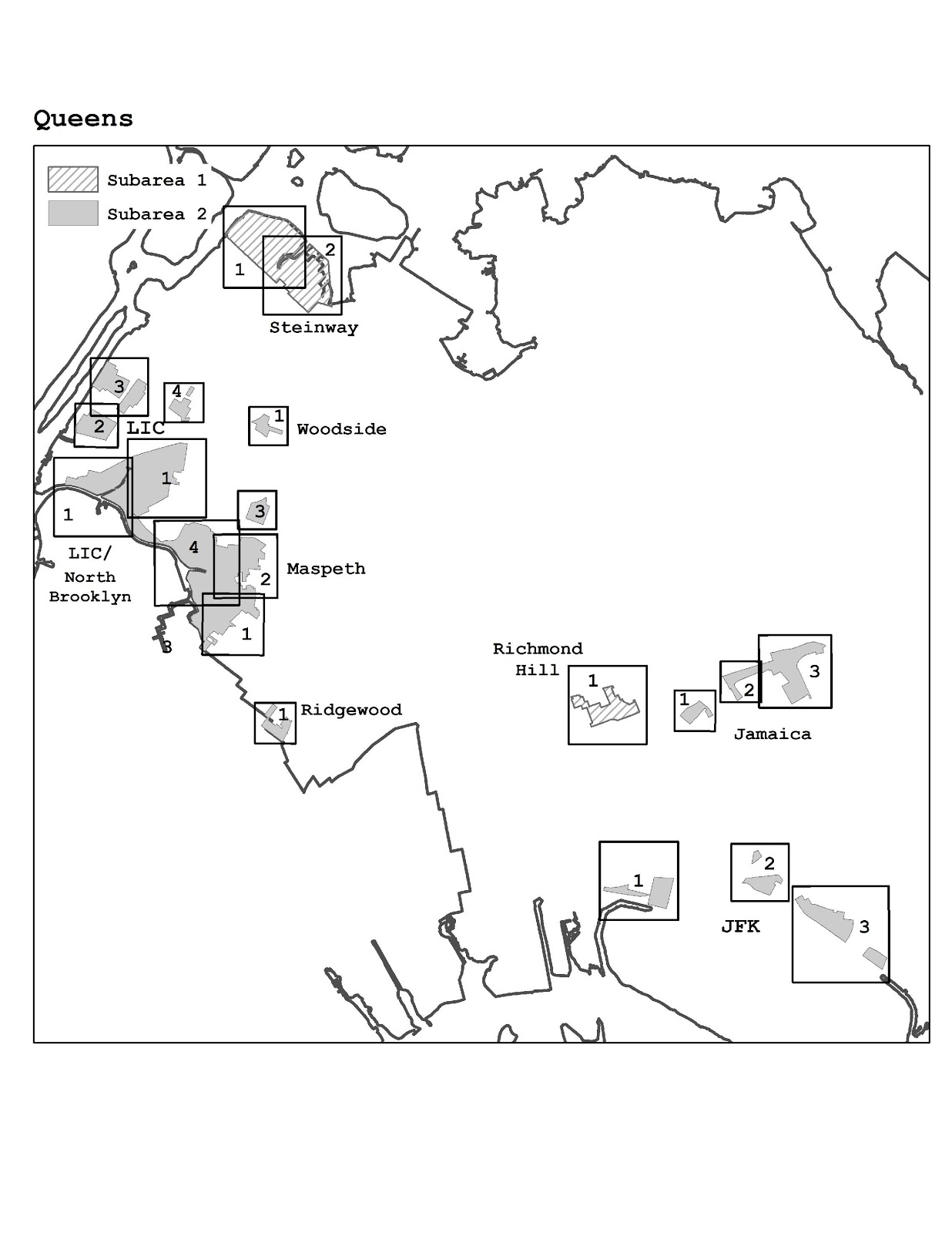
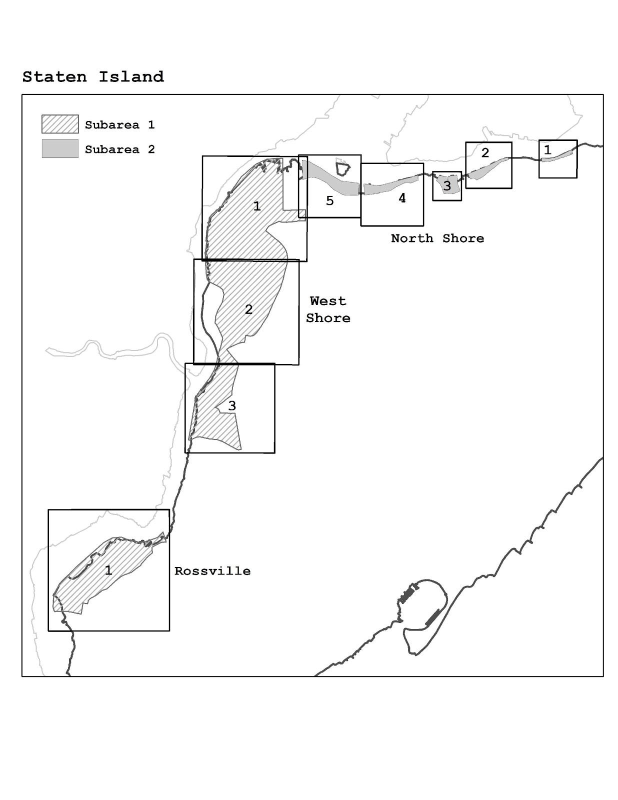
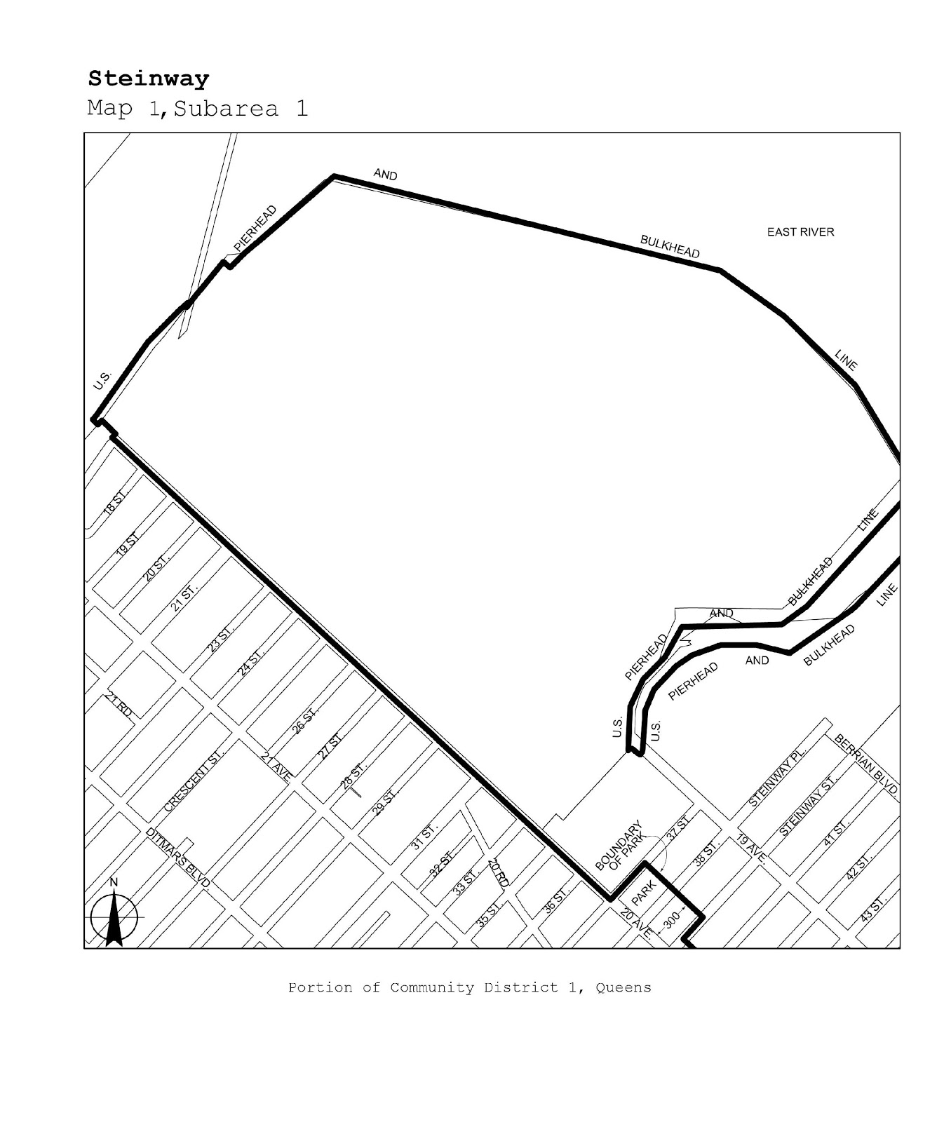
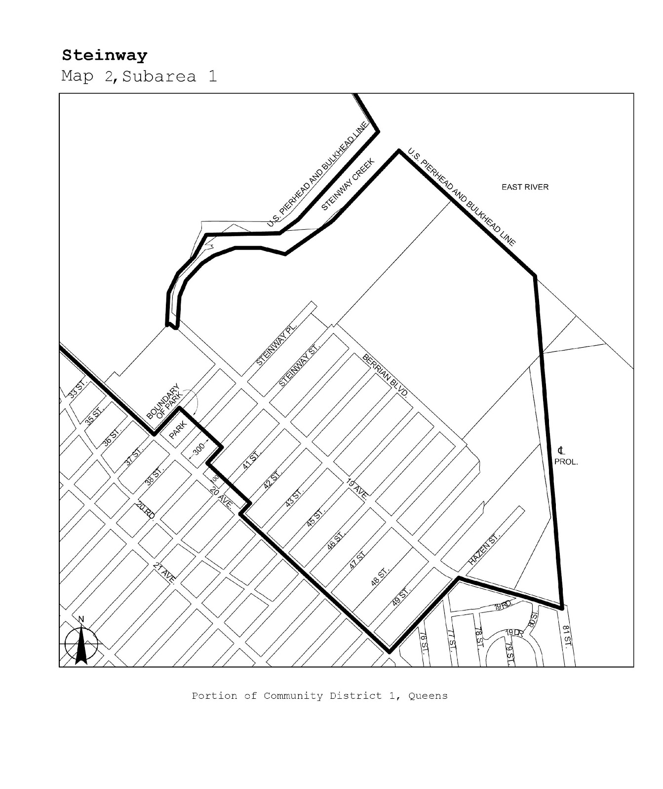
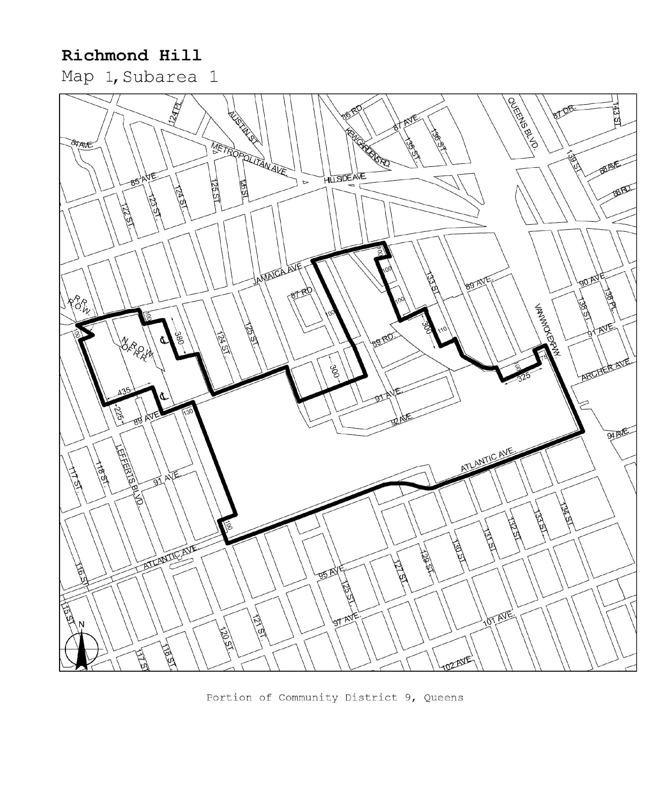
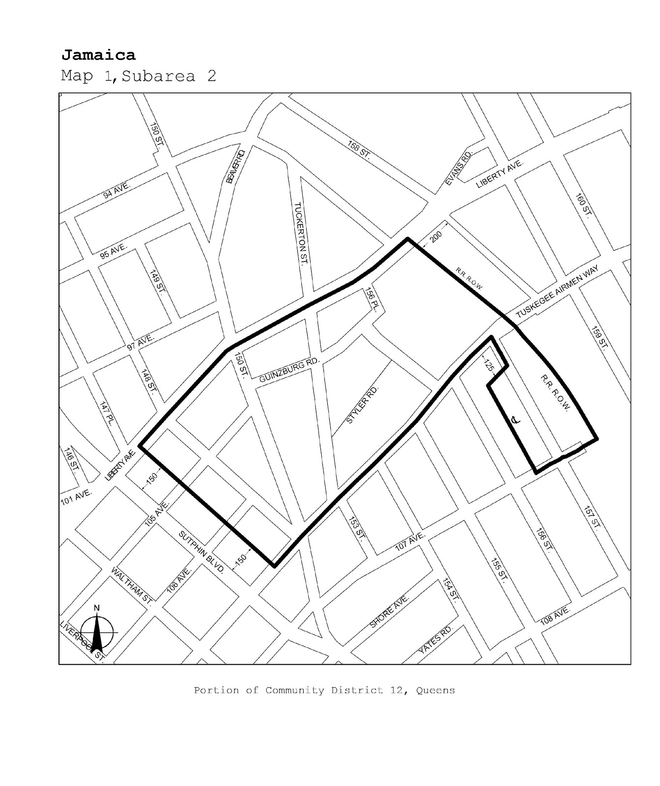
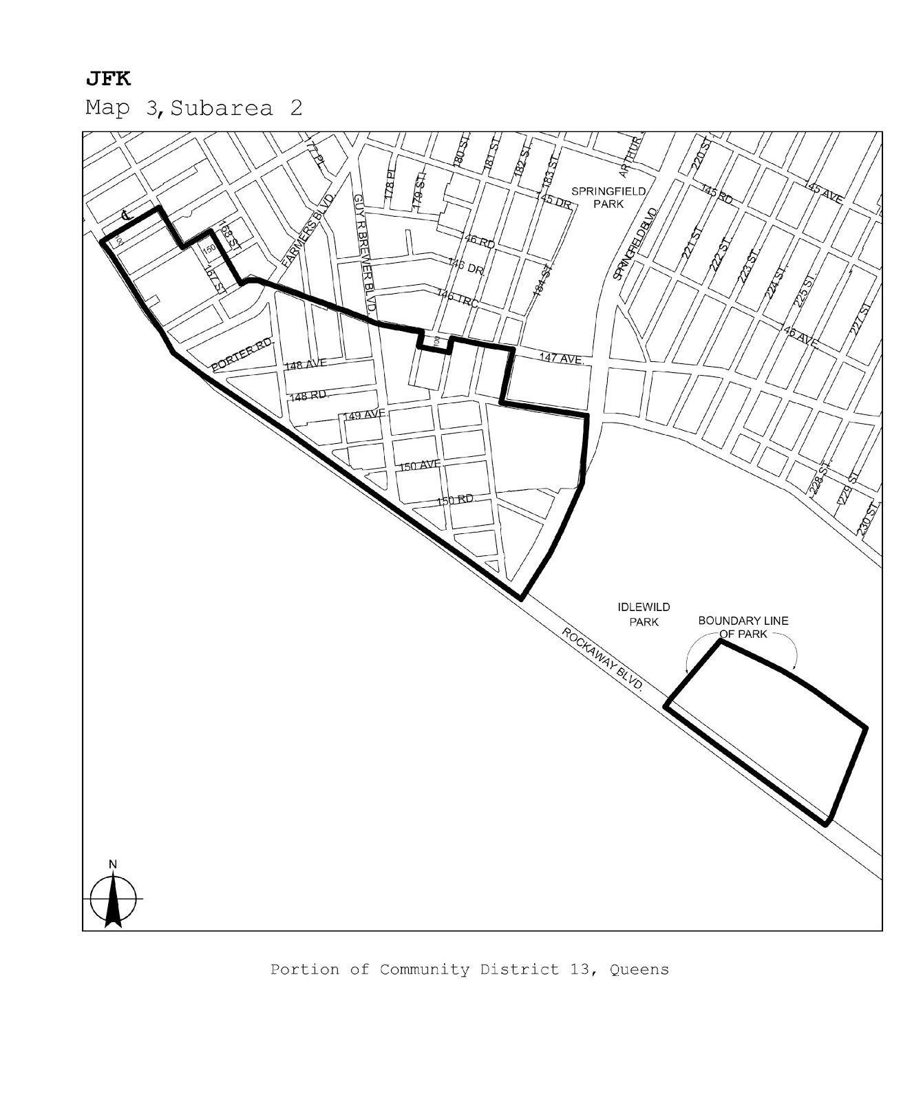
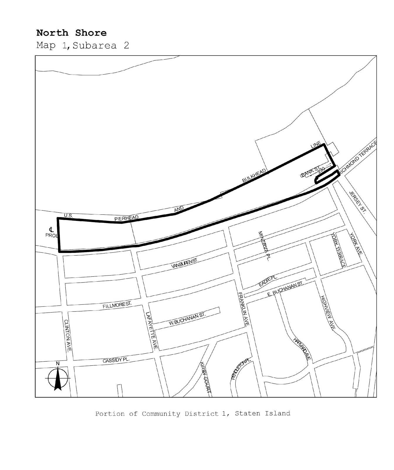
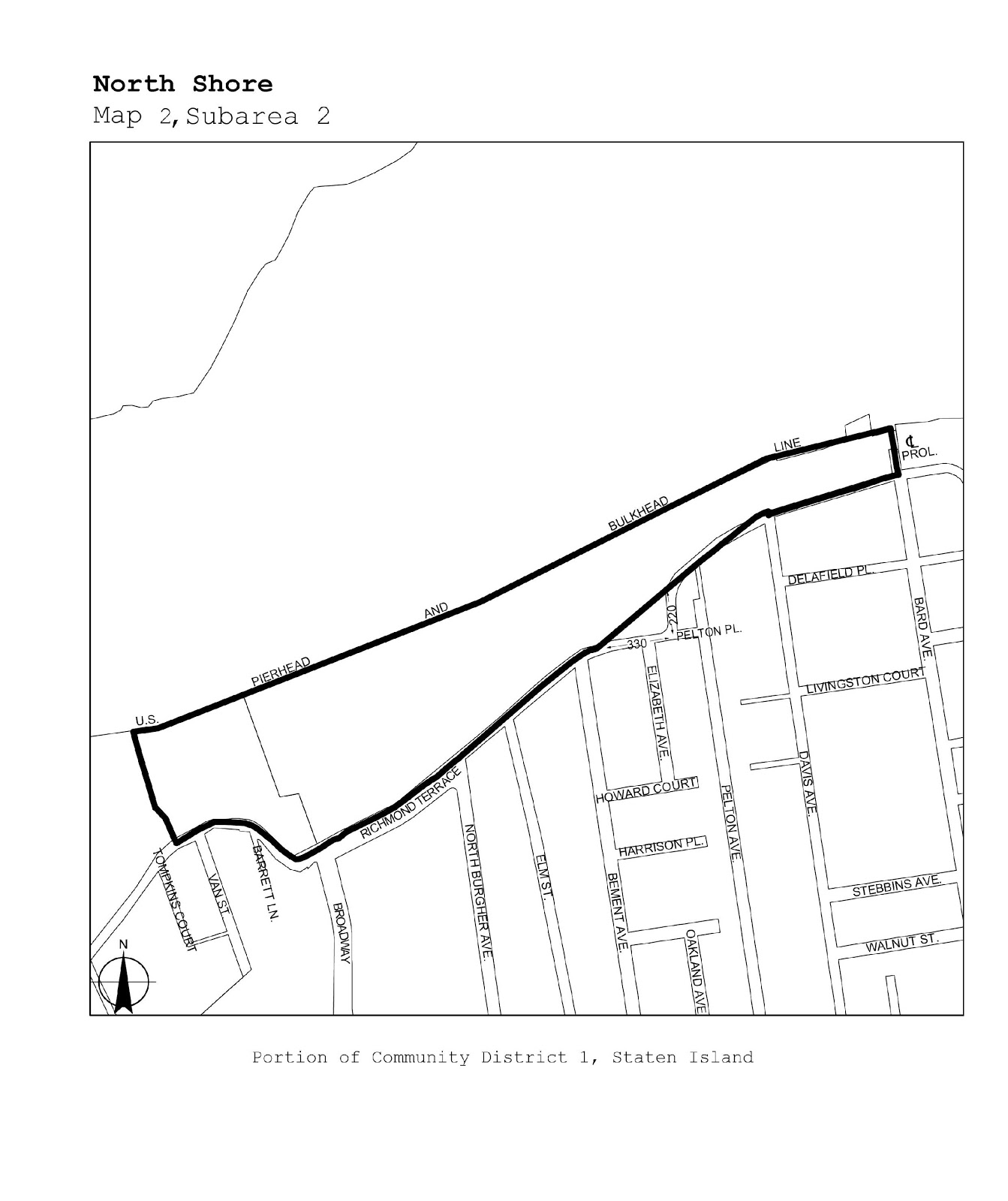
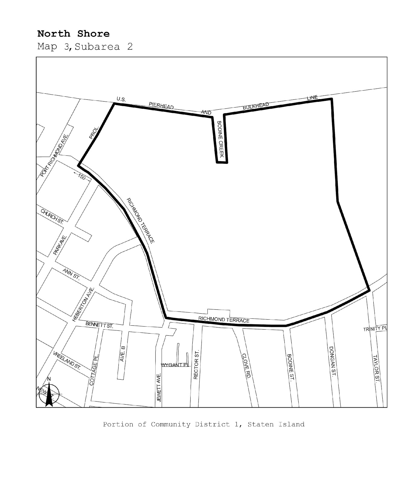
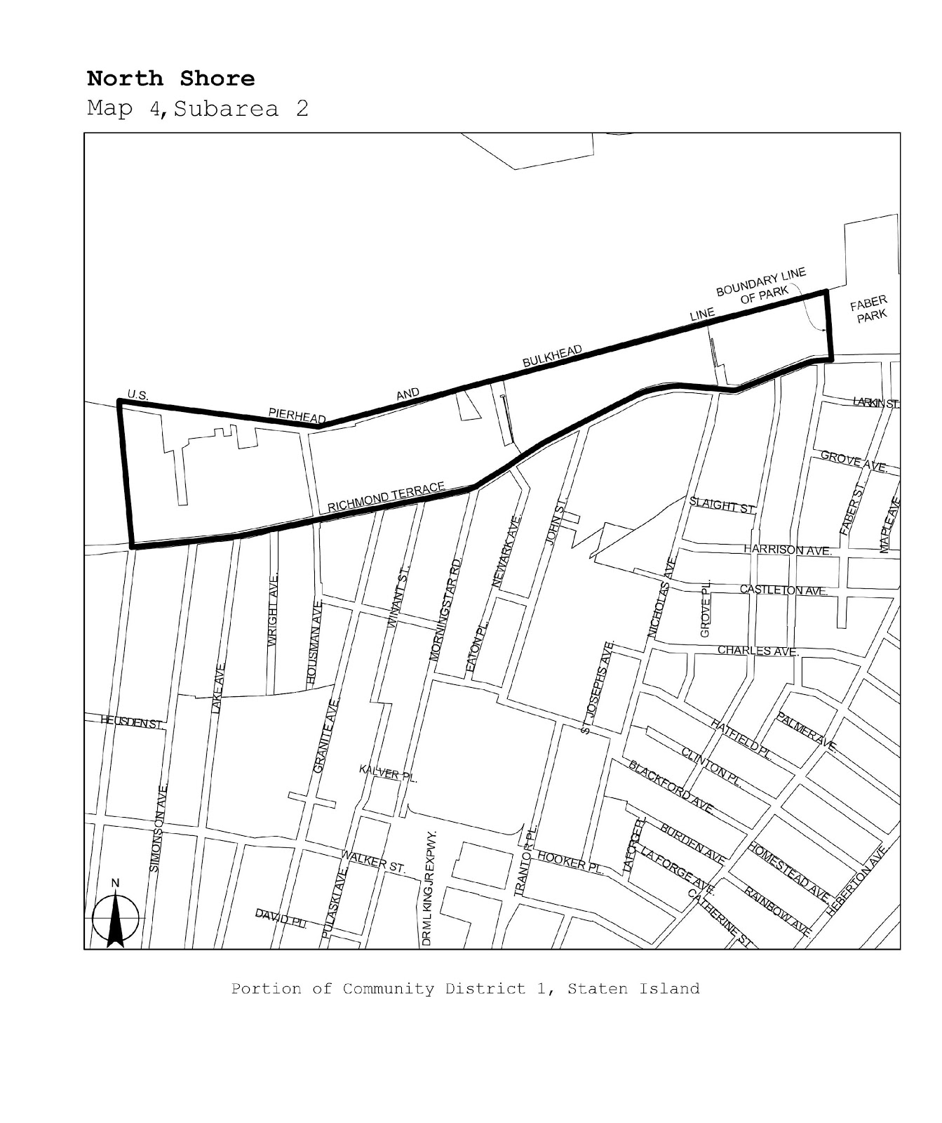
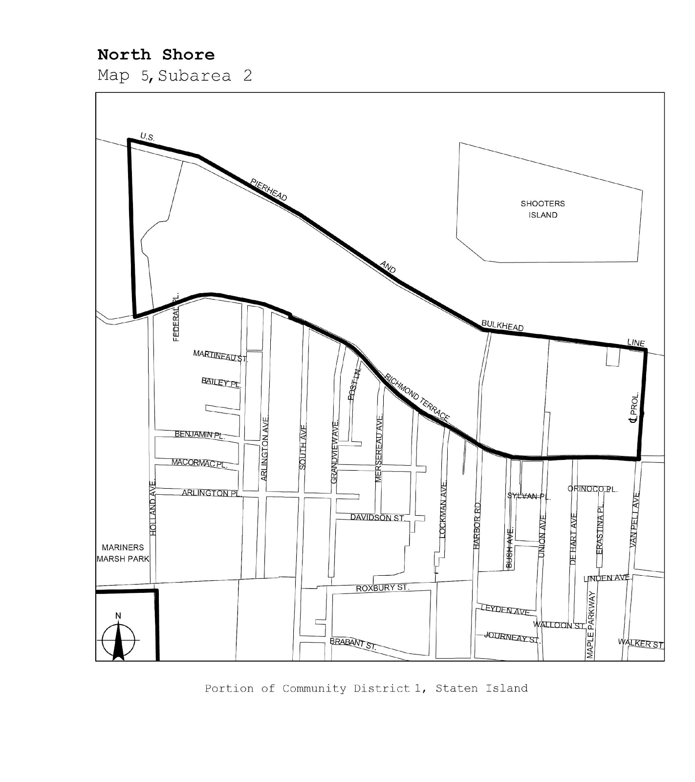
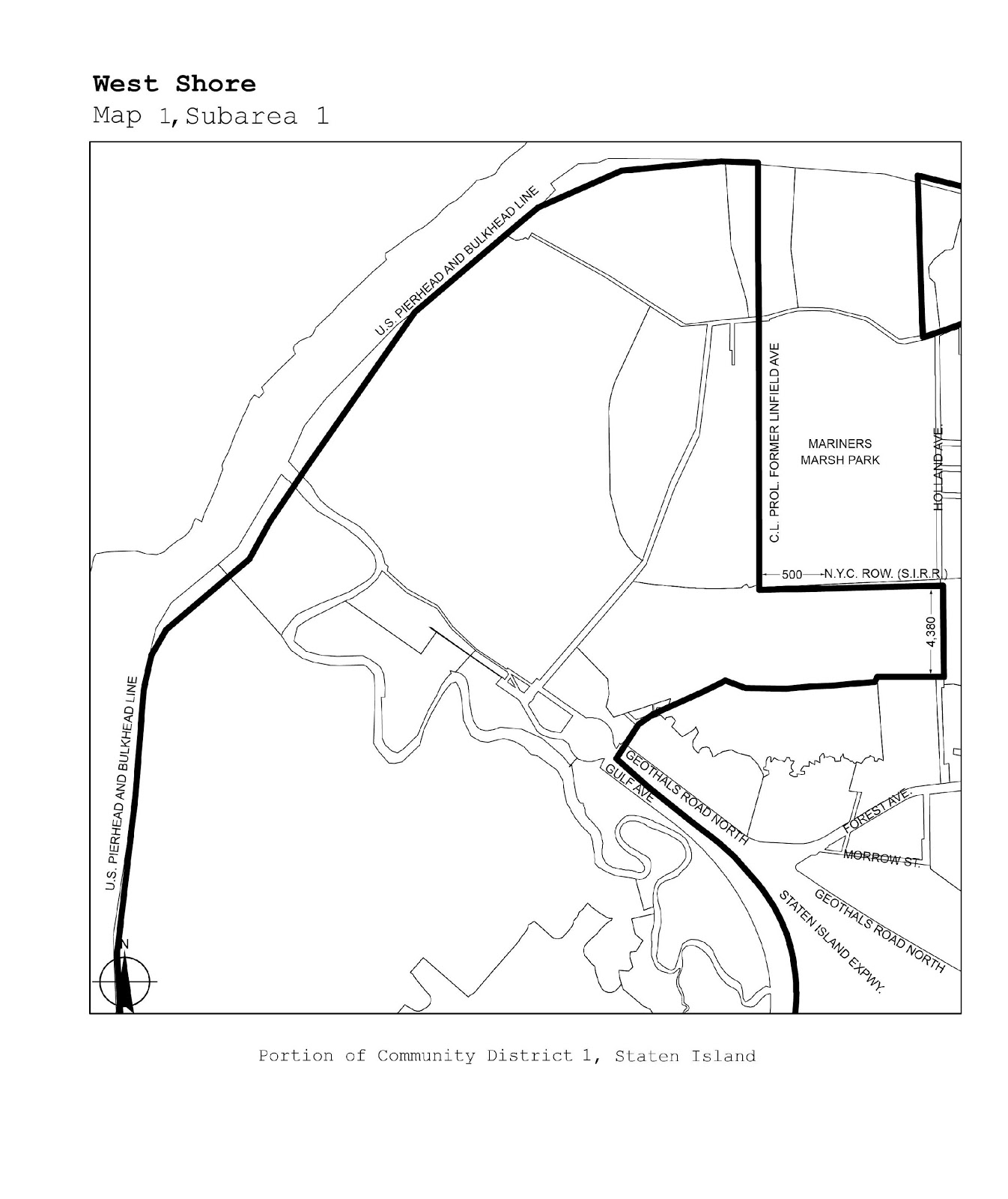
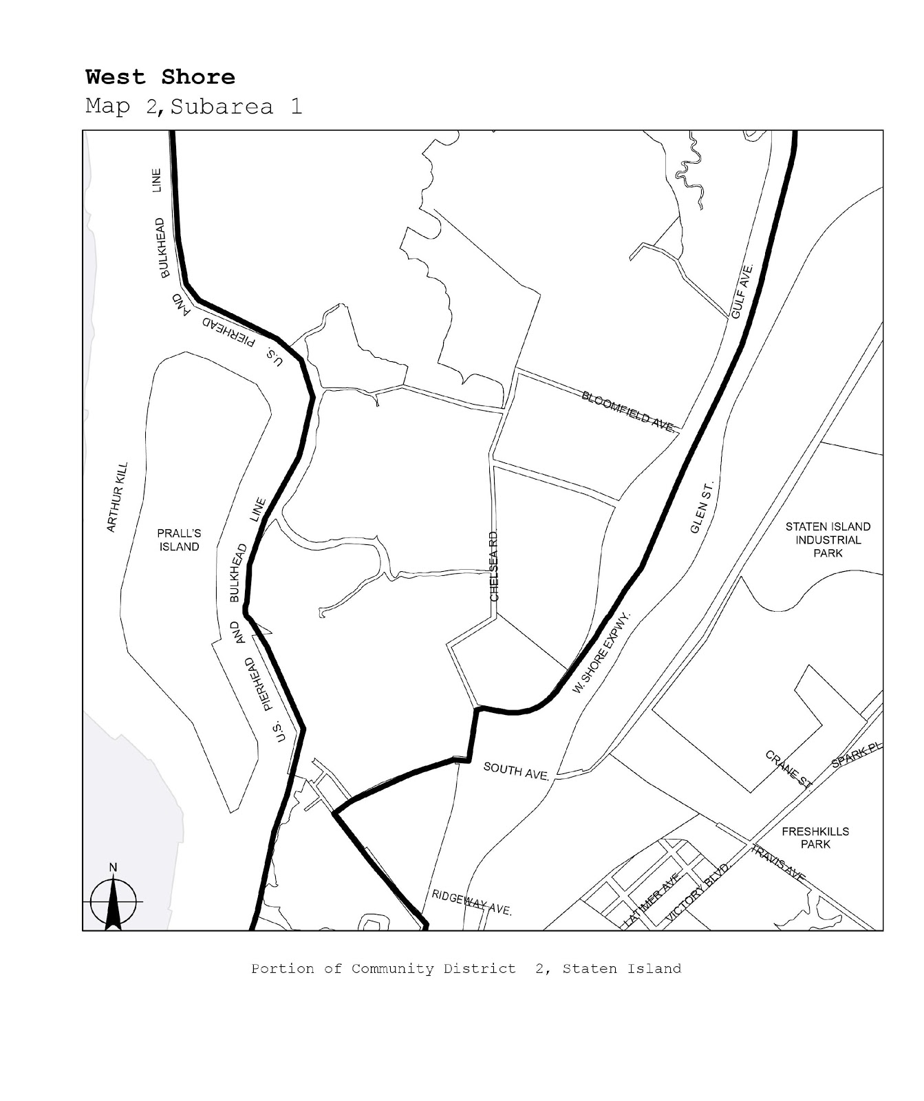
The boundaries of certain designated areas within Manufacturing Districts are shown on the maps in this APPENDIX. Designated areas in which self-service storage facilities are subject to the as-of-right provisions of Section 42-121 (Use Group 16D self-service storage facilities) are shown on the maps in Subarea 1, and those in which such uses are subject to special permit of the City Planning Commission pursuant to Section 74-932 (Self-service storage facility in designated areas within Manufacturing Districts) are shown on the maps in Subarea 2.
SUBAREA 1
|
Borough |
Community Districts |
Name of Designated Area |
Map No |
|
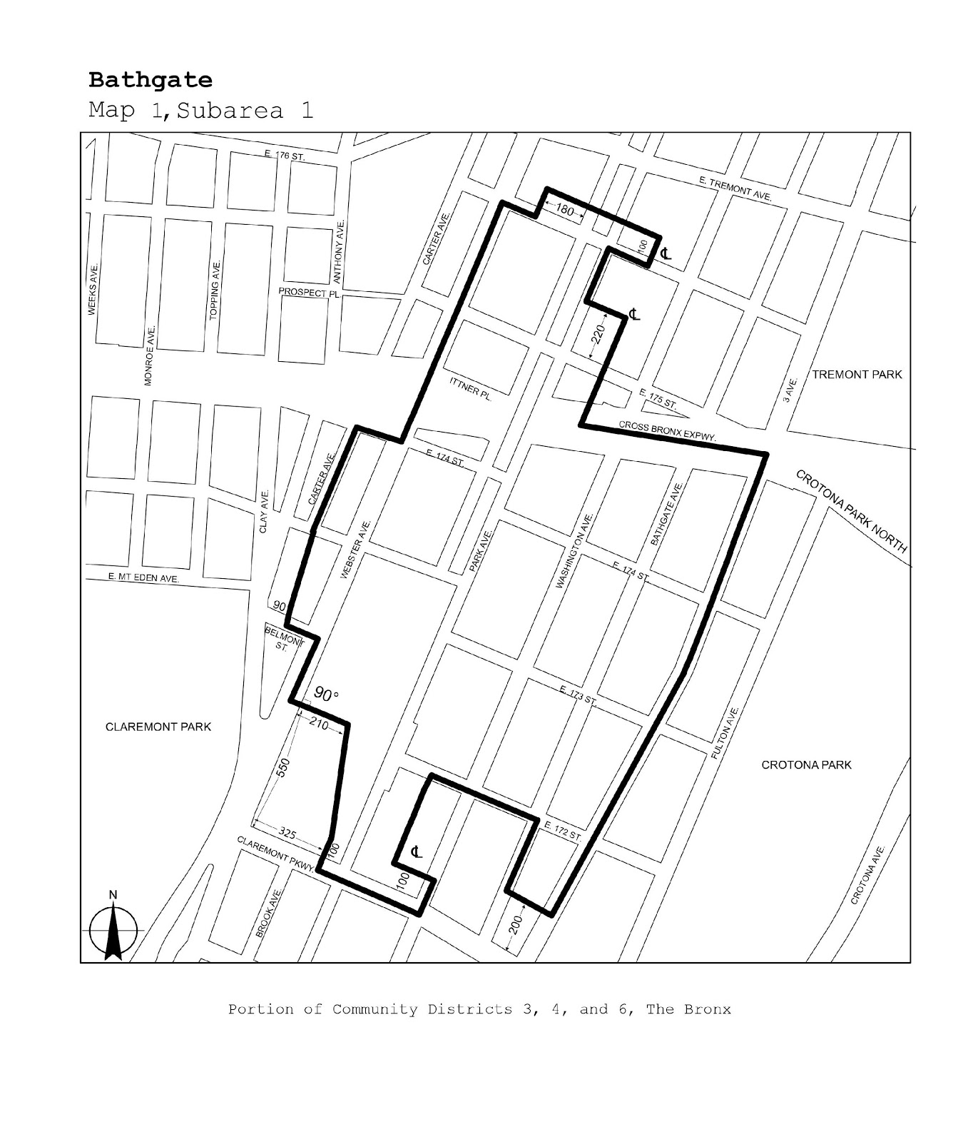
The Bronx |
3, 4, 6 |
Bathgate |
Map 1 |
|
Queens |
1 |
Steinway |
Maps 1, 2 |
|
Queens |
9 |
Richmond Hill |
Map 1 |
|
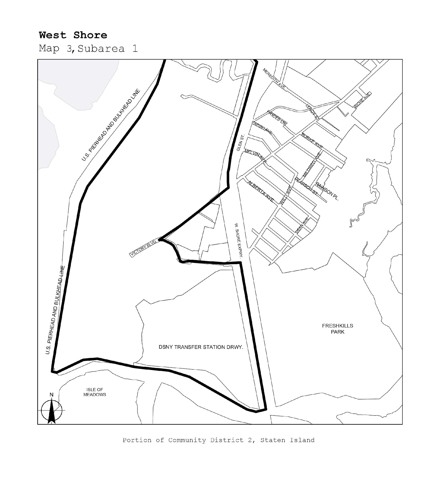
Staten Island |
1, 2 |
West Shore |
Maps 1-3 |
|
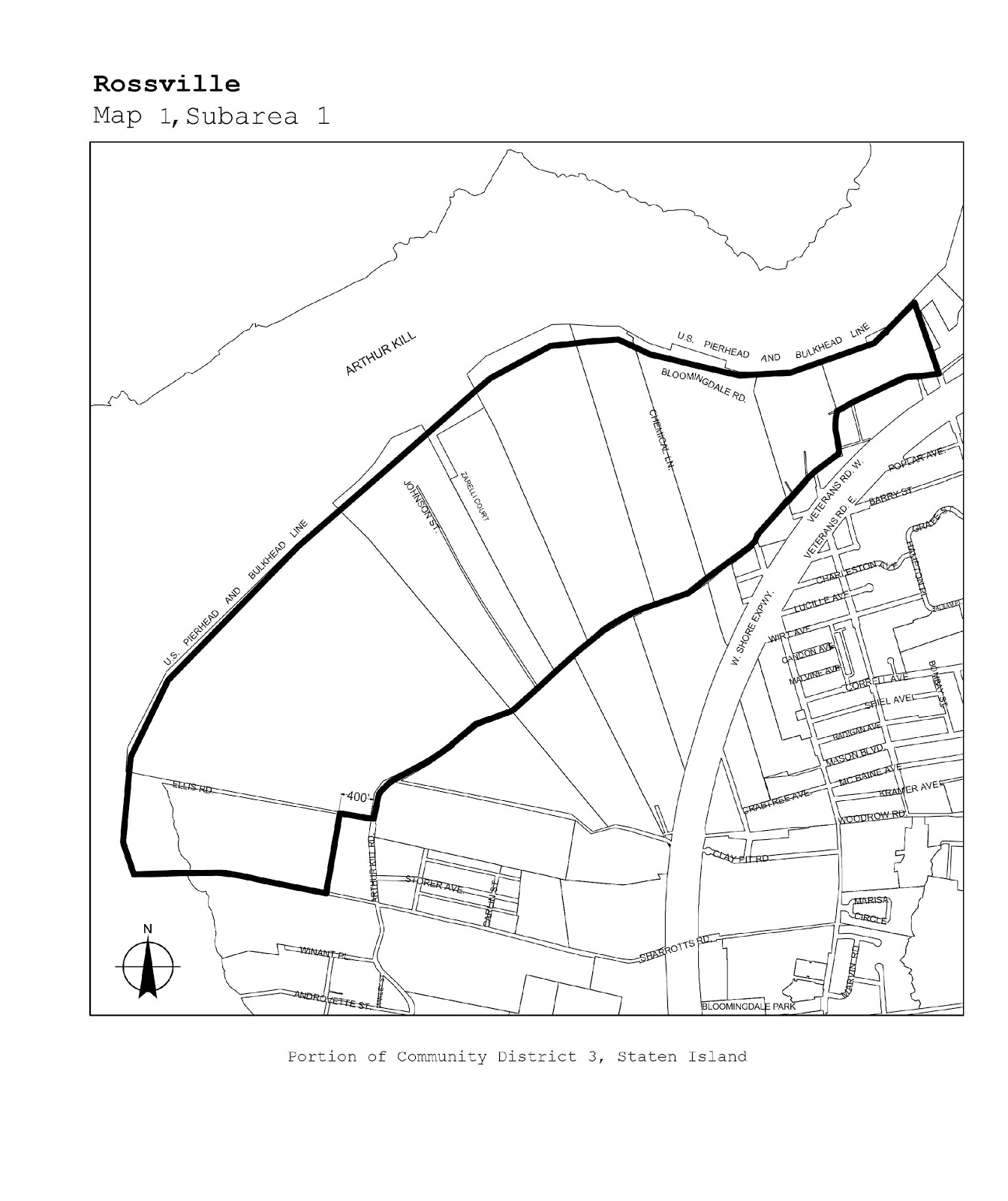
Staten Island |
3 |
Rossville |
Map 1 |
SUBAREA 2
|
Borough |
Community Districts |
Name of Designated Area |
Map No |
|
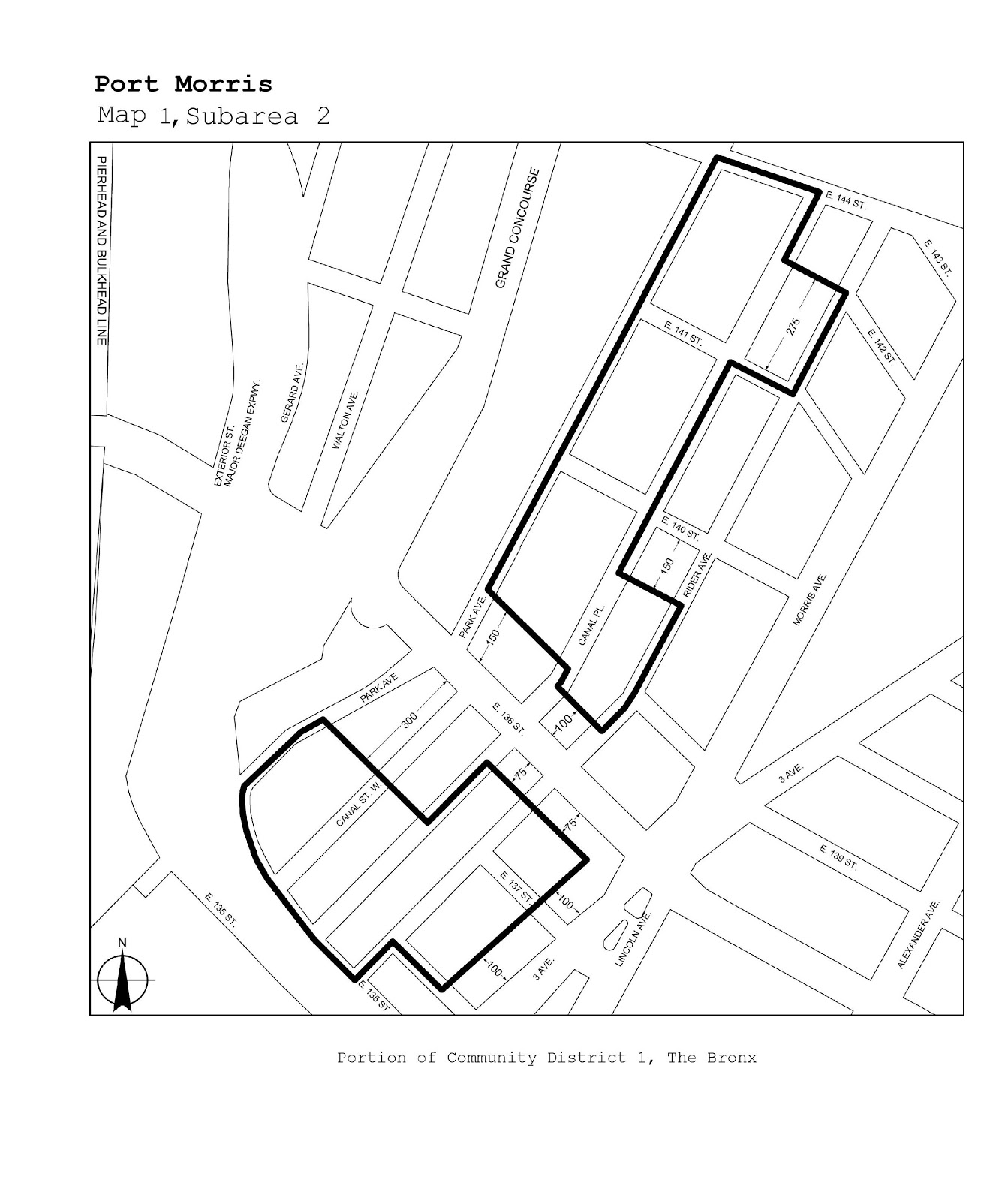
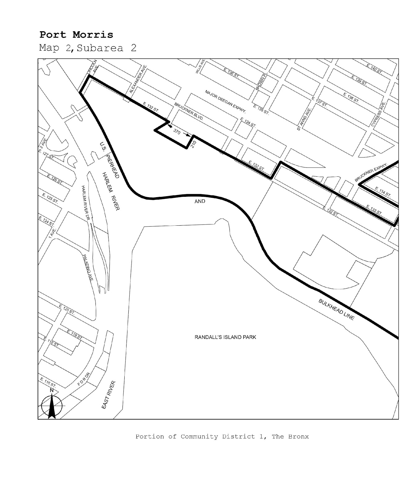
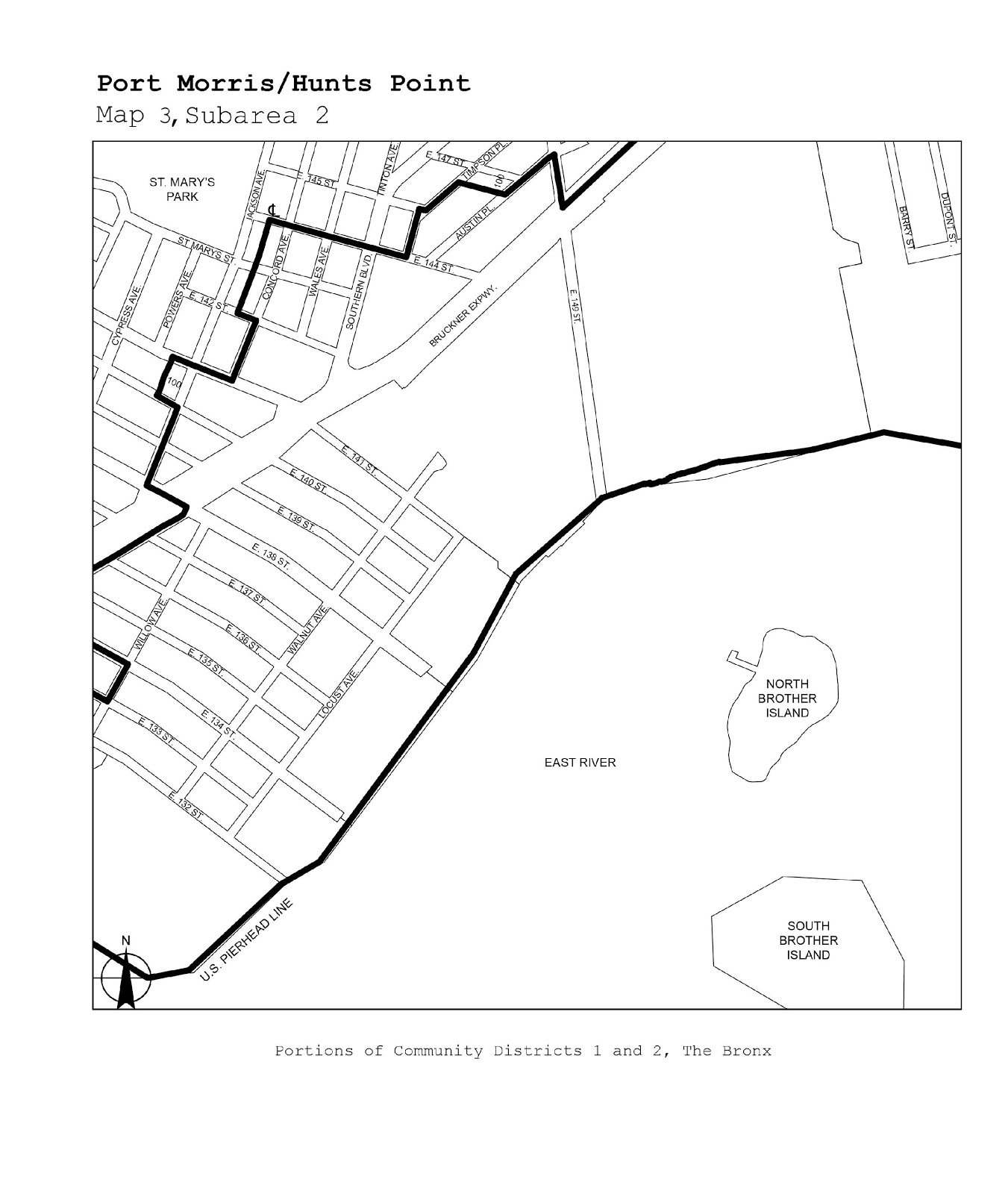
The Bronx |
1, 2 |
Port Morris |
Maps 1-3 |
|
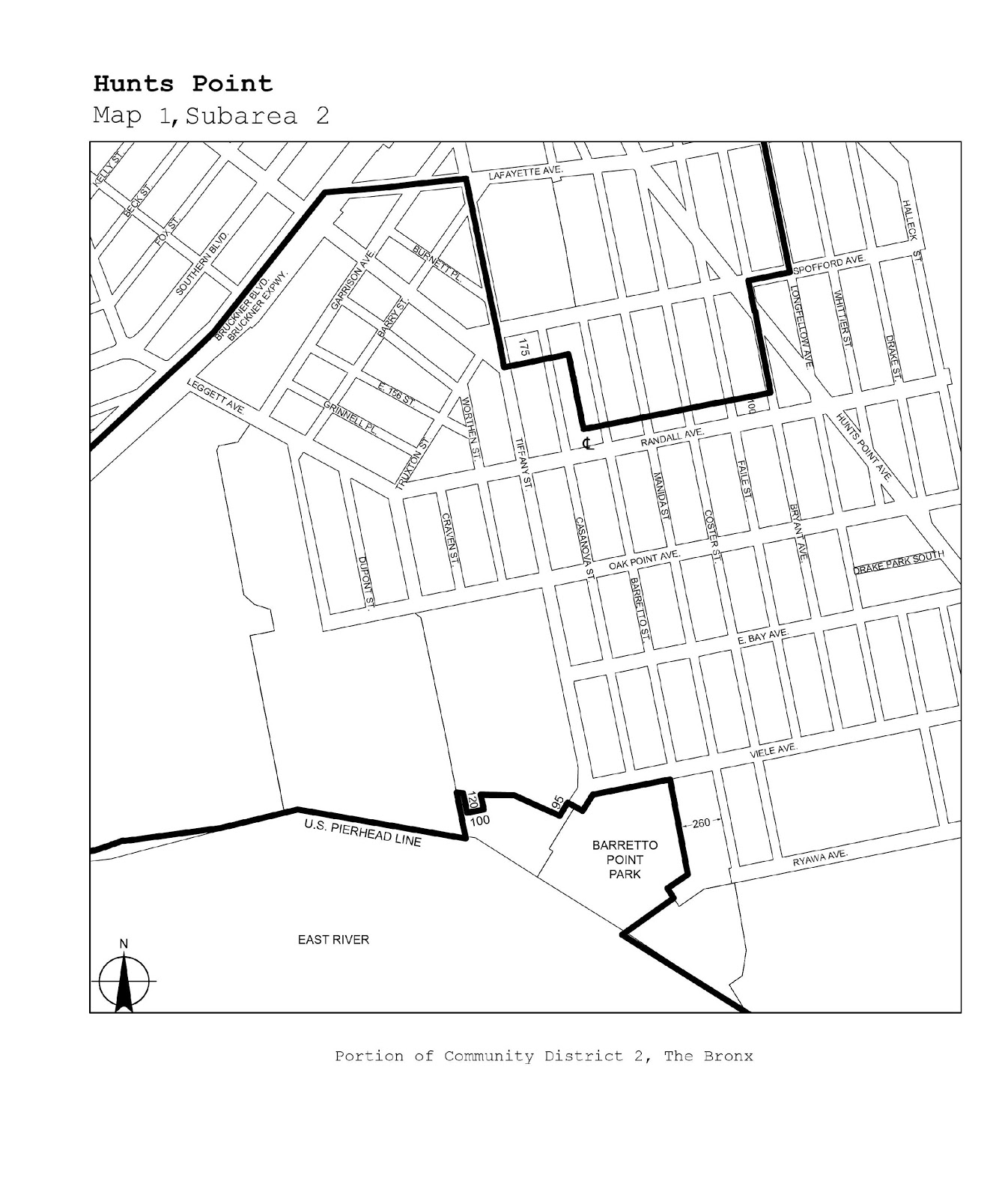
The Bronx |
2 |
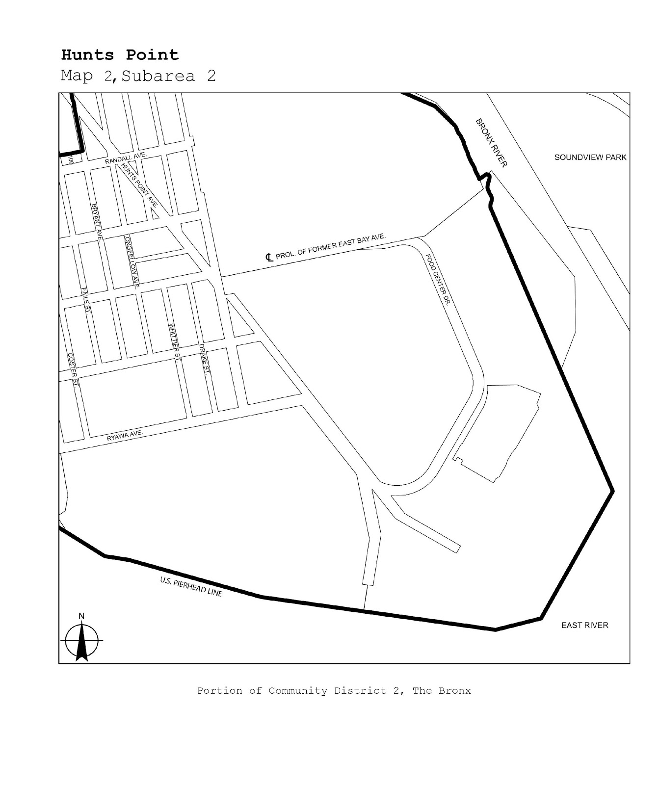
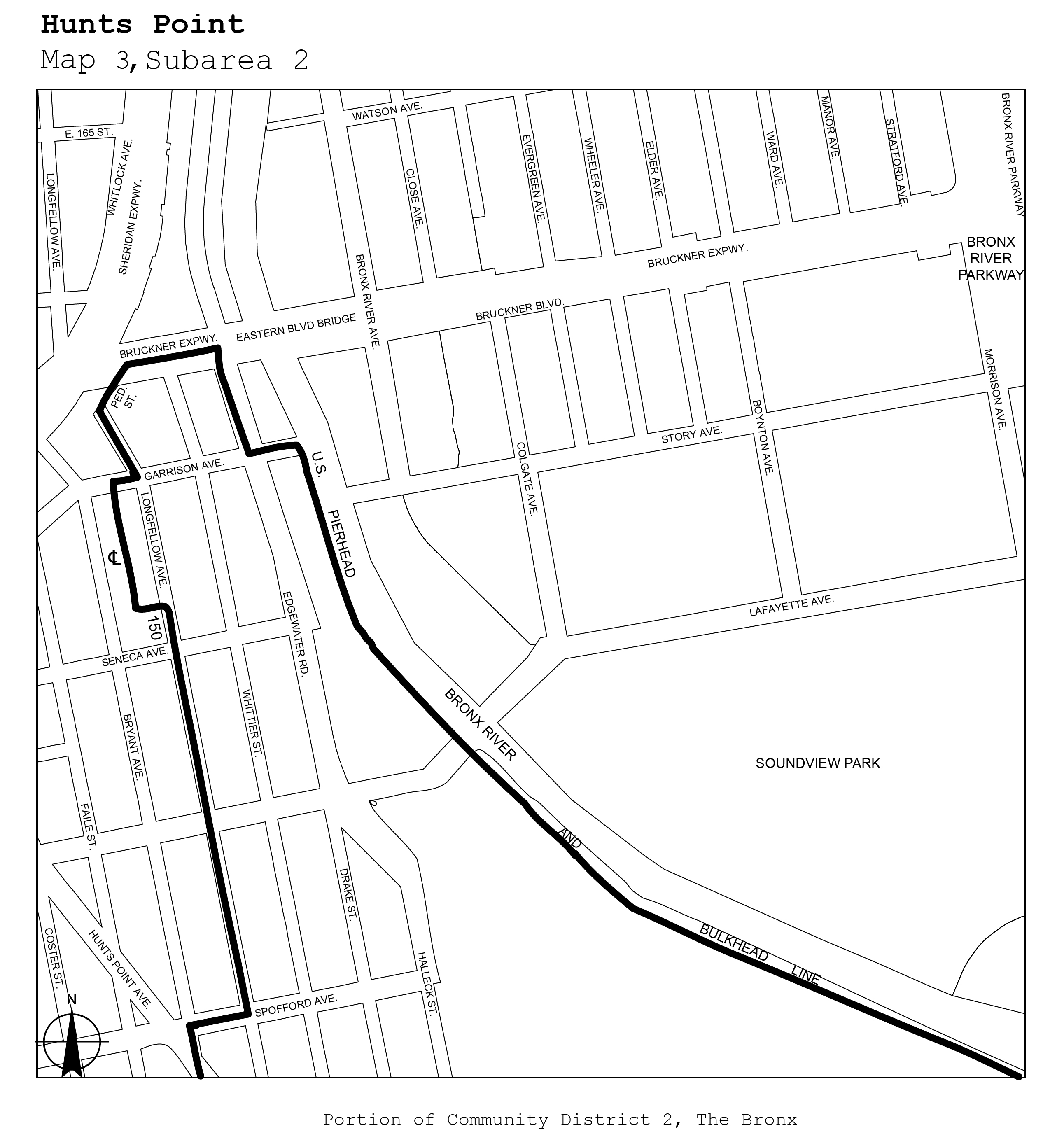
Hunts Point |
Maps 1-3 |
|
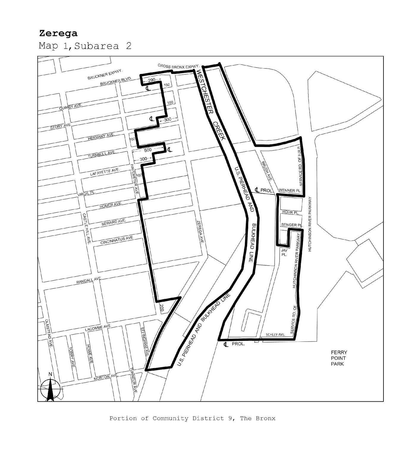
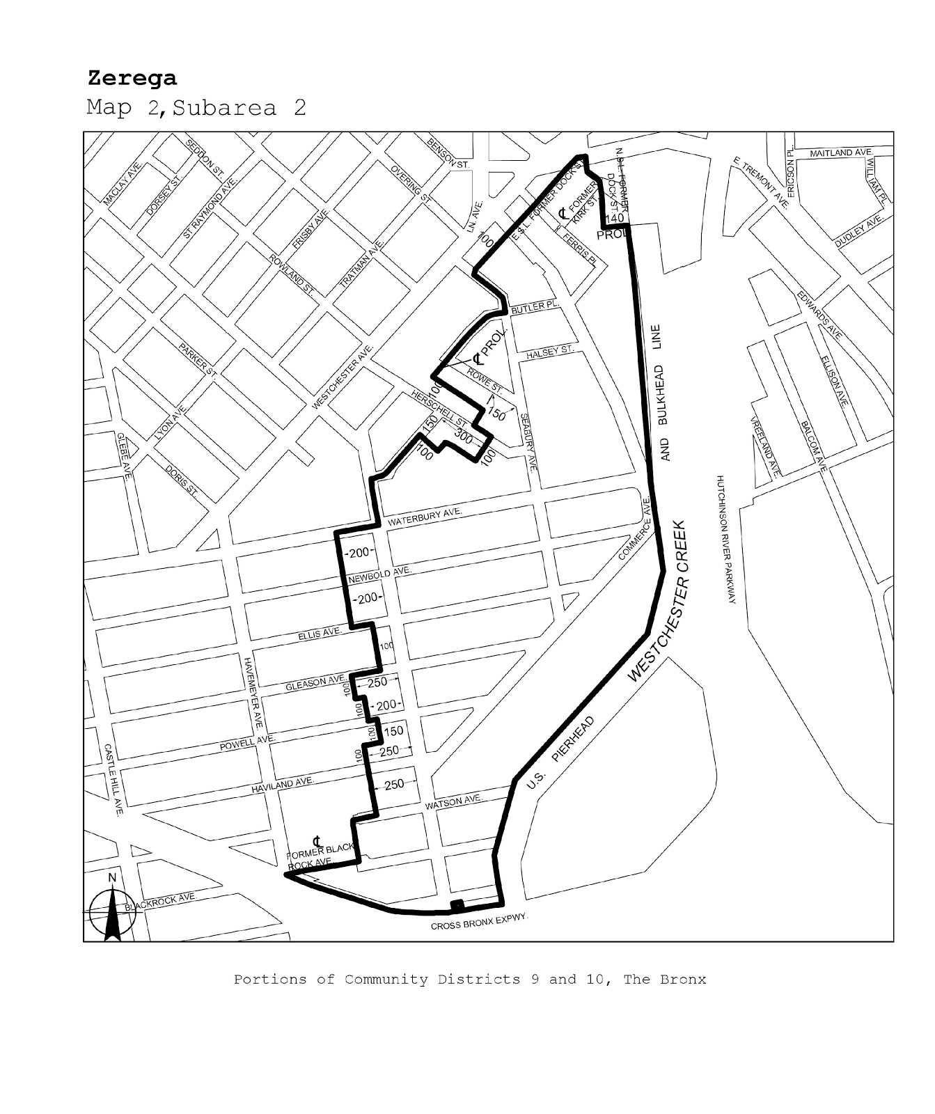
The Bronx |
9, 10 |
Zerega |
Maps 1, 2 |
|
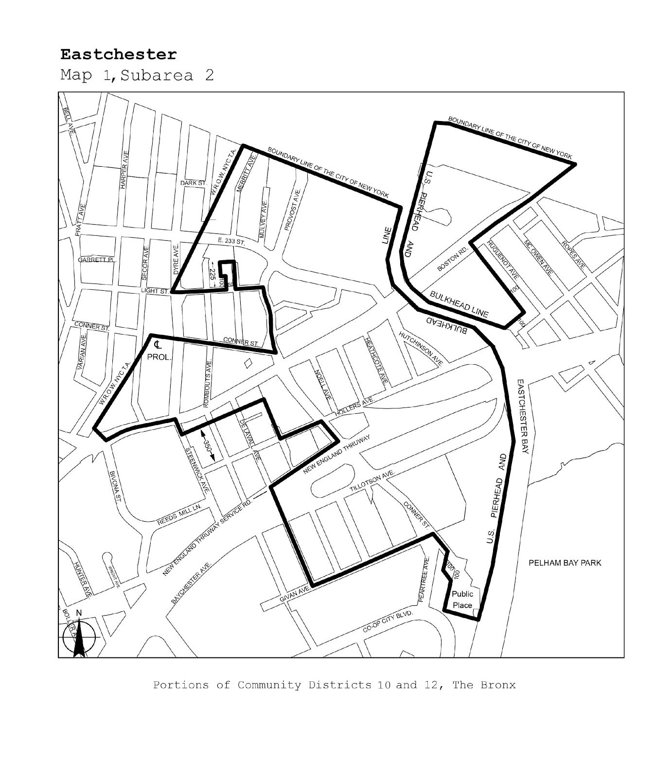
The Bronx |
10, 12 |
Eastchester |
Map 1 |
|
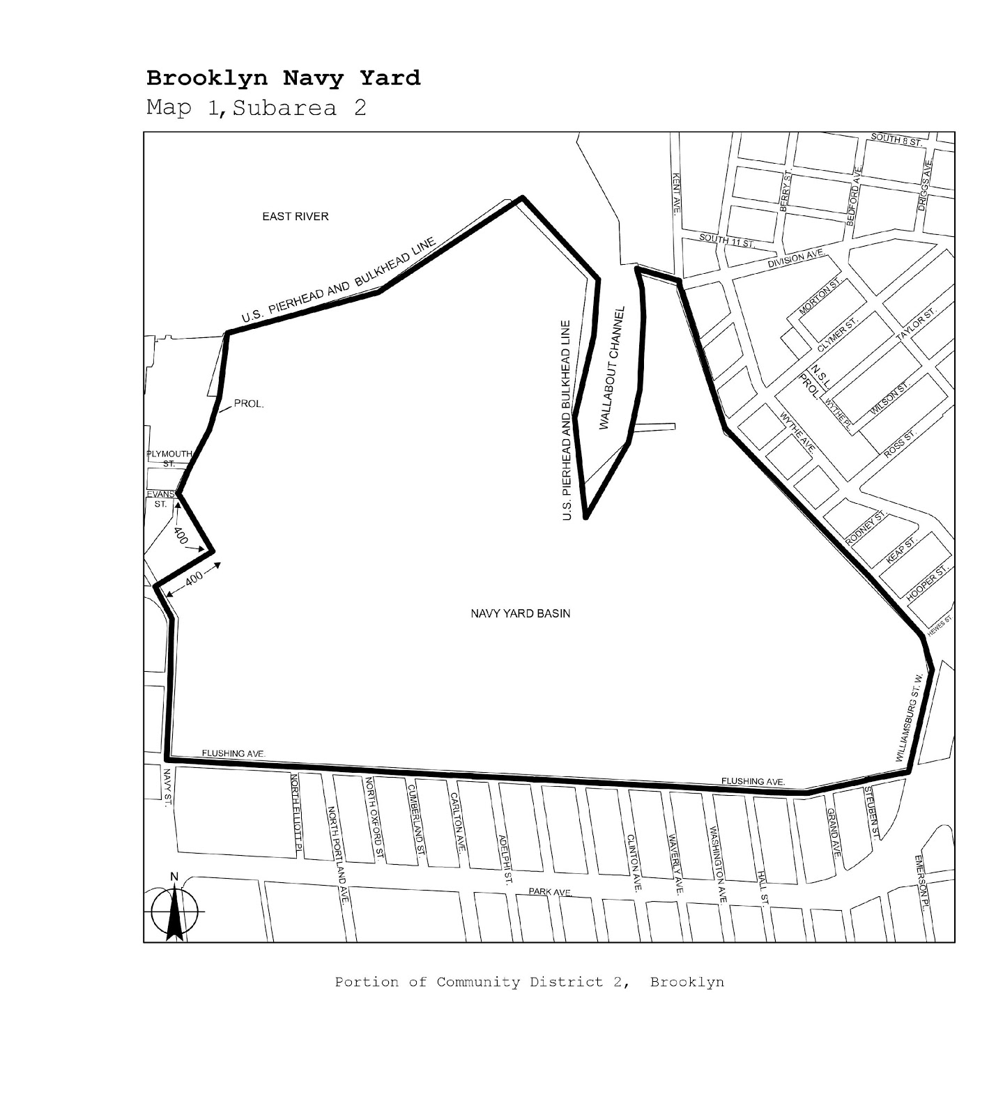
Brooklyn |
2 |
Brooklyn Navy Yard |
Map 1 |
|
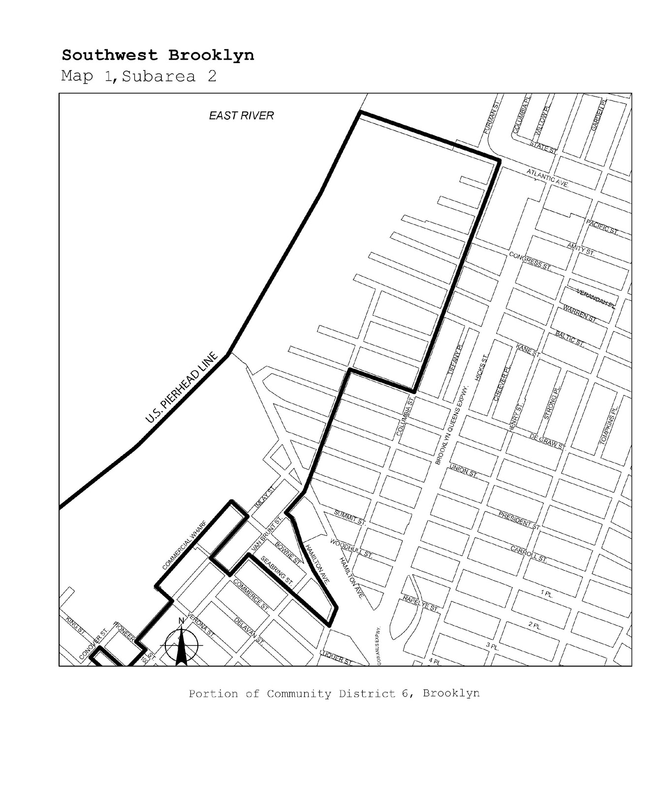
Brooklyn |
6, 7 |
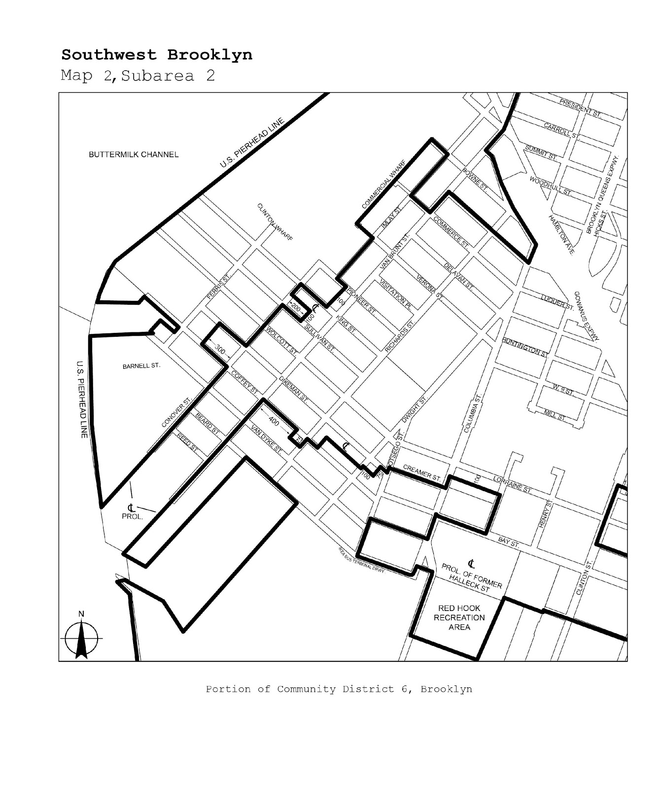
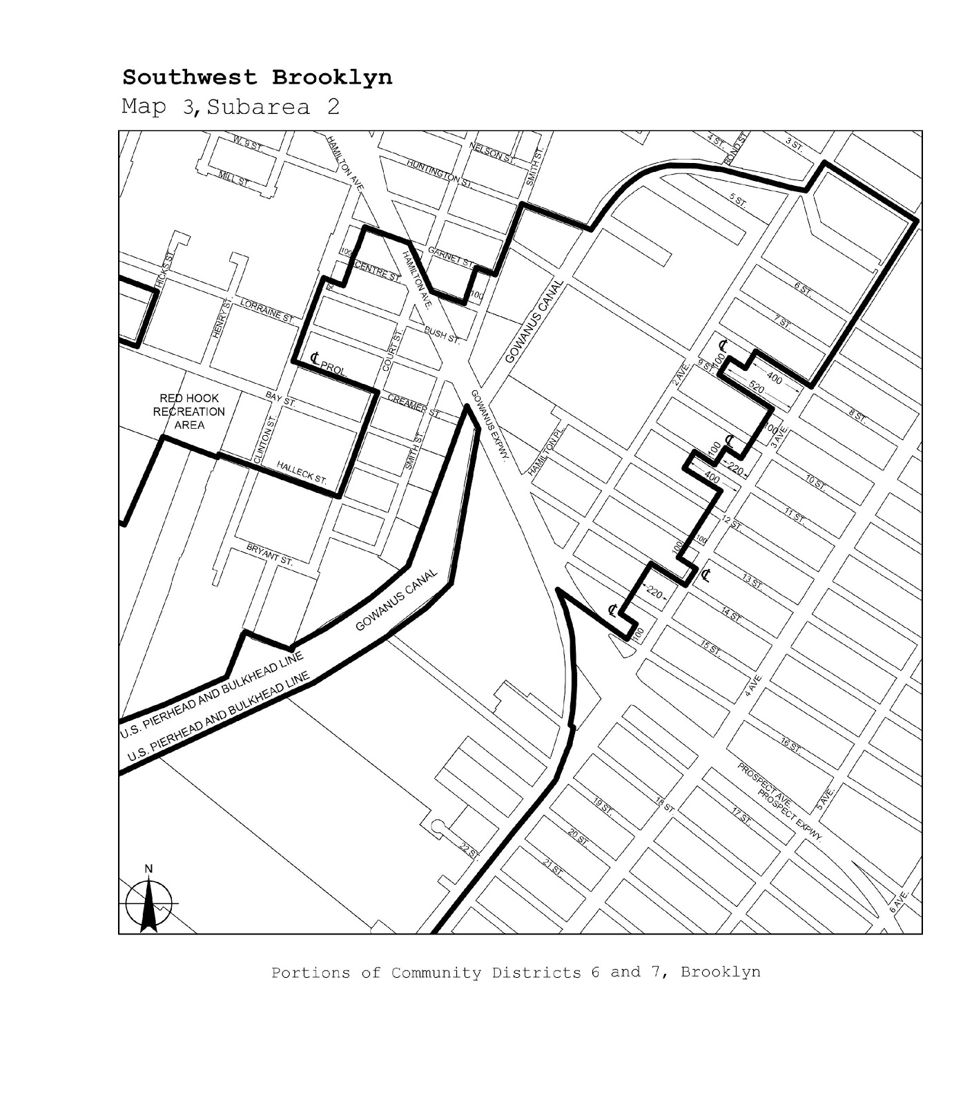
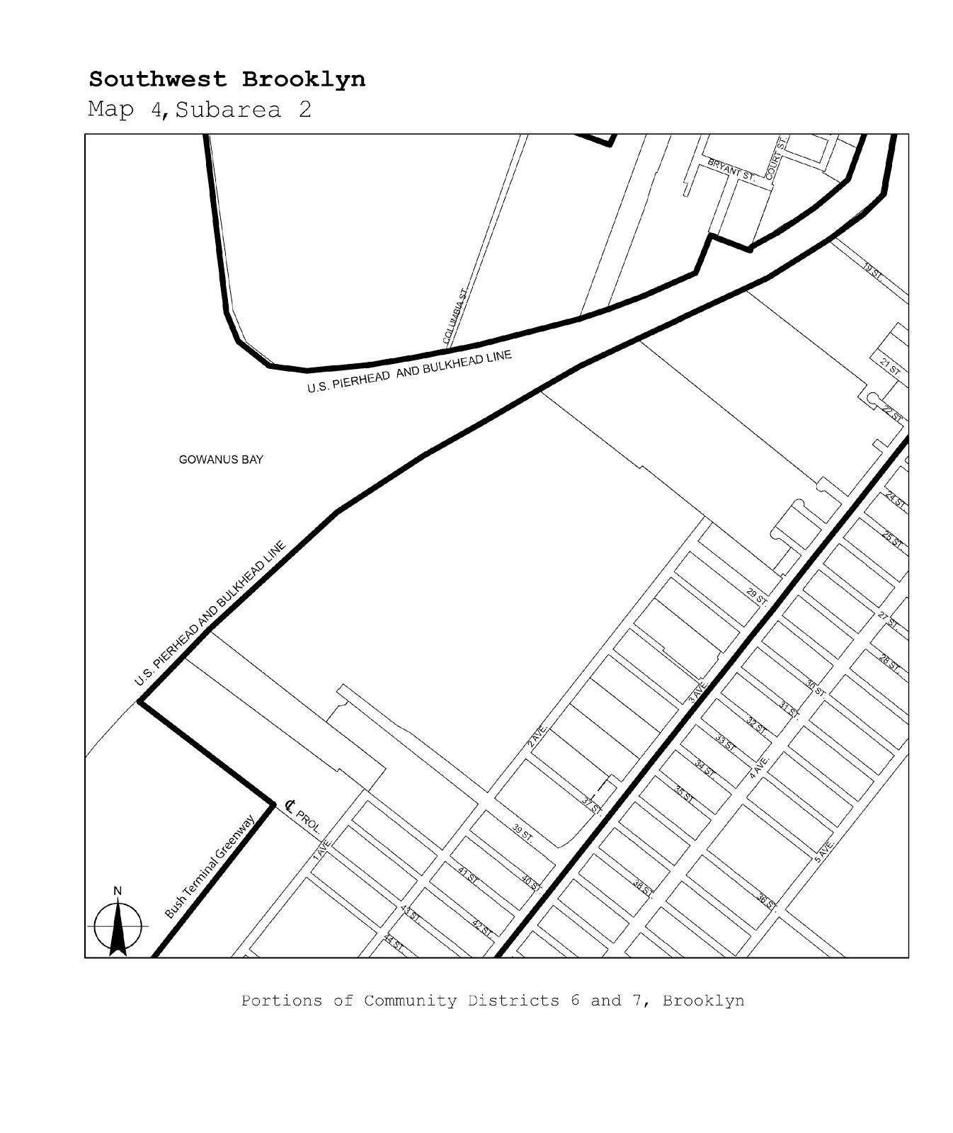
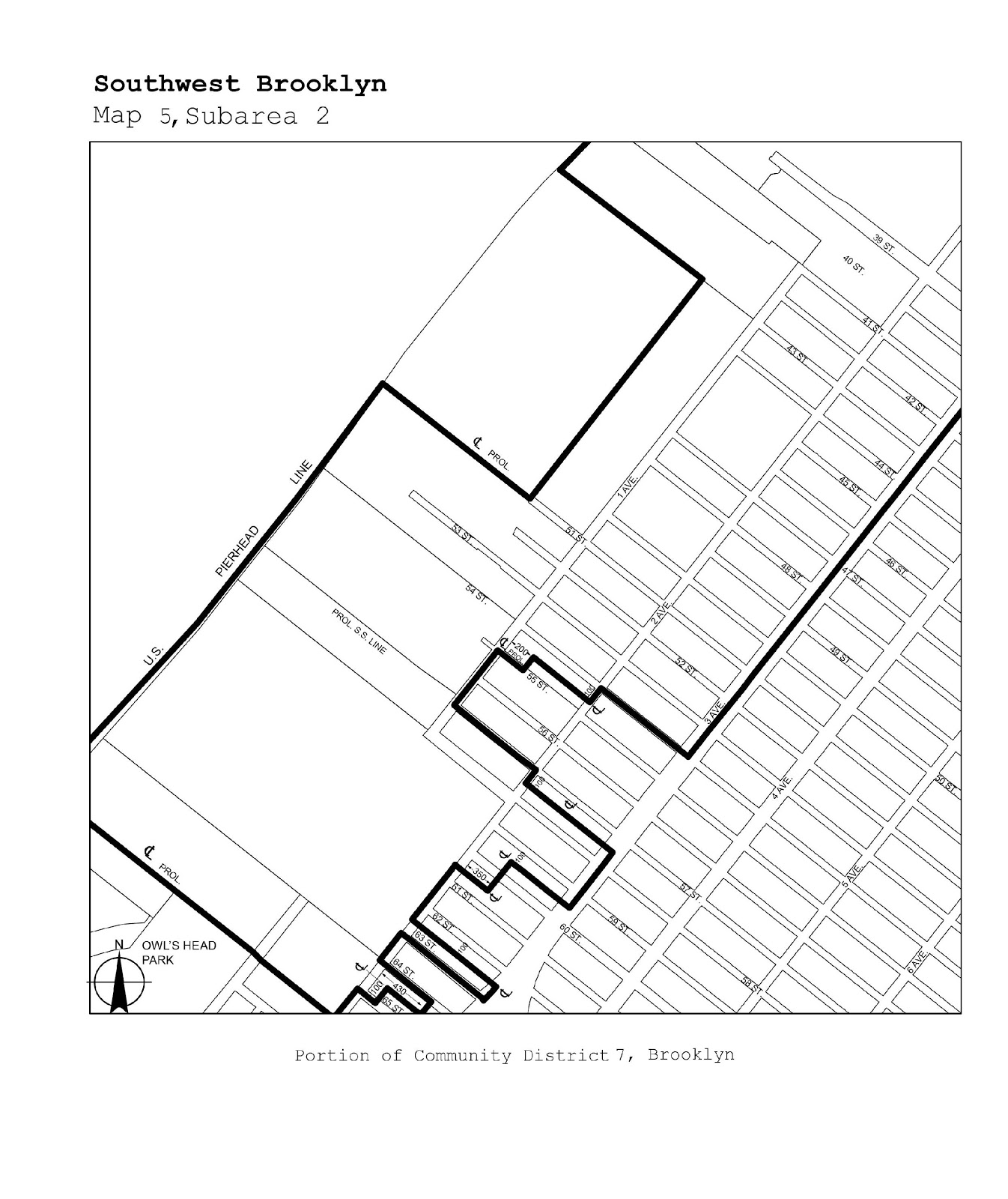
Southwest Brooklyn |
Maps 1-5 |
|
Brooklyn |
5, 16, 17, 18 |
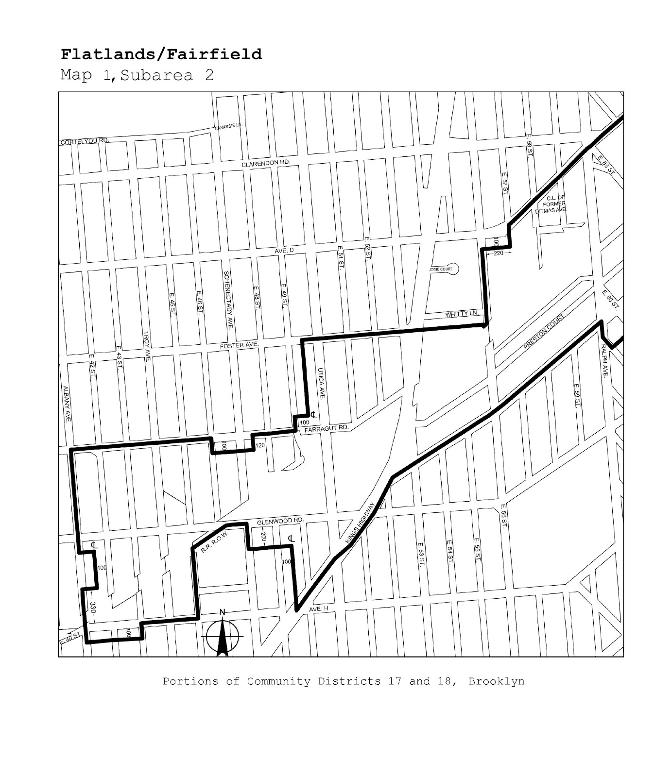
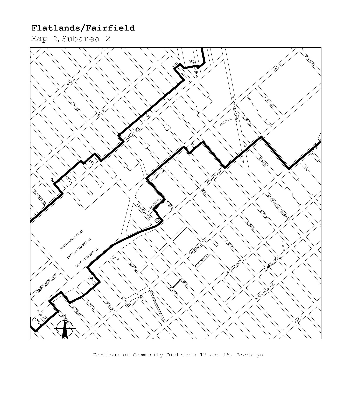
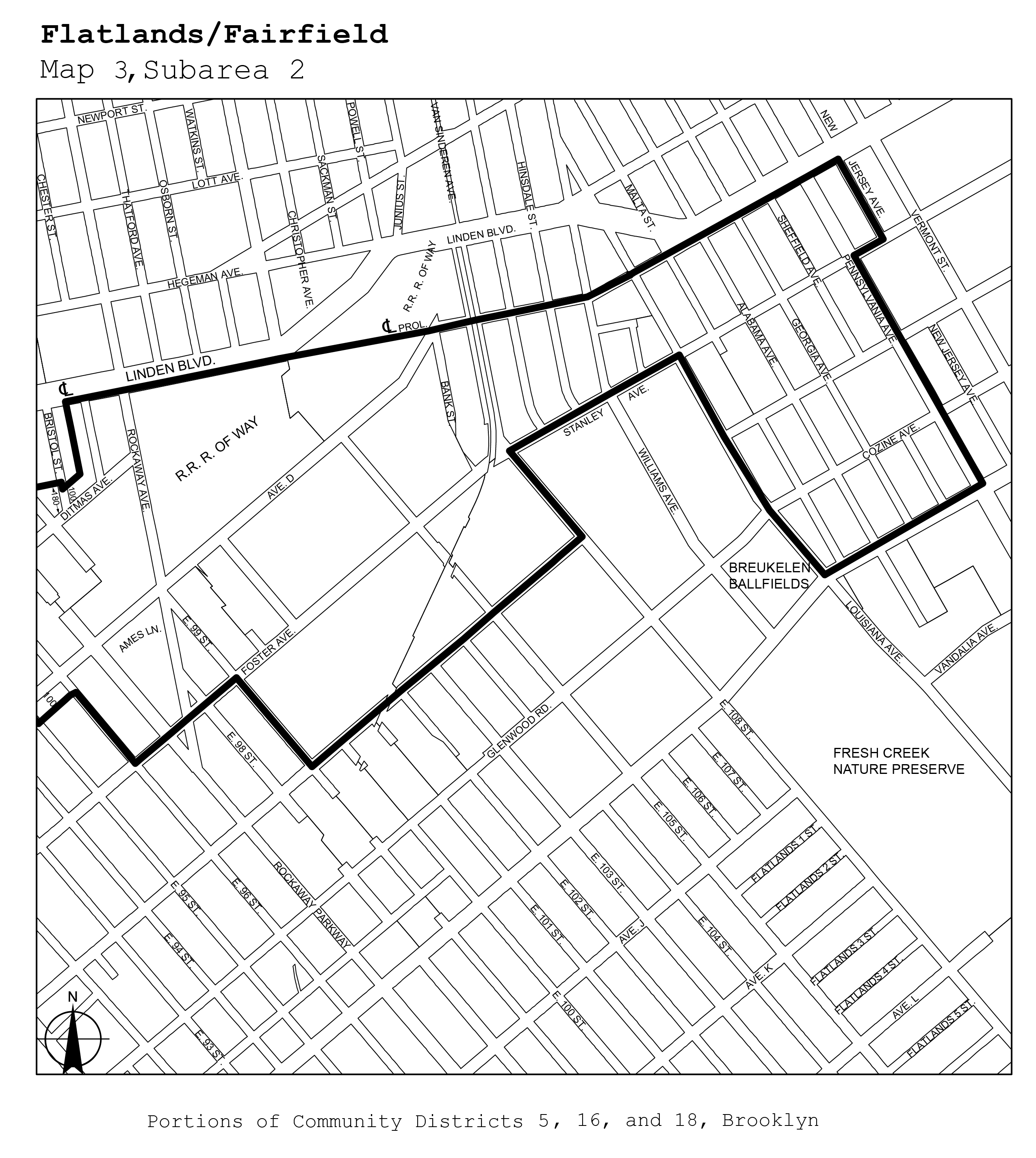
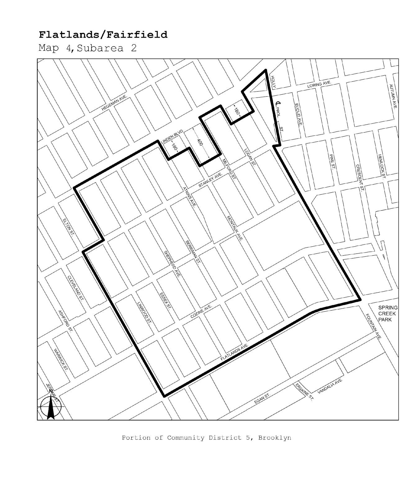
Flatlands/Fairfield |
Maps 1-4 |
|
Brooklyn |
5, 16 |
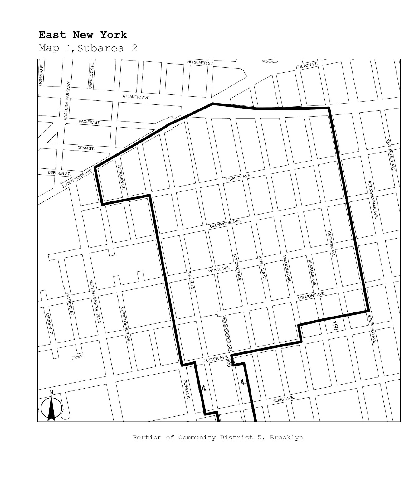
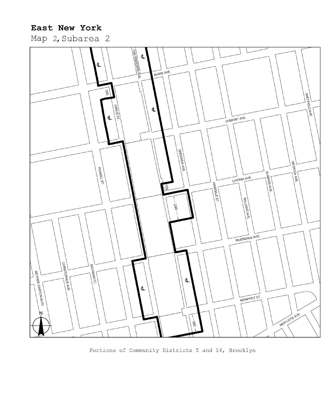
East New York |
Maps 1, 2 |
|
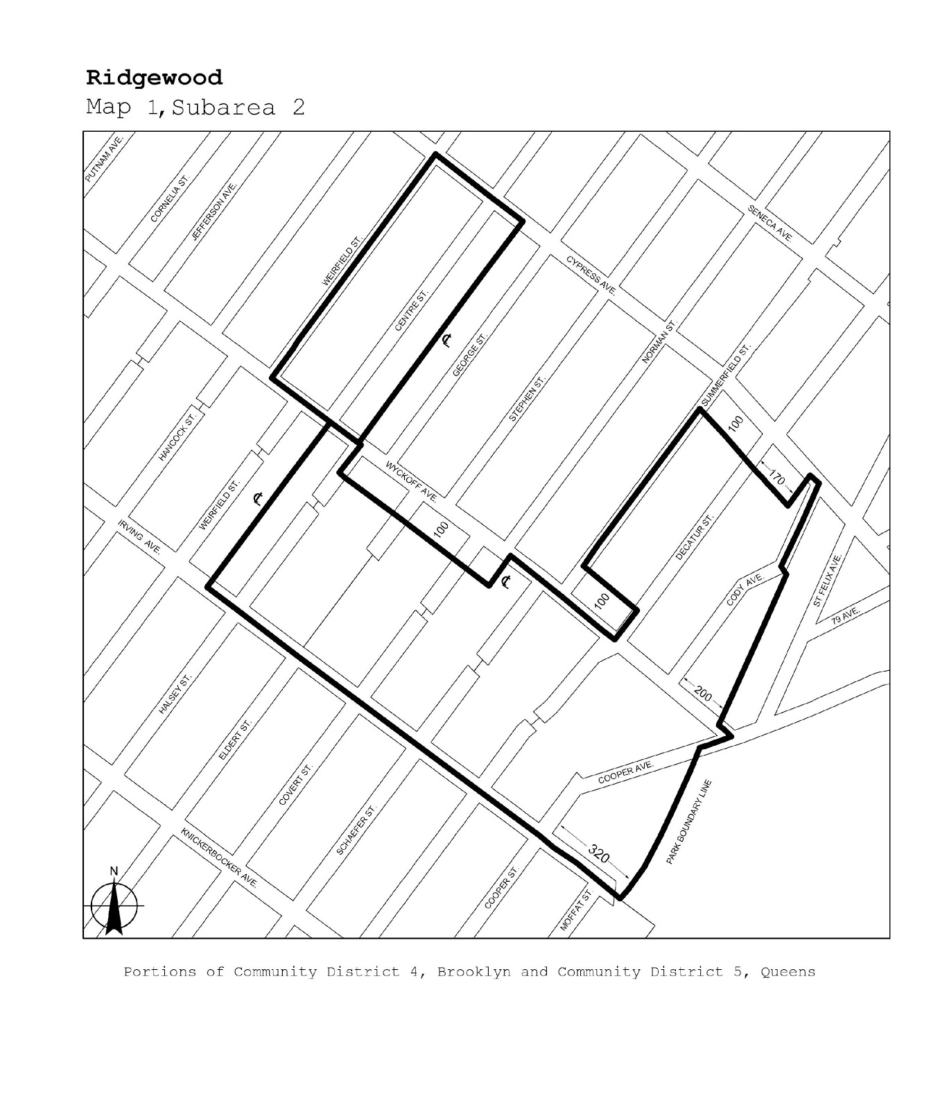
Brooklyn/Queens |
BK 4/QN 5 |
Ridgewood |
Map 1 |
|
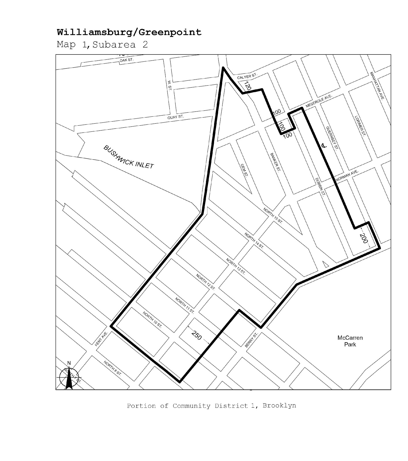
Brooklyn |
1 |
Williamsburg/Greenpoint |
Map 1 |
|
Brooklyn/Queens |
BK 1, 4/QN 2 |
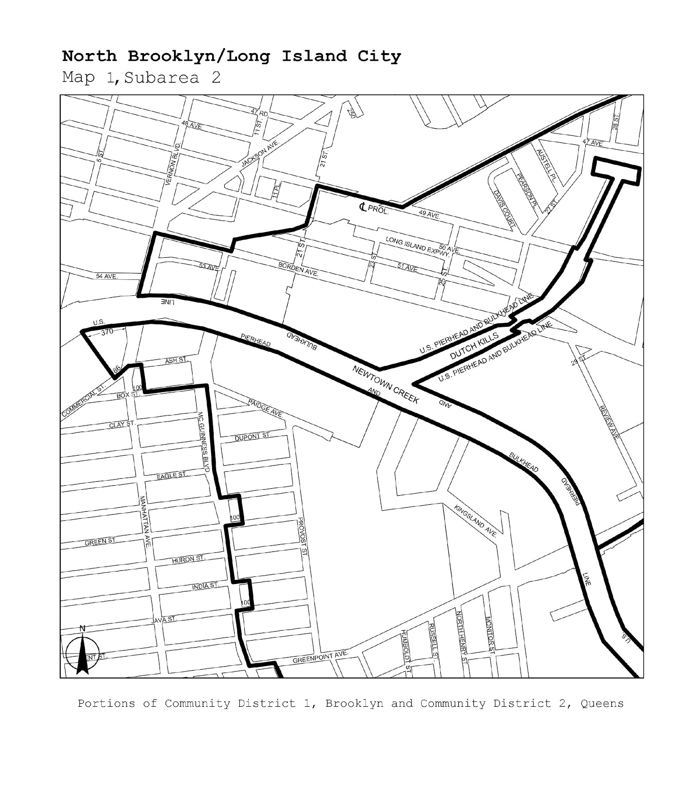
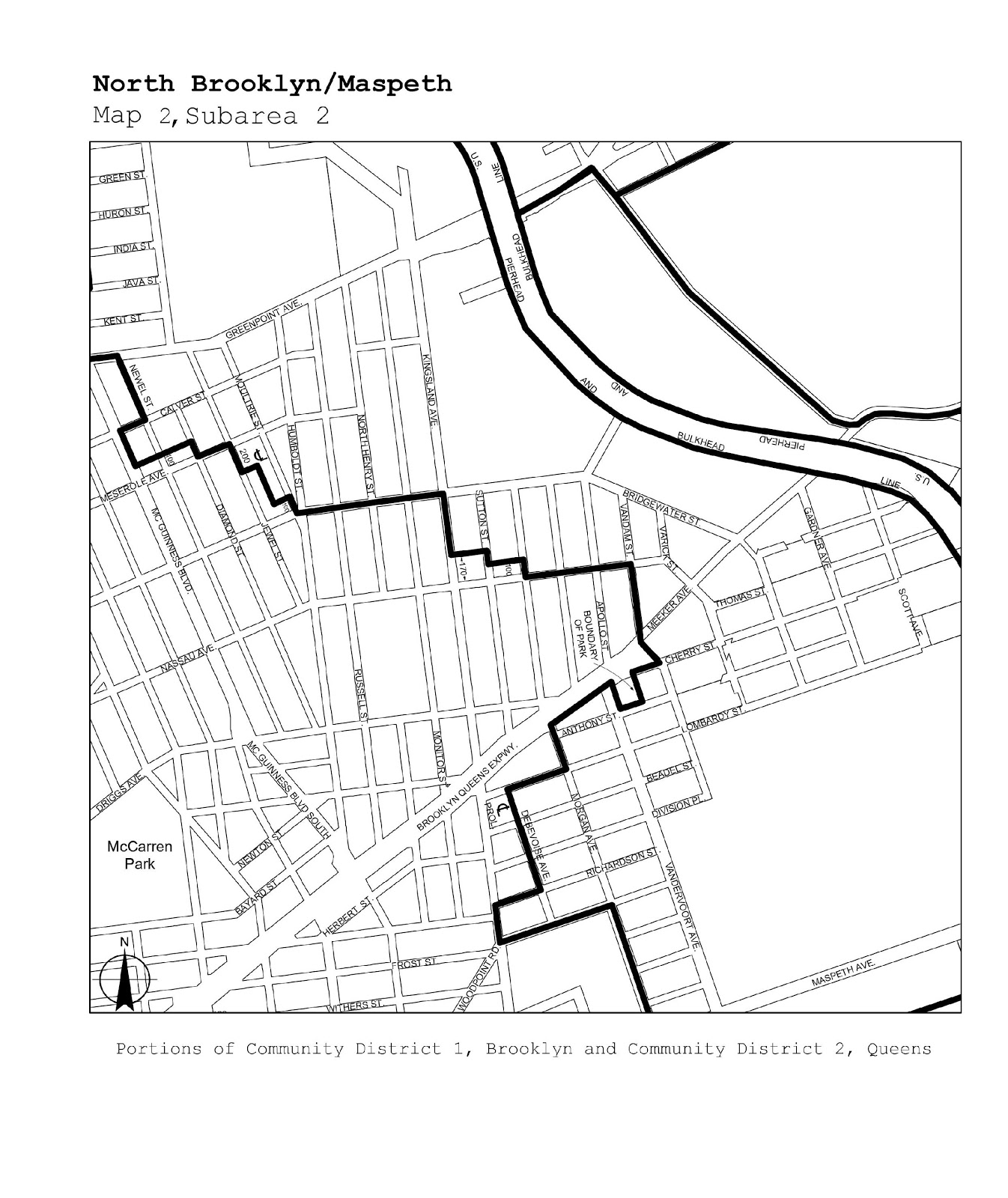
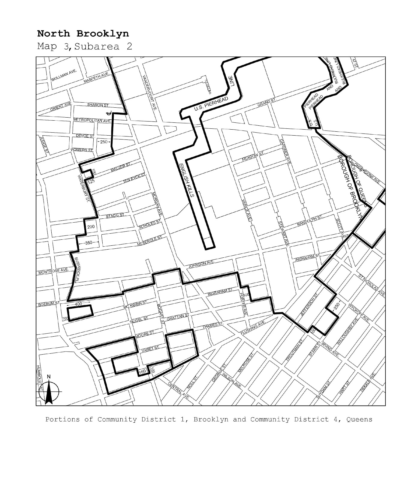
North Brooklyn/Long Island City/ Maspeth |
Maps 1-3 |
|
Queens/Brooklyn |
QN 2, 5/BK 1 |
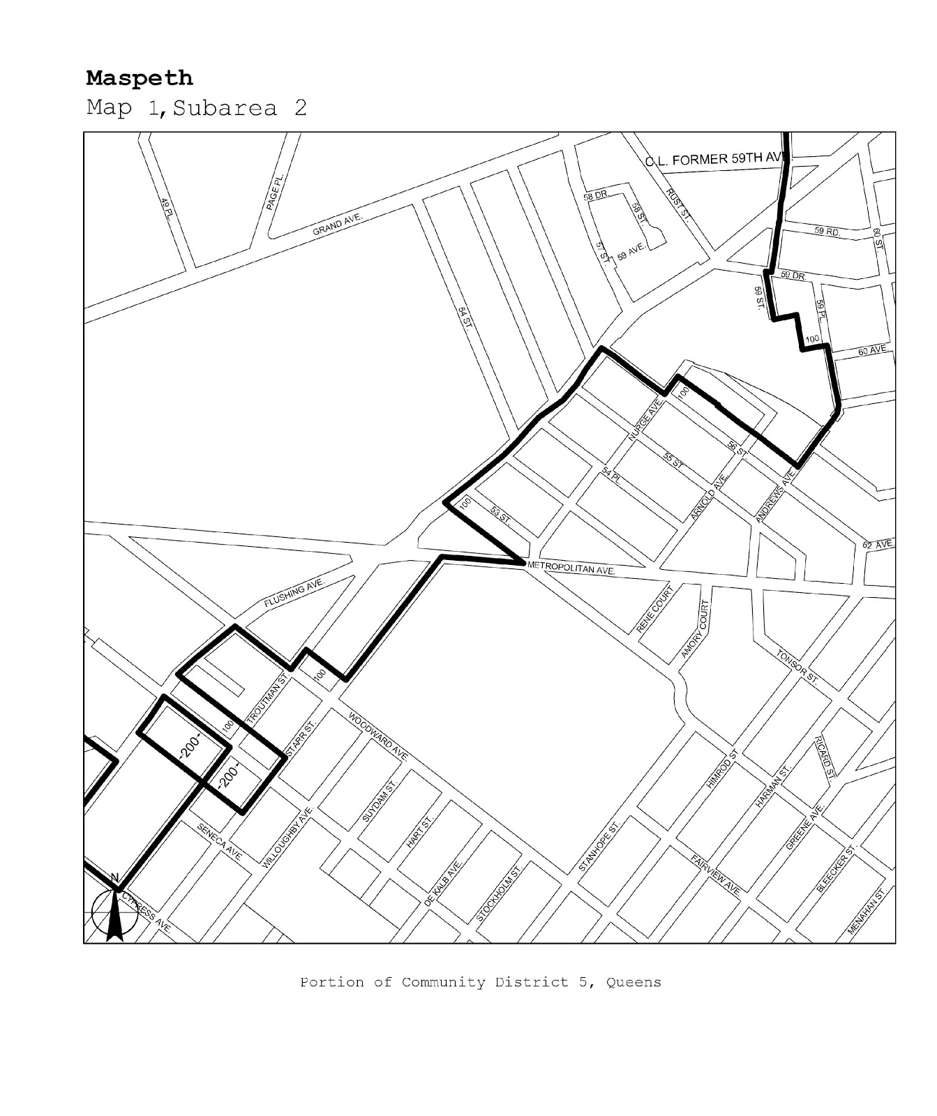
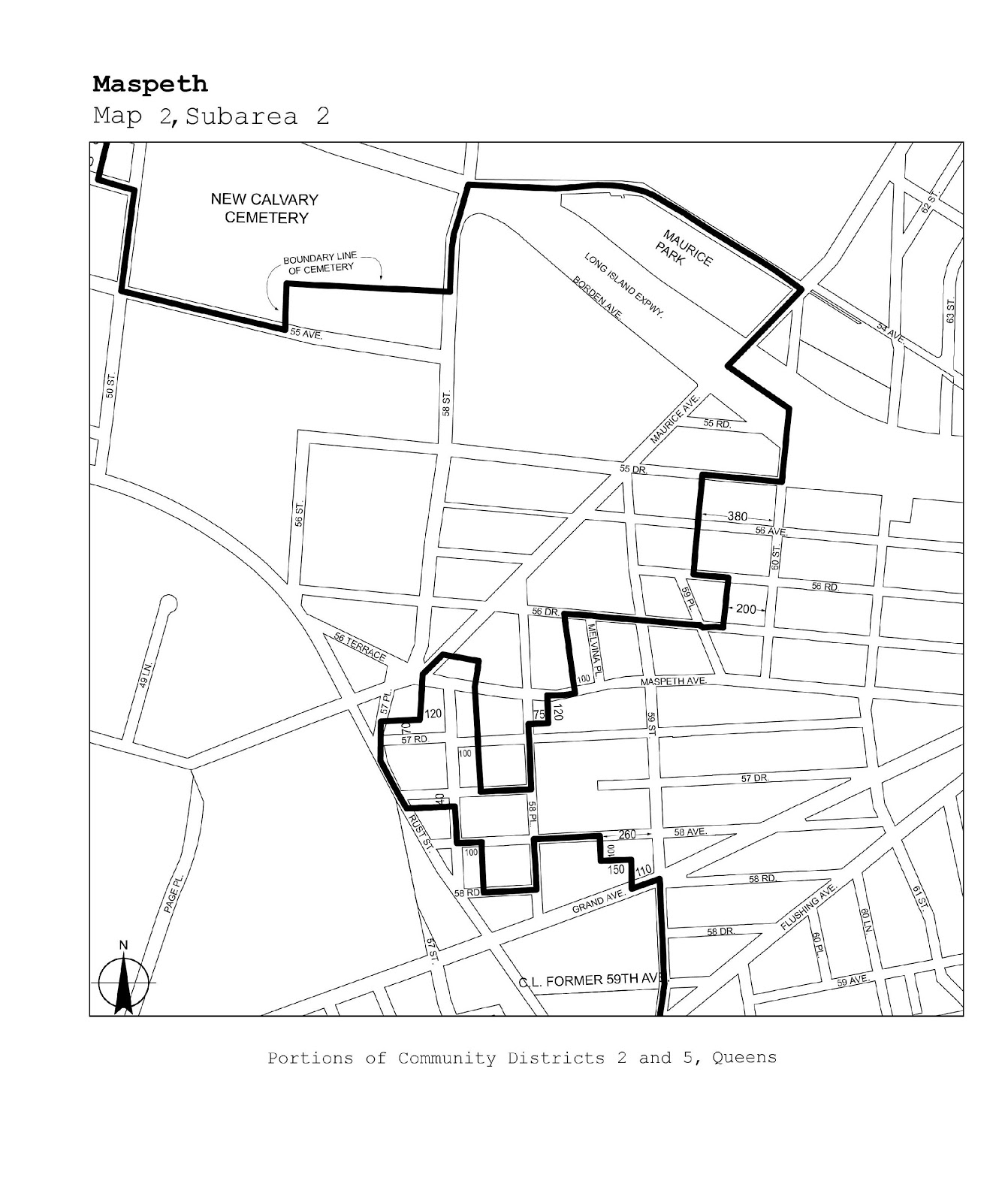
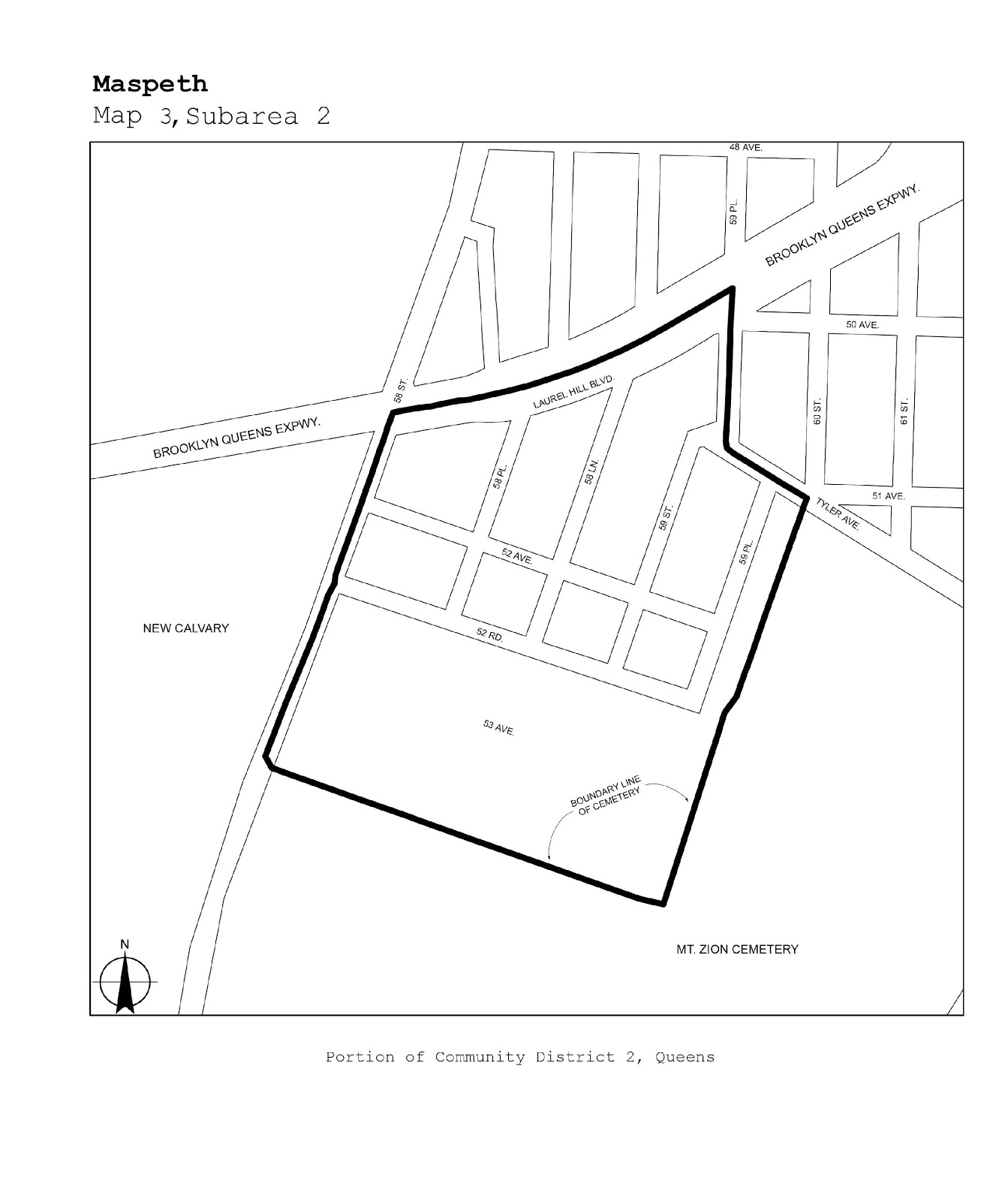
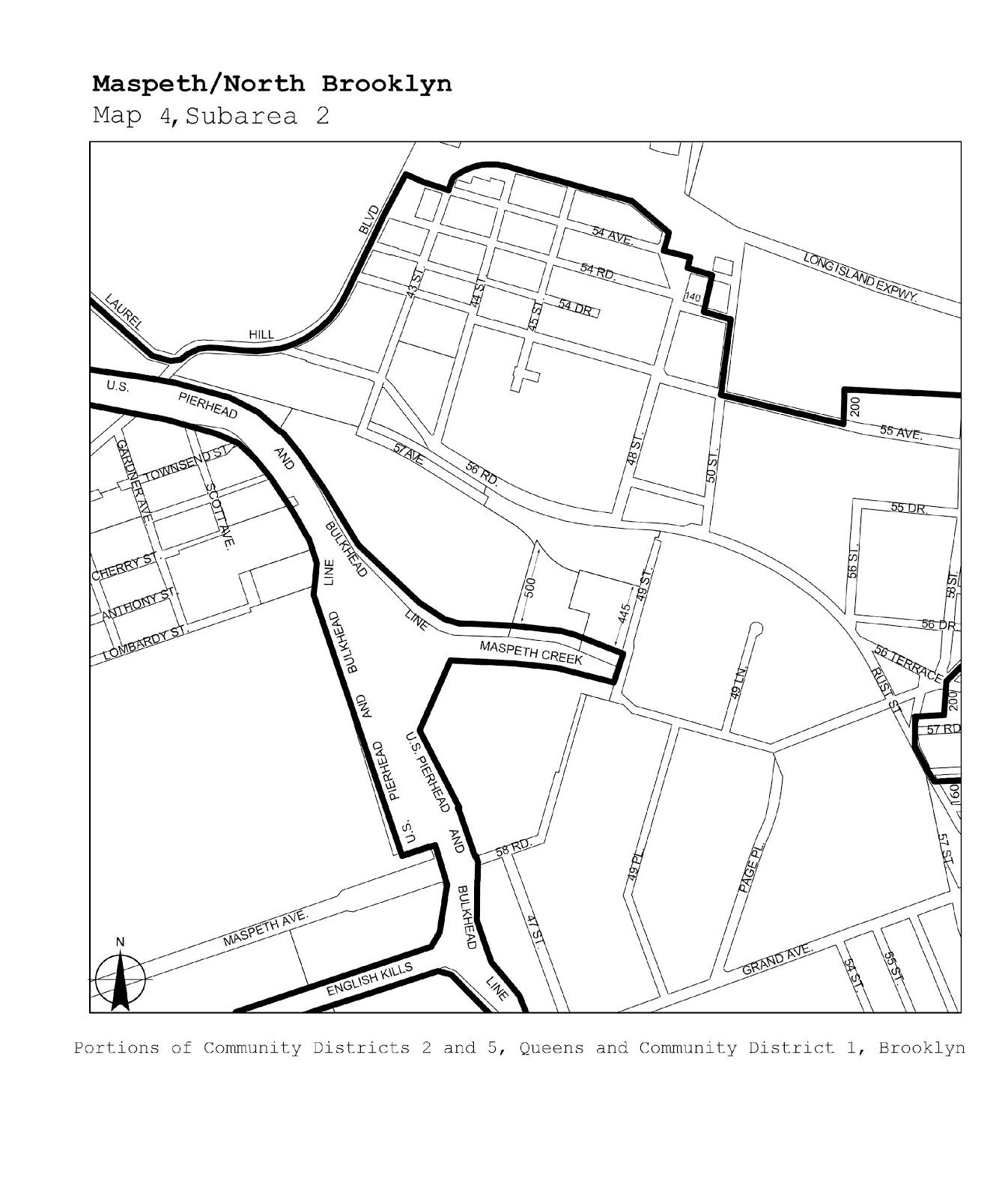
Maspeth/North Brooklyn |
Maps 1-4 |
|
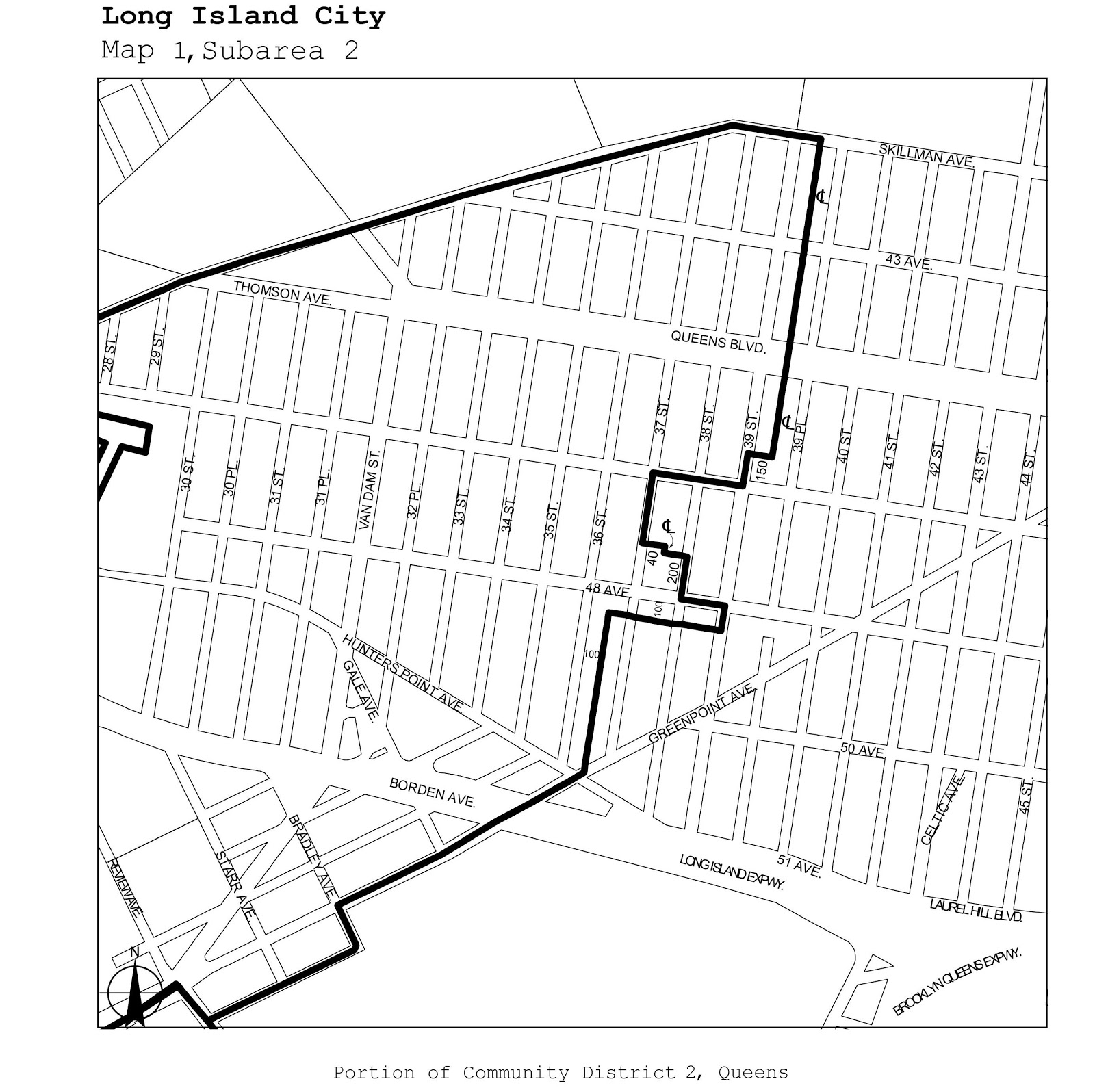
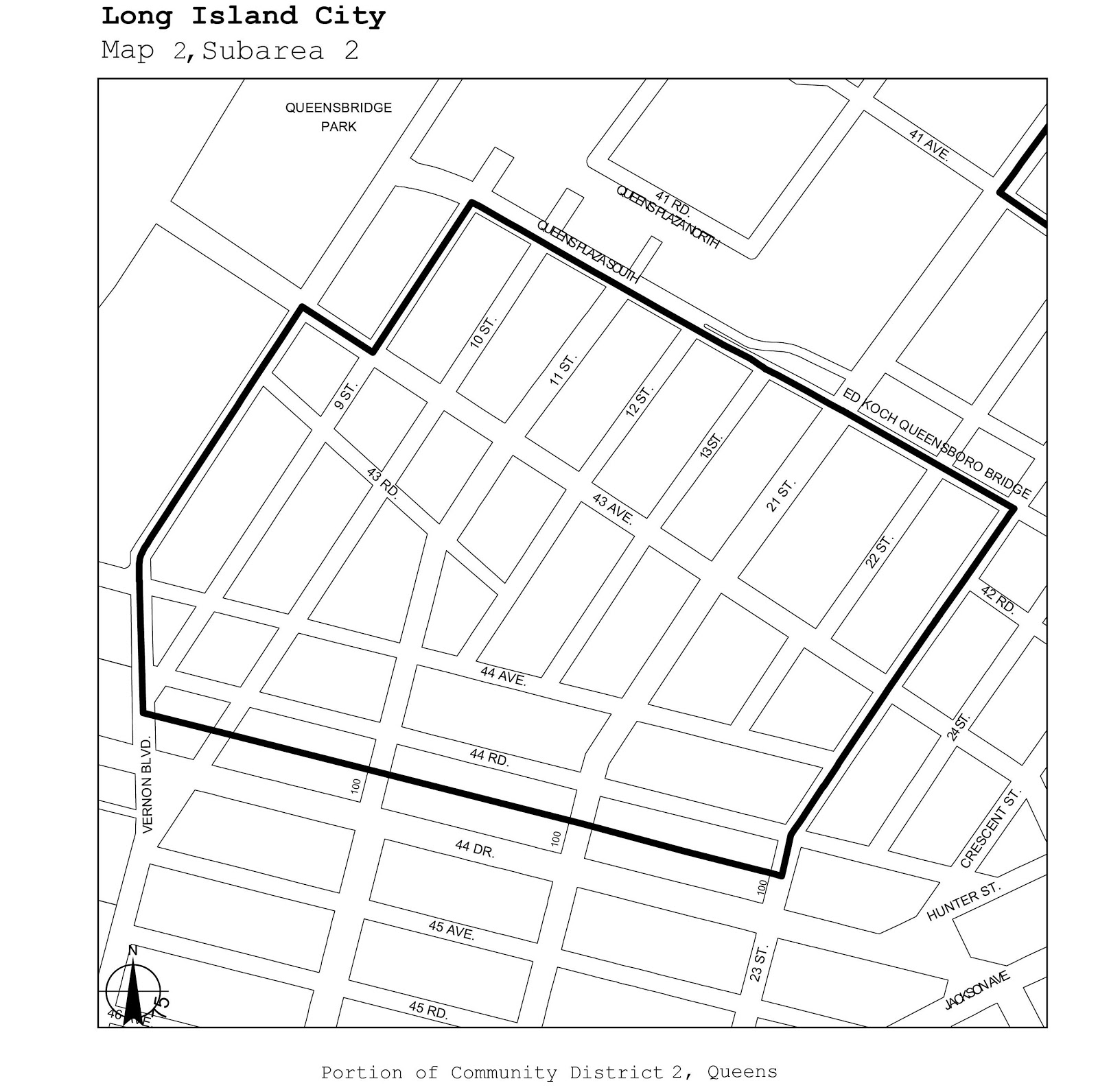
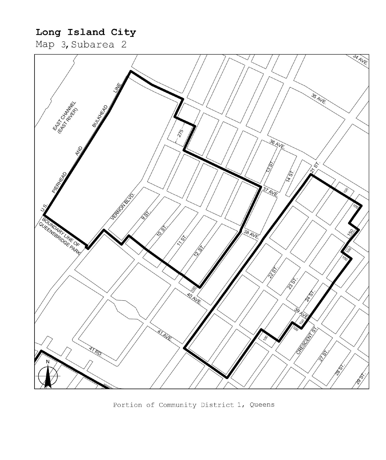
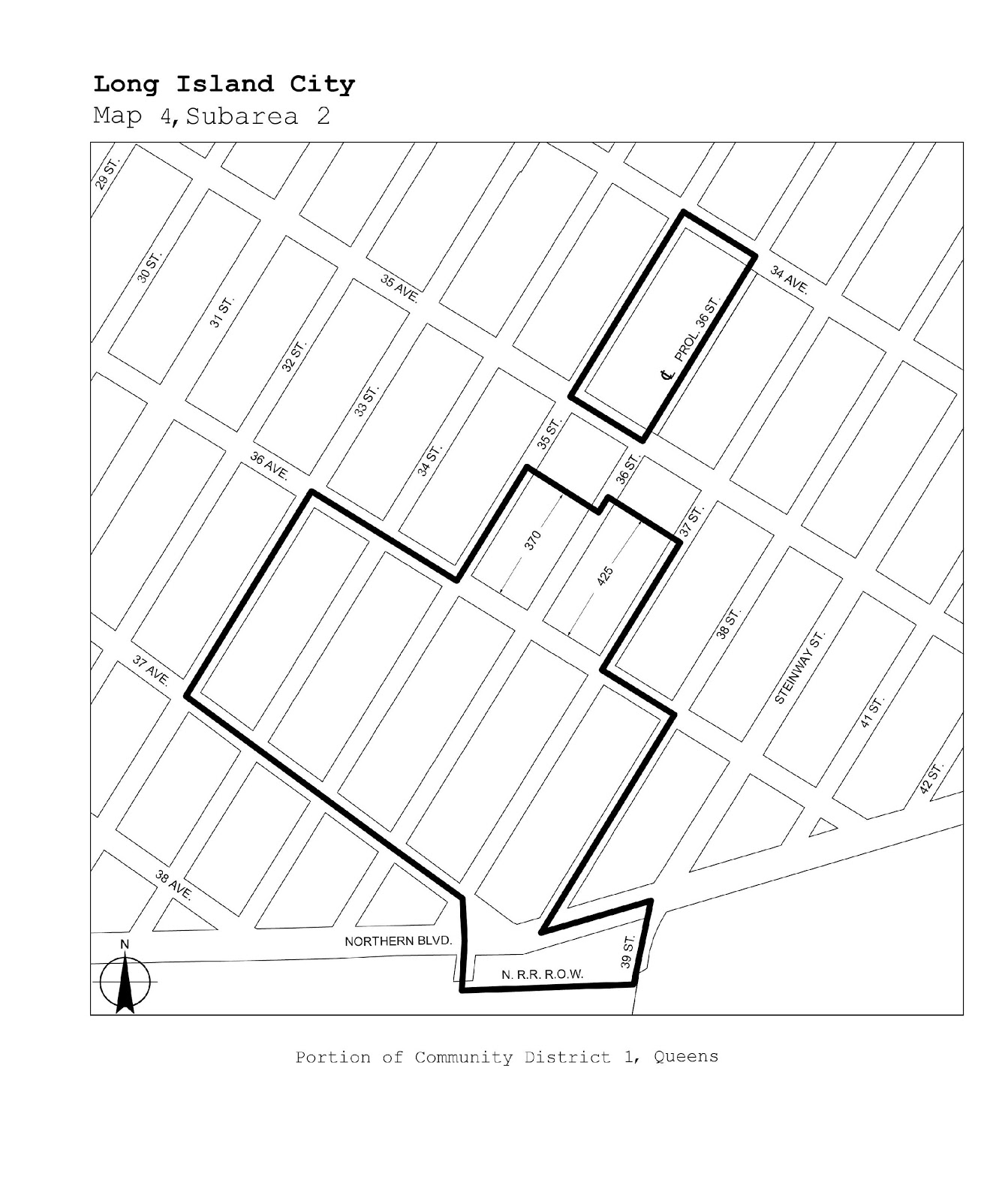
Queens |
1, 2 |
Long Island City |
Maps 1-4 |
|
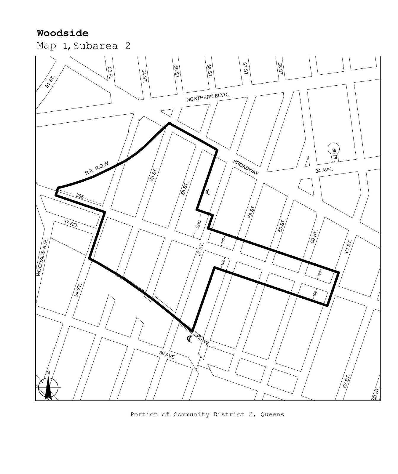
Queens |
2 |
Woodside |
Map 1 |
|
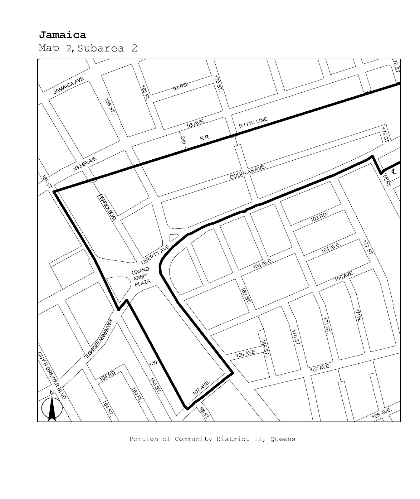
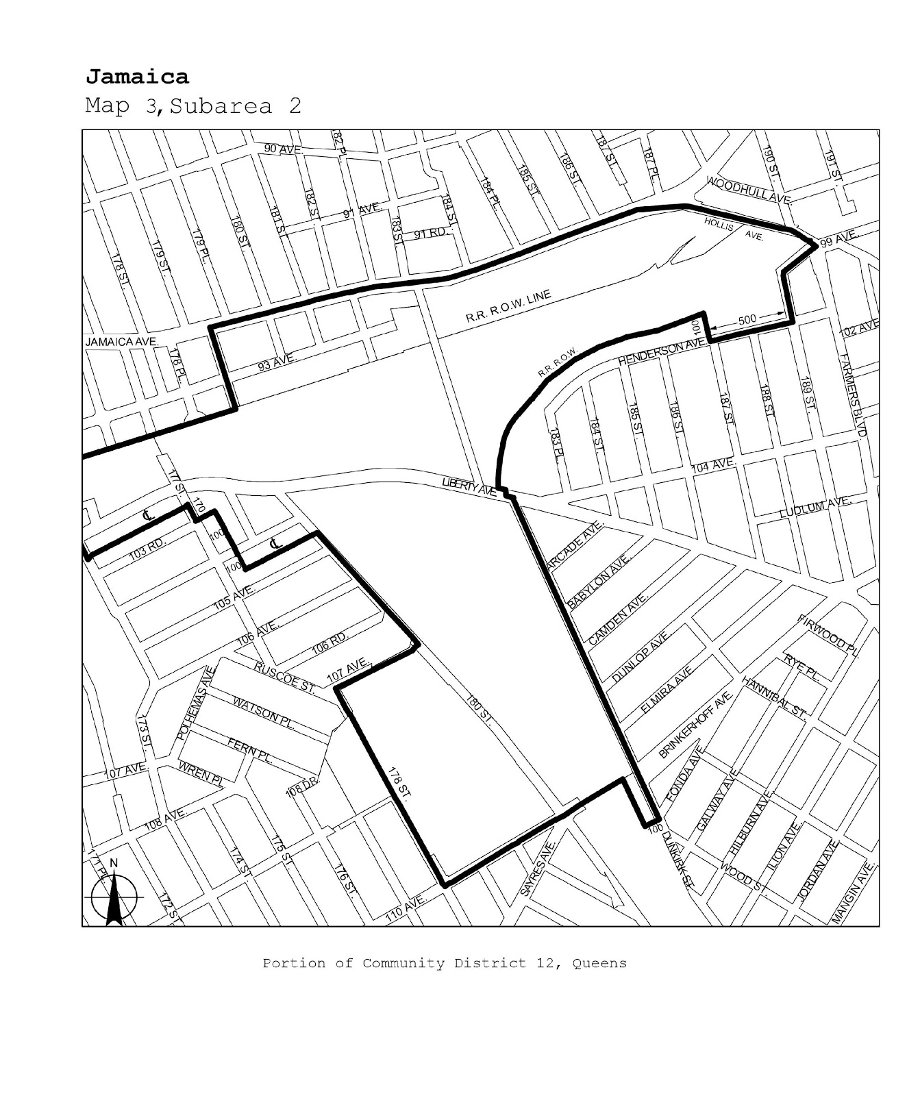
Queens |
12 |
Jamaica |
Maps 1-3 |
|
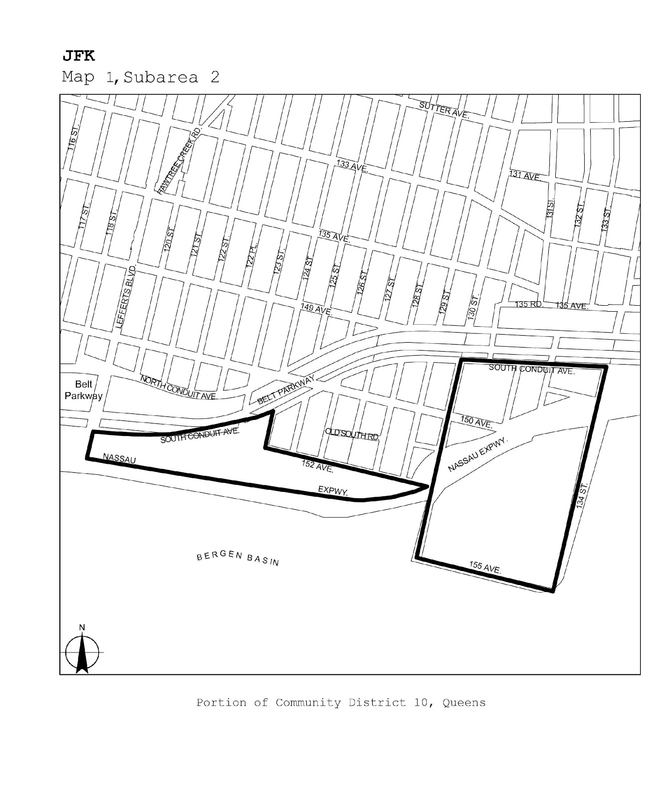
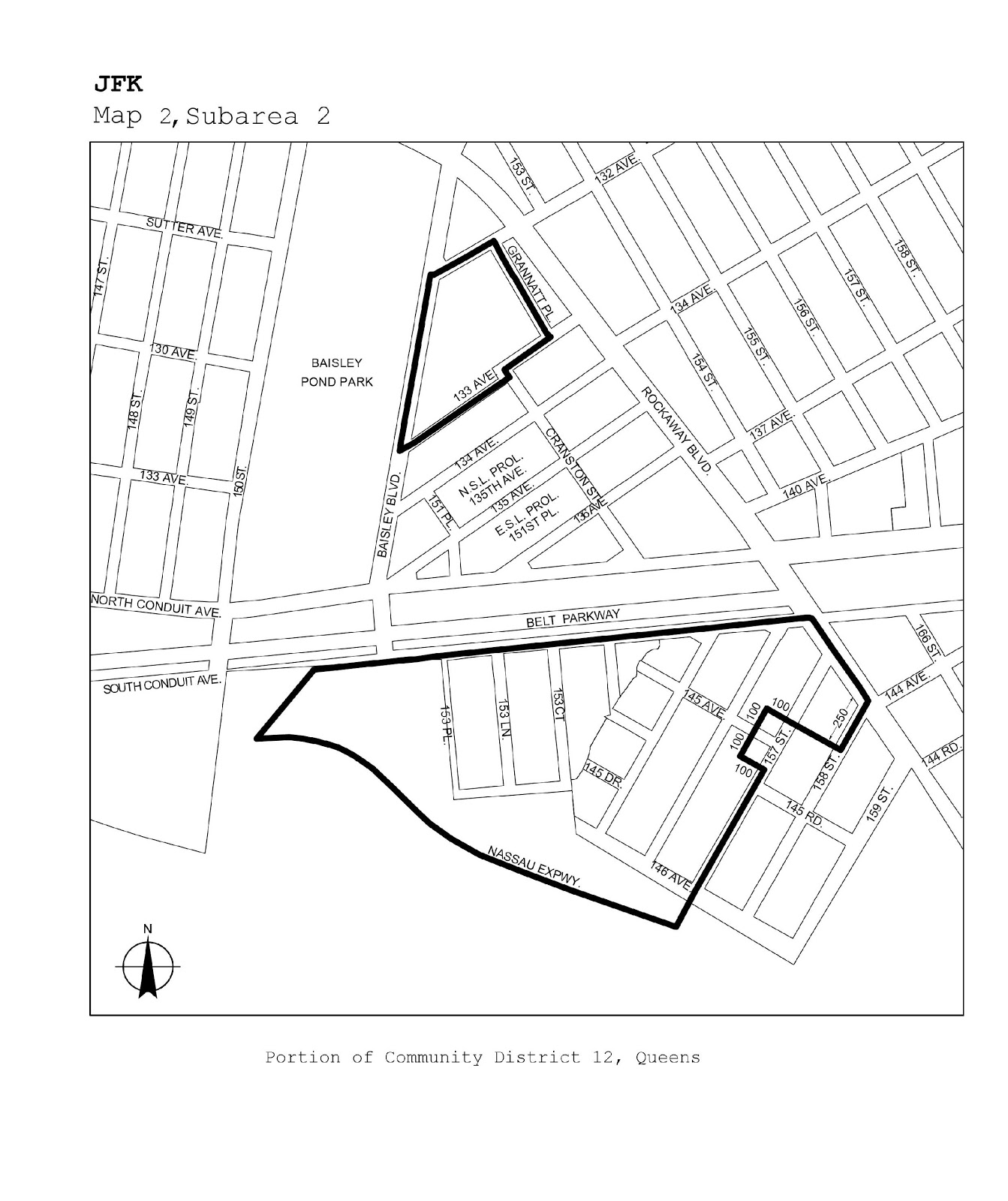
Queens |
10, 12, 13 |
JFK |
Maps 1-3 |
|
Staten Island |
1 |
North Shore |
Maps 1-5 |